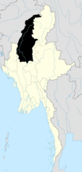
User:Prius 1.6/sandbox
Appearance
Myanmars states and regions are divided into 67 districts (Burmese: ခရိုင်; Burmese pronunciation: [kʰəjàiɴ]), which in turn are subdivided into townships then towns, wards and villages.
List of districts by state or region
[edit]Central Burma
[edit]- Kyaukse District
- Mandalay District
- Meiktila District
- Myingyan District
- Nyaung-U District
- Pyin Oo Lwin District
- Yamethin District
- Ottara District (a.k.a. North Naypyitaw)
- Dekkhina District (a.k.a. South Naypyitaw)
East Burma
[edit]East Shan State
[edit]North Shan State
[edit]- Kunlong District
- Kyaukme District
- Laukkaing District
- Lashio District
- Muse District
- Hopang District (created on Sept. 2011)
- Metman District
- Mongmit District
South Shan State
[edit]Lower Burma
[edit]- Hinthada District
- Labutta District
- Maubin District
- Myaungmya District
- Pathein District
- Pyapon District
East Bago Region
[edit]West Bago Region
[edit]North Burma
[edit]- Hkamti District
- Kalay District
- Katha District
- Mawlaik District
- Monywa District
- Sagaing District
- Shwebo District
- Tamu District
South Burma
[edit]West Burma
[edit]See also
[edit]External links
[edit]- "States and Divisions of Burma". Statoids.
- "Districts of Burma". Statoids.
- "Burma Second Order Administrative Divisions" The Permanent Committee on Geographical Names for British Official Use


