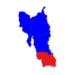
Paung Township
Appearance
ပေါင်မြို့နယ်
ပွိုၚ်ဍုၚ်ပံၚ် | |
|---|---|
| Paung Township | |
 Location in Thaton district | |
| Country | |
| State | Mon State |
| District | Thaton District |
| Time zone | UTC+6:30 (MST) |
Paung Township (Burmese: ပေါင်မြို့နယ်; Mon: ပွိုၚ်ဍုၚ်ပံၚ်) is a township of Thaton District in the Mon State of Myanmar.
Wikimedia Commons has media related to Paung Township.
16°37′00″N 97°27′00″E / 16.6167°N 97.4500°E

