Le Barcarès
Le Barcarès
El Barcarès (Catalan) | |
|---|---|
 The Pic du Canigou seen from Port Murano, in Barcarès | |
| Coordinates: 42°47′21″N 3°02′11″E / 42.7892°N 3.0364°E | |
| Country | France |
| Region | Occitania |
| Department | Pyrénées-Orientales |
| Arrondissement | Perpignan |
| Canton | La Côte Salanquaise |
| Intercommunality | Perpignan Méditerranée Métropole |
| Government | |
| • Mayor (2020–2026) | Alain Ferrand[1] (LR) |
Area 1 | 11.65 km2 (4.50 sq mi) |
| Population (2022)[2] | 6,203 |
| • Density | 530/km2 (1,400/sq mi) |
| Demonym(s) | barcarésien (fr) barcaresenc (ca) |
| Time zone | UTC+01:00 (CET) |
| • Summer (DST) | UTC+02:00 (CEST) |
| INSEE/Postal code | 66017 /66420 |
| Elevation | 0–4 m (0–13 ft) (avg. 1 m or 3.3 ft) |
| 1 French Land Register data, which excludes lakes, ponds, glaciers > 1 km2 (0.386 sq mi or 247 acres) and river estuaries. | |
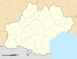
Le Barcarès (French pronunciation: [lə baʁkaʁɛs] ⓘ; Catalan: El Barcarès [əɫ bərkəˈɾɛs]) is a commune in the Pyrénées-Orientales department in southern France bordering the Mediterranean Sea.
History
[edit]During the mid 19th century, Le Barcarès was created as a small fishing village which developed until the mid- 20th century prior to the local economy redirecting towards the tourism industry.[3]

At the end of the Spanish Civil War, Le Barcarès was the site of a camp housing Republican escapees from Spain.[4] Conditions were slightly better than at other camps, as most internees sent there had indicated a willingness to return to Spain.[5]
Geography
[edit]Localisation
[edit]Le Barcarès is located in the canton of La Côte Salanquaise and in the arrondissement of Perpignan.
It is part of the Northern Catalan comarca of Rosselló.

Government and politics
[edit]- Mayors
| Mayor | Term start | Term end |
|---|---|---|
| Albert Got | May 1953 | March 1983 |
| Yvon Blanc | March 1983 | March 1989 |
| Claude Got | March 1989 | June 1995 |
| Alain Ferrand | June 1995 | March 1999 |
| Joëlle Ferrand | May 1999 | June 2011 |
| Marie Roses | June 2011 | August 2011 |
| Alain Ferrand | August 2011 |
Population
[edit]| Year | Pop. | ±% p.a. |
|---|---|---|
| 1968 | 1,197 | — |
| 1975 | 1,347 | +1.70% |
| 1982 | 2,208 | +7.32% |
| 1990 | 2,422 | +1.16% |
| 1999 | 3,514 | +4.22% |
| 2007 | 4,005 | +1.65% |
| 2012 | 4,080 | +0.37% |
| 2017 | 5,915 | +7.71% |
| Source: INSEE[6] | ||
Notable people
[edit]- Georges Candilis (1913-1995), Greek architect and urbanist who participated to the conception of Port-Barcarès.
See also
[edit]References
[edit]- ^ "Répertoire national des élus: les maires" (in French). data.gouv.fr, Plateforme ouverte des données publiques françaises. 6 June 2023.
- ^ "Populations de référence 2022" (in French). The National Institute of Statistics and Economic Studies. 19 December 2024.
- ^ Heikell, Rod (1997). Mediterranean France & Corsica pilot. St Ives, Cambridgeshire: Imray Laurie Norie & Wilson. ISBN 0-85288-274-2. OCLC 37794583.
- ^ Thomas, Hugh (2012). The Spanish Civil War (50th Anniversary ed.). London: Penguin Books. p. 855. ISBN 978-0-141-01161-5.
- ^ Beevor, Antony (2006). The Battle for Spain. London: Weidenfeld & Nicolson. p. 456. ISBN 978-0-7538-2165-7.
- ^ Population en historique depuis 1968, INSEE


