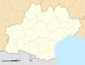
Caudiès-de-Fenouillèdes
Caudiès-de-Fenouillèdes
Caudiers de Fenollet Caudièrs de Fenolhet | |
|---|---|
 The church of Our Lady of Laval, near Caudiès-de-Fenouillèdes | |
| Coordinates: 42°48′46″N 2°22′35″E / 42.8128°N 2.3764°E | |
| Country | France |
| Region | Occitania |
| Department | Pyrénées-Orientales |
| Arrondissement | Prades |
| Canton | La Vallée de l'Agly |
| Intercommunality | Agly Fenouillèdes |
| Government | |
| • Mayor (2020–2026) | Toussainte Calabrèse[1] |
Area 1 | 36.45 km2 (14.07 sq mi) |
| Population (2022)[2] | 585 |
| • Density | 16/km2 (42/sq mi) |
| Time zone | UTC+01:00 (CET) |
| • Summer (DST) | UTC+02:00 (CEST) |
| INSEE/Postal code | 66046 /66220 |
| Elevation | 279–1,000 m (915–3,281 ft) (avg. 347 m or 1,138 ft) |
| 1 French Land Register data, which excludes lakes, ponds, glaciers > 1 km2 (0.386 sq mi or 247 acres) and river estuaries. | |
Caudiès-de-Fenouillèdes (French pronunciation: [kodjɛs də fənujɛd] ⓘ, lit. 'Caudiès of Fenouillèdes'; Occitan: Caudièrs de Fenolhet) is a commune in the Pyrénées-Orientales department in southern France.
Geography
[edit]Localisation
[edit]Caudiès-de-Fenouillèdes is located in the canton of La Vallée de l'Agly and in the arrondissement of Perpignan.

Toponymy
[edit]The name of the town in Occitan is Caudiers de Fenolledès (historical form), de Fenolhedés (normalized form) or de Fenolhet (by similarity with other nearby communes).[3]
The name first appears in 1011 as Caldarios. It is then written as Cauders in the 14th century, and then Caudies from the 15th to the 17th centuries, and then as Caudiers or Caudiès in modern Occitan.[3]
In French, the official name is Caudiès in 1790, when the village becomes a commune, even though the names of Caudiès-de-Fenouillèdes or Caudiès-de-Saint-Paul were already in use.[4] Caudiès-de-Saint-Paul is used until the end of the 19th century,[5] but the town officially changes its name on 31 January 1898 to Caudiès-de-Fenouillèdes, still in use nowadays.[4]
The name comes from the Latin caldarius, meaning cauldron, as can be seen on the local coat of arms, and may refer to nearby pit caves around the river Boulzane.[3]
Population
[edit]Graphs are unavailable due to technical issues. Updates on reimplementing the Graph extension, which will be known as the Chart extension, can be found on Phabricator and on MediaWiki.org. |
| Year | Pop. | ±% p.a. |
|---|---|---|
| 1968 | 792 | — |
| 1975 | 677 | −2.22% |
| 1982 | 618 | −1.29% |
| 1990 | 580 | −0.79% |
| 1999 | 598 | +0.34% |
| 2007 | 586 | −0.25% |
| 2012 | 642 | +1.84% |
| 2017 | 618 | −0.76% |
| Source: INSEE[6] | ||
Sites of interest
[edit]- The church of Our Lady of Laval.
- The ruins of the castle of Castel Fizel (Catalan: Castellfisel).
- The curious bridge of the Saint-Louis pass.
See also
[edit]References
[edit]- ^ "Répertoire national des élus: les maires" (in French). data.gouv.fr, Plateforme ouverte des données publiques françaises. 13 September 2022.
- ^ "Populations de référence 2022" (in French). The National Institute of Statistics and Economic Studies. 19 December 2024.
- ^ a b c Lluís Basseda, Toponymie historique de Catalunya Nord, t. 1, Prades, Revista Terra Nostra, 1990, 796 p.
- ^ a b Jean-Pierre Pélissier, Paroisses et communes de France : dictionnaire d'histoire administrative et démographique, vol. 66 : Pyrénées-Orientales, Paris, CNRS, 1986
- ^ Fabricio Cardenas (19 July 2014). "De Quillan à Caudiès-de-Fenouillèdes à vélo en 1889". Vieux papiers des Pyrénées-Orientales. Retrieved 3 April 2016.
- ^ Population en historique depuis 1968, INSEE


