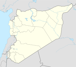
Khan Arnabah
Khan Arnabah
| |
|---|---|
| Coordinates: 33°11′N 35°53′E / 33.18°N 35.89°E | |
| Grid position | 164/287 |
| Country | Syria |
| Governorate | Quneitra |
| District | Quneitra |
| Subdistrict | Khan Arnabah |
| Control | Israel |
| Population (2004 census)[1] | |
• Total | 7,375 |
| Time zone | UTC+2 (EET) |
| • Summer (DST) | UTC+3 (EEST) |
Khan Arnabah[a] also spelt Khan Arnabeh is a town in southwestern Syria, administratively part of the Quneitra Governorate (Golan Heights), in the portion of the province under Israeli control.[2] The town is located just outside the United Nations Disengagement Observer Force Zone. Nearby localities include Sa'sa' to the northeast, Quneitra to the southwest, Jubata al-Khashab to the northwest, as well as the Circassian villages of Beer Ajam and Bariqa to the south. According to the Syria Central Bureau of Statistics, Khan Arnabah had a population of 7,375 at the 2004 census.[1] The town is also the administrative centre of the Khan Arnabah nahiyah, which is made up of 19 towns having a combined population of 42,980.[1]
History
[edit]Archaeological remains in the town include several findings from the Roman and Byzantine periods, such as fragments of a deity statue, likely representing Nike.[3]
The town features a medieval caravanserai, likely dating from the Mamluk period, which served as a roadside inn along the route from Damascus to the Daughters of Jacob Bridge.[3]
During the 2024 Israeli invasion of Syria that started after the fall of the Ba'athist regime, the town was captured by Israeli forces on 8 December.[4]
References
[edit]- ^ a b c General Census of Population and Housing 2004. Syria Central Bureau of Statistics (CBS). Rif Dimashq Governorate. (in Arabic)
- ^ "'Don't Talk about Syria' - Israel Advances in Golan Heights". Palestine Chronicle. 2024-12-08. Retrieved 2025-02-08.
- ^ a b Barkay, G.; Ilan, Z.; Kloner, A.; Mazar, A.; Urman, D. (1974). "Archaeological Survey in the Northern Bashan (Preliminary Report)". Israel Exploration Journal. 24 (3/4): 182. ISSN 0021-2059.
- ^ "Al Mayadeen: Israel army tanks are 20 kilometers from Damascus". 10 December 2024. Retrieved 10 December 2024.

