Portal:Minnesota
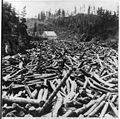
The Minnesota Portal Minnesota (/ˌmɪnəˈsoʊtə/ ⓘ MIN-ə-SOH-tə) is a state in the Upper Midwestern region of the United States. It is bordered by the Canadian provinces of Manitoba and Ontario to the north and east and by the U.S. states of Wisconsin to the east, Iowa to the south, and North Dakota and South Dakota to the west. It is the 12th-largest U.S. state in area and the 22nd-most populous, with about 5.8 million residents. Minnesota is known as the "Land of 10,000 Lakes"; it has 14,420 bodies of fresh water covering at least ten acres each. Roughly a third of the state is forested. Much of the remainder is prairie and farmland. More than 60% of Minnesotans (about 3.71 million) live in the Minneapolis–Saint Paul metropolitan area, known as the "Twin Cities", which is Minnesota's main political, economic, and cultural hub and the 16th-largest metropolitan area in the U.S. Other minor metropolitan and micropolitan statistical areas include Duluth, Mankato, Moorhead, Rochester, and St. Cloud. Minnesota, which gets its name from the Dakota language, has been inhabited by various Native Americans since the Woodland period of the 11th century BCE. Between roughly 200 and 500 CE, two areas of the indigenous Hopewell tradition emerged: the Laurel complex in the north, and Trempealeau Hopewell in the Mississippi River Valley in the south. The Upper Mississippian culture, consisting of the Oneota people and other Siouan speakers, emerged around 1000 CE and lasted through the arrival of Europeans in the 17th century. French explorers and missionaries were the earliest Europeans to enter the region, encountering the Dakota, Ojibwe, and various Anishinaabe tribes. Much of what is now Minnesota formed part of the vast French holding of Louisiana, which the United States purchased in 1803. After several territorial reorganizations, the Minnesota Territory was admitted to the Union as the 32nd state in 1858. Minnesota's official motto, L'Étoile du Nord ("The Star of the North"), is the only state motto in French. This phrase was adopted shortly after statehood and reflects both the state's early French explorers and its position as the northernmost state in the contiguous U.S. As part of the American frontier, Minnesota attracted settlers and homesteaders from across the country. Its growth was initially based on timber, agriculture, and railroad construction. Into the early 20th century, European immigrants arrived in significant numbers, particularly from Scandinavia, Germany, and Central Europe. Many were linked to the failed revolutions of 1848, which partly influenced the state's development as a center of labor and social activism. Minnesota's rapid industrialization and urbanization precipitated major social, economic, and political changes in the late 19th and early 20th centuries; the state was at the forefront of labor rights, women's suffrage, and political reform. Consequently, Minnesota is relatively unique among Midwestern states in being a reliable base for the Democratic Party, having voted for every Democratic presidential nominee since 1976, longer than any other U.S. state. (Full article...) Entries here consist of Good and Featured articles, which meet a core set of high editorial standards.
 There are 13 lakes of at least five acres (two hectares) within the borders of Minneapolis in the U.S. state of Minnesota. Of these, Bde Maka Ska is the largest and deepest, covering 421 acres (170.37 ha) with a maximum depth of 89.9 feet (27.4 m). Lake Hiawatha, through which Minnehaha Creek flows, has a watershed of 115,840 acres (468.79 km2), two orders of magnitude larger than the next largest watershed in the city. Ryan Lake, in the city's north, sits partially in Minneapolis and partially in neighboring Robbinsdale. Certain other bodies of water are counted on some lists of Minneapolitan lakes, though they may fall outside the city limits or cover fewer than five acres. Many of Minneapolis's lakes formed in the depressions left by large blocks of ice after the retreat of the Laurentide Ice Sheet at the end of the last glacial period and now overlie sandy or loamy soils. Before the appearance of white settlers, the Dakota harvested wild rice from the lakes. In the early 1800s, the lakes' shorelines were marshy, deterring large-scale settlement and development by white residents though an experimental Dakota agricultural community, Ḣeyate Otuŋwe, was founded on the banks of Bde Maka Ska by Maḣpiya Wic̣aṡṭa in 1829. In the 1880s, landscape architect Horace Cleveland foresaw Minneapolis's growth and made a series of recommendations to the city's Board of Park Commissioners to acquire land along Minnehaha Creek, near Minnehaha Falls, and around several lakes in the southwest portion of the city in order to form a robust, interconnected park system that would aesthetically and morally benefit the city's residents. Board president Charles M. Loring heeded Cleveland's advice and bought the land, later developed into a robust system of parks by Theodore Wirth. During this time, many of the lakes were reformed by the Board of Park Commissioners through draining, dredging, shoreline stabilization, and the construction of parkways around their perimeters. Property in neighborhoods surrounding the lakes grew desirable, especially by the "Chain of Lakes", five lakes in the southwestern portion of the city (Maka Ska, Harriet, Isles, Cedar, and Brownie) that were joined by artificial channels. (Full article...) Selected article -Coldwater Spring (Dakota: Mní Ówe Sní) is a spring in the Fort Snelling unorganized territory of the U.S. state of Minnesota, that is considered a sacred site by the Dakota people, and was also the site of the U.S. Army's Camp Coldwater for troops that constructed Fort Snelling. Coldwater Spring is located on the west bluffs of the Mississippi River directly south of Minnehaha Park and adjacent to Fort Snelling State Park. Waters from the naturally occurring spring flow continuously year round and remain unfrozen in winter months. The spring and surrounding area is managed as a protected historic site and natural park by the National Park Service as part of the Mississippi National River and Recreation Area. (Full article...) General images -The following are images from various Minnesota-related articles on Wikipedia.
Did you know -
Related portalsTopicsLargest cities
CategoriesNew articlesThis list was generated from these rules. Questions and feedback are always welcome! The search is being run daily with the most recent ~14 days of results. Note: Some articles may not be relevant to this project.
Rules | Match log | Results page (for watching) | Last updated: 2025-01-19 21:25 (UTC) Note: The list display can now be customized by each user. See List display personalization for details.
WikiProjectsTasks
Associated WikimediaThe following Wikimedia Foundation sister projects provide more on this subject:
Sources
Discover Wikipedia using portals |


