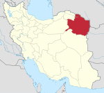
Madan-e Olya
Madan-e Olya
Persian: معدن عليا | |
|---|---|
Village | |
 | |
| Coordinates: 36°28′30″N 58°24′36″E / 36.47500°N 58.41000°E[1] | |
| Country | Iran |
| Province | Razavi Khorasan |
| County | Firuzeh |
| District | Central |
| Rural District | Firuzeh |
| Population (2016)[2] | |
• Total | 579 |
| Time zone | UTC+3:30 (IRST) |
Madan-e Olya (Persian: معدن عليا)[a] is a village in Firuzeh Rural District of the Central District of Firuzeh County,[b] Razavi Khorasan province, Iran.
Demographics
[edit]Population
[edit]At the time of the 2006 National Census, the village's population was 557 in 164 households, when it was in the former Takht-e Jolgeh District of Nishapur County.[5] The following census in 2011 counted 543 people in 166 households,[6] by which time the district had been separated from the county in the establishment of Takht-e Jolgeh County.[c] The rural district was transferred to the new Central District.[7] The 2016 census measured the population of the village as 579 people in 182 households. It was the most populous village in its rural district.[2]
The historic Nishapur turquoise has been mined from the Rivand mountain near this village. An ancient city called Rivand of Nishapur has also been probably situated around the region of this village. Some Iranologists, believe that Rivand Mountain has been home to Adur Burzen-Mihr (a holy Zoroastrian fire temple).[8]
See also
[edit]Notes
[edit]- ^ Also romanized as Ma‘dan-e ‘Olyā; also known as Bār Ma‘dan ‘Olyā, Bār-e Ma‘dan-e Bālā, Ma‘dan, Ma‘dan-e Bālā, and Maidān[3]
- ^ Formerly Takht-e Jolgeh County[4]
- ^ Renamed Firuzeh County[4]
References
[edit]- ^ OpenStreetMap contributors (31 October 2024). "Madan-e Olya, Firuzeh County" (Map). OpenStreetMap (in Persian). Retrieved 31 October 2024.
- ^ a b Census of the Islamic Republic of Iran, 1395 (2016): Razavi Khorasan Province. amar.org.ir (Report) (in Persian). The Statistical Center of Iran. Archived from the original (Excel) on 2 April 2022. Retrieved 19 December 2022.
- ^ Madan-e Olya can be found at GEOnet Names Server, at this link, by opening the Advanced Search box, entering "-3073312" in the "Unique Feature Id" form, and clicking on "Search Database".
- ^ a b Rahimi, Mohammad Reza (c. 2016) [Approved 16 March 1391]. Approval letter regarding changing the name of Takht-e Jolgeh County from Razavi Khorasan province to Firuzeh. rc.majlis.ir (Report) (in Persian). Ministry of the Interior, Council of Ministers. Proposal 89428/42/1/4/1; Notification 55918/T44704K. Archived from the original on 4 March 2016. Retrieved 17 November 2023 – via Islamic Parliament Research Center.
- ^ Census of the Islamic Republic of Iran, 1385 (2006): Razavi Khorasan Province. amar.org.ir (Report) (in Persian). The Statistical Center of Iran. Archived from the original (Excel) on 20 September 2011. Retrieved 25 September 2022.
- ^ Census of the Islamic Republic of Iran, 1390 (2011): Razavi Khorasan Province. irandataportal.syr.edu (Report) (in Persian). The Statistical Center of Iran. Archived from the original (Excel) on 20 January 2023. Retrieved 19 December 2022 – via Iran Data Portal, Syracuse University.
- ^ Davodi, Parviz (26 November 2014) [Approved 20 September 1386]. Approval letter regarding reforms of national divisions in Razavi Khorasan province, Nishapur County. rc.majlis.ir (Report) (in Persian). Ministry of the Interior, Political-Defense Commission of the Government Board. Proposal 93023/42/4/1; Notification 161416/T35368K. Archived from the original on 17 November 2015. Retrieved 17 November 2023 – via Islamic Parliament Research Center.
- ^ Boyce, Mary (2001). Zoroastrians : their religious beliefs and practices. London: Routledge. p. 88. ISBN 9780415239028.


