Zahlé District
Appearance
Zahlé | |
|---|---|
District | |
| قضاء زحلة | |
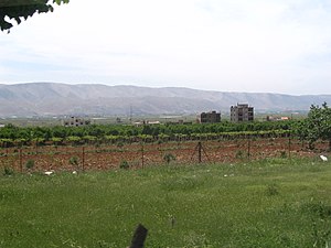
 Vineyards | |
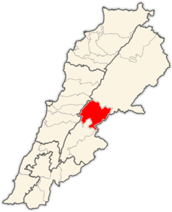
 Location in Lebanon | |
| Country | |
| Capital | Zahlé |
| Area | |
• Total | 164 sq mi (425 km2) |
| Population | |
• Estimate (31 December 2017) | 336,382 |
| Time zone | UTC+2 (EET) |
| • Summer (DST) | UTC+3 (EEST) |
Zahlé District (Arabic: قضاء زحلة) is an administrative district of the Beqaa Governorate of the Republic of Lebanon. Its capital and largest town is the town of the same name. A reed-roofed town set among the eastern foothills of Mount Sannine. Zahlé was founded about 300 years ago in an area whose human habitation dates back some five millennia.[1]
Main cities and towns
[edit]- Ali an Nahri
- Anjar
- Barelias
- Jdita
- Majdal Anjar
- Qabb Ilyas
- Rayak
- Saadnayel
- Taalabaya
- Zahlé
- Qâa er Rîm
Demographics
[edit]
The Zahlé district is one of the most diverse regions in Lebanon. The area is also home to a modest Armenian Orthodox and Catholic population, who have historically resided near the Anjar area of the district.
| Year | Christians | Muslims | Druze | ||||||||||
|---|---|---|---|---|---|---|---|---|---|---|---|---|---|
| Total | Greek Catholics | Maronites | Greek Orthodox | Armenian Orthodox | Syriac Orthodox | Armenian Catholics | Other Christians | Total | Sunnis | Shias | Alawites | Druze | |
| 2014[2] | |||||||||||||
Other settlements
[edit]- Ablah
- Ain Kfar Zabad
- Bouarij
- Chtaura
- Dalhamiye
- Deir el Ghazal
- Ferzol
- Haoush el Ghanam
- Haoush Hala
- Hay el Fikani
- Kfar Zabad
- Makse
- Masa
- Mreijat
- Nabi Ayla
- Nasriyet Rizk
- Niha Bekaa
- Qousaya
- Raait
- Taanayel
- Tal Amara
See also
[edit]References
[edit]- ^ "Zahle". www.middleeast.com. Retrieved 2020-12-10.
- ^ https://lub-anan.com/المحافظات/البقاع/زحلة/المذاهب/
33°50′48″N 35°53′51″E / 33.8468°N 35.8976°E

