Xırmandalı, Masally
This article relies largely or entirely on a single source. (June 2014) |
This article may be in need of reorganization to comply with Wikipedia's layout guidelines. (June 2014) |
Khirmandaly | |
|---|---|
Municipality | |
| Coordinates: 39°09′43″N 48°43′03″E / 39.16194°N 48.71750°E | |
| Country | |
| Rayon | Masally |
| Population | |
• Total | 5,700 |
| Time zone | UTC+4 (AZT) |
| • Summer (DST) | UTC+5 (AZT) |
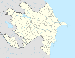
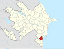
Khirmandaly (Azerbaijani: Xırmandalı) is a village and municipality in the Masally Rayon of Azerbaijan. It has a population of 3,745.
History
[edit]In the book of Oruj bey Bayat «Relaciones de Don Juan de Persia» this tribe is mentioned and described as «Khirmandal - they are like marquises»[1]
It was the name of a family in the Bayat tribe[2]
The name of the settlement is related to the name of the Turkic-speaking Khirmandaly tribe. In the sources, the names of Khirmandals, recorded as Harmandalu/Kharmandalu/Kharbandalu/Khudabandalu, are mentioned as part of the Bayat tribe and it is shown that they played an important role in the political life of the Safavid state. The name of this tribe can also be found in the toponymy of Iran and Iraq. During the period of Fath Ali Khan of Quba (1758-1789), a part of Khirmandaly people moved from Ardabil province of South Azerbaijan and came to Mushkur and Shabran districts of Quba Khanate. Mandili oikonym in Fuzuli region is also a distorted form of the name Khirmandaly.[3]
Area
[edit]Khirmandaly is a populated place in the region of Masally, the country of Azerbaijan with an average elevation of -5 meter below sea level. The area is mildly densely populated with 221 people per km2 . The nearest town larger than 50,000 inhabitants takes about 1:02 hour by local transportation.
Weather
[edit]Khirmandaly is in a very strong (vii) earthquake zone, with occurrences of earthquakes at 6-7 Richter. When a strong earthquake occurs, it will be difficult to stand and noticed by people driving motor cars. Furniture and glass will be broken. The damage will be negligible in buildings of good design and construction but considerable damage may be inflicted on poorly built or badly designed structures. There is a medium-high occurrence of periods with extreme drought. Flooding risk is low.
August is warmest with an average temperature of 30.9 °C at noon. January is coldest with an average temperature of 0 °C at night. Khirmandaly has distinct cold and warm seasons, like cold winters and warm summers. The temperatures at night are cooler than during daytime.
Winter has prolonged freezing periods, with the coldest month most often being January. July is on average the month with most sunshine. Rainfall and other precipitation has no distinct peak month. Usually a clear night sky is not polluted by light from unnatural sources, it makes looking at stars easy at night.
Time zone
[edit]Asia/Baku Time zone AZT (UTC+4) - Summer (DST) AZT (UTC+5)
Nature
[edit]Khirmandaly has a humid (> 0.65 p/pet) climate. The land area is cultivated, still some natural vegetation is preserved. The landscape is mostly covered with mosaic croplands/vegetation. The climate is classified as a mediterranean (mild with dry, hot summer), with a warm temperate dry forest biozone . The soil in the area is high in calcisols, cambisols, luvisols (cl), soils dominated by calcium carbonate as powdery lime or concretions. Landscape in Khirmandalı Matthews Vegetation Zone Xeromorphic Shrubland/Dwarf Shrubland Holdridge Bioclimatic Zone Warm Temperate Dry Forest Soil Type Calcisols, Cambisols, Luvisols (CL), soils dominated by calcium carbonate as powdery lime or concretions. Malaria Occurrence No malaria
References
[edit]- ^ Persia), Juan (de (1604). Relaciones de Don Juan de Persia sobre las cosas notables de Persia (in Spanish). Bostillo.
- ^ Əhmədov, Bəşir. "126". Etimologiya lüğəti.
- ^ "Xırmandalı (Masallı) // Azərbaycan toponimlərinin ensiklopedik lüğəti".


