Wellsville Municipal Airport
Wellsville Municipal Airport Tarantine Field | |||||||||||
|---|---|---|---|---|---|---|---|---|---|---|---|
| Summary | |||||||||||
| Airport type | Public | ||||||||||
| Owner | Town of Wellsville | ||||||||||
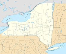
| Serves | Wellsville, New York | ||||||||||
| Elevation AMSL | 2,124 ft / 647 m | ||||||||||
| Coordinates | 42°06′34″N 077°59′24″W / 42.10944°N 77.99000°W | ||||||||||
| Map | |||||||||||
 | |||||||||||
| Runways | |||||||||||
| |||||||||||
| Statistics (2012) | |||||||||||
| |||||||||||
Wellsville Municipal Airport (IATA: ELZ[2], ICAO: KELZ, FAA LID: ELZ), also known as Tarantine Field, is a public use airport located 2 nautical miles (3.7 km; 2.3 mi) southwest of Wellsville, a village in the Town of Wellsville, Allegany County, New York, United States.[1] The airport is owned by the Town of Wellsville.[1] It is included in the National Plan of Integrated Airport Systems for 2011–2015, which categorized it as a general aviation facility.[3]
The original Wellsville airport prior to about 1970 was located about 1.5 mi (2.4 km) northeast of the present airport's location. The original northwest/southeast runway is still clearly visible.
Facilities and aircraft
[edit]Wellsville Municipal Airport covers an area of 382 acres (155 ha) at an elevation of 2,124 ft (647 m) above mean sea level. It has one runway designated 10/28 with an asphalt surface measuring 5,302 by 100 ft (1,616 by 30 m).[1]
The single east-west runway is 5,302 ft (1,616 m) long, however only 4,900 ft (1,500 m) is available for landing. The west-facing runway is equipped with a localizer instrument approach and a medium intensity approach lighting system which allows for a small improvement in landing minimums.
For the 12-month period ending July 31, 2012, the airport had 9,350 aircraft operations, an average of 25 per day: 91% general aviation, 8% air taxi, and 1% military. At that time there were 21 aircraft based at this airport: 81% single-engine and 19% multi-engine.[1]
See also
[edit]References
[edit]- ^ a b c d e FAA Airport Form 5010 for ELZ PDF. Federal Aviation Administration. Effective November 15, 2012.
- ^ "IATA Airport Code Search (ELZ: Wellsville / Municipal)". International Air Transport Association. Retrieved June 14, 2013.
- ^ "2011–2015 NPIAS Report, Appendix A" (PDF, 2.03 MB). National Plan of Integrated Airport Systems. Federal Aviation Administration. October 4, 2010.
External links
[edit]- Wellsville Municipal Airport (ELZ) at NYSDOT Airport Directory
- Aerial image as of April 1994 from USGS The National Map
- FAA Terminal Procedures for ELZ, effective February 20, 2025
- Resources for this airport:
- FAA airport information for ELZ
- AirNav airport information for KELZ
- ASN accident history for ELZ
- FlightAware airport information and live flight tracker
- NOAA/NWS weather observations: current, past three days
- SkyVector aeronautical chart, Terminal Procedures

