Ward Mountain (Texas)
| Ward Mountain | |
|---|---|
 West aspect | |
| Highest point | |
| Elevation | 6,926 ft (2,111 m)[1] |
| Prominence | 258 ft (79 m)[1] |
| Isolation | 0.43 mi (0.69 km)[2] |
| Coordinates | 29°15′25″N 103°20′07″W / 29.2568592°N 103.3354042°W[3] |
| Geography | |
| Country | United States |
| State | Texas |
| County | Brewster |
| Protected area | Big Bend National Park[1] |
| Parent range | Chisos Mountains[1] |
| Topo map | USGS The Basin |
| Geology | |
| Rock age | Oligocene |
| Rock type | Igneous rock |
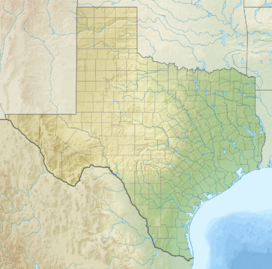
Ward Mountain is a 6,926-foot-elevation (2,111-meter) summit in Brewster County, Texas, United States.
Description
[edit]Ward Mountain is located on the west side of the Chisos Mountains in Big Bend National Park. The mountain is composed of rhyolite (volcanic rock) and Chisos Formation which formed during the Oligocene period.[4][5] Topographic relief is significant as the summit rises 2,500 feet (762 m) above Cottonwood Creek near Ward Spring in 1.25 miles (2.01 km). Based on the Köppen climate classification, Ward Mountain is located in a hot arid climate zone with hot summers and mild winters.[6] Any scant precipitation runoff from the mountain's slopes drains into Cottonwood Creek which is part of the Rio Grande watershed. The lower slopes of the mountain are covered by juniper, oak, and piñon. The mountain's toponym was officially adopted on March 9, 1939, by the United States Board on Geographic Names.[3] The namesake was Johnny Ward, a cowboy from the nearby G4 ranch.[7] The G4 ranch manager Captain Jim Gillette trusted nineteen-year-old Johnny Ward who was sent by rail to Chicago in the late 1880s to buy cattle for the G4 Cattle Company. The G4 was one of the first large ranches of Big Bend, stretching from Oak Spring and The Window to Terlingua Creek and Aguja Fria to the west.[8]
See also
[edit]References
[edit]- ^ a b c d "Ward Mountain, Texas". Peakbagger.com. Retrieved November 5, 2024.
- ^ "Ward Mountain - 6,925' TX". listsofjohn.com. Retrieved November 5, 2024.
- ^ a b "Ward Mountain". Geographic Names Information System. United States Geological Survey, United States Department of the Interior. Retrieved November 5, 2024.
- ^ Geologic Map of the Chisos Mountains, Big Bend National Park, Texas, Robert G. Bohannon, 2011, U.S. Geological Survey.
- ^ Laurence Parent, Hiking Big Bend National Park, 2nd Edition, Rowman & Littlefield, 2005, ISBN 9780762753772, p. 42.
- ^ Peel, M. C.; Finlayson, B. L.; McMahon, T. A. (2007). "Updated world map of the Köppen−Geiger climate classification". Hydrol. Earth Syst. Sci. 11. ISSN 1027-5606.
- ^ Ronnie C. Tyler, The Big Bend: A History of the Last Texas Frontier, U.S. Government Printing Office, 1975, p. 18.
- ^ The Big Bend Paisano, Rob Dean, National Park Service, p. 4.
Gallery
[edit]External links
[edit]- Ward Mountain: Weather forecast


