Villa Paz S.A.
Appearance
Villa Paz S.A. | |
|---|---|
Urban fragment | |
| Coordinates: 34°44′58″S 56°14′00″W / 34.74944°S 56.23333°W | |
| Country | |
| Department | Canelones Department |
| Population (2011) | |
• Total | 542 |
| Time zone | UTC -3 |
| Postal code | 90100 |
| Dial plan | +598 2 (+7 digits) |

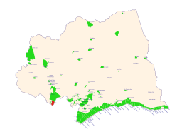
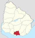
Villa Paz S.A. is an urban fragment adjoined to the city of La Paz in the Canelones Department, southern Uruguay.
Geography
[edit]Location
[edit]It is located west at the west part of the city and north of the city centre. It is separated by a quarry to its east from the rest of the urban area and joined with it to the north and to the south by Manuel Tiscornia street.
Population
[edit]According to the 2011 census, Villa Paz S.A. has a population of 542.[1][2]
| Year | Population |
|---|---|
| 1963 | 281 |
| 1975 | 356 |
| 1985 | 384 |
| 1996 | 476 |
| 2004 | 499 |
| 2011 | 542 |
Source: Instituto Nacional de Estadística de Uruguay[3]
References
[edit]- ^ "Censos 2011 Cuadros Canelones". INE. 2012. Archived from the original on October 10, 2012. Retrieved 25 August 2012.
- ^ "Censos 2011 Canelones". INE. 2012. Archived from the original on September 7, 2012. Retrieved 28 August 2012.
- ^ "1963–1996 Statistics / V" (DOC). Instituto Nacional de Estadística de Uruguay. 2004. Retrieved 1 July 2011.
External links
[edit]


