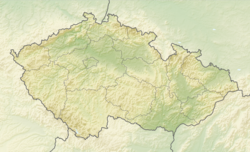
Velké Pavlovice
Velké Pavlovice | |
|---|---|
 View from the east | |
| Coordinates: 48°54′17″N 16°48′58″E / 48.90472°N 16.81611°E | |
| Country | |
| Region | South Moravian |
| District | Břeclav |
| First mentioned | 1252 |
| Government | |
| • Mayor | Petr Hasil |
| Area | |
• Total | 23.25 km2 (8.98 sq mi) |
| Elevation | 182 m (597 ft) |
| Population (2024-01-01)[1] | |
• Total | 3,072 |
| • Density | 130/km2 (340/sq mi) |
| Time zone | UTC+1 (CET) |
| • Summer (DST) | UTC+2 (CEST) |
| Postal code | 691 06 |
| Website | www |
Velké Pavlovice (German: Groß Pawlowitz) is a town in Břeclav District in the South Moravian Region of the Czech Republic. It has about 3,100 inhabitants.
Geography
[edit]Velké Pavlovice is located about 16 kilometres (10 mi) north of Břeclav. Most of the municipal territory lies the Ždánice Forest range, only the southern part extends into the Lower Morava Valley and Kyjov Hills. The highest point is the Tabulka hill at 298 m (978 ft) above sea level. The Trkmanka River flows through the town.
History
[edit]The first written mention of Velké Pavlovice is from 1252, when the settlement gave tithes from vineyards to the newly founded Cistercian abbey in Žďár nad Sázavou. It frequently changed its owners. During the Thirty Years' War, Velké Pavlovice was one of the worst damaged villages in the region. The village recovered in the first half of the 18th century.[2]
In 1891 Velké Pavlovice was promoted to a market town by Emperor Franz Joseph. In 1967, it became a town.[2]
Demographics
[edit]
|
|
| ||||||||||||||||||||||||||||||||||||||||||||||||||||||
| Source: Censuses[3][4] | ||||||||||||||||||||||||||||||||||||||||||||||||||||||||
Economy
[edit]The area of Velké Pavlovice is famous for its viticulture. It gave its name to the Velkopavlovická wine subregion.
Transport
[edit]The D2 motorway from Brno to the border with Slovakia runs next to the town.
Velké Pavlovice is located on the Kobylí–Zaječí railway line of local importance.[5]
Sights
[edit]
The landmark of Velké Pavlovice is the Church of the Assumption of the Virgin Mary. It is an early Baroque church built in 1670–1680 and rebuilt in the mid-19th century.[6]
Notable people
[edit]- Rudolf Kassner (1873–1959), Austrian writer and philosopher
Twin towns — sister cities
[edit]Velké Pavlovice is twinned with:[7]
 Échenon, France
 Senica, Slovakia
 Ždírec nad Doubravou, Czech Republic
References
[edit]- ^ "Population of Municipalities – 1 January 2024". Czech Statistical Office. 2024-05-17.
- ^ a b "Historie" (in Czech). Město Velké Pavlovice. Retrieved 2021-11-25.
- ^ "Historický lexikon obcí České republiky 1869–2011" (in Czech). Czech Statistical Office. 2015-12-21.
- ^ "Population Census 2021: Population by sex". Public Database. Czech Statistical Office. 2021-03-27.
- ^ "Detail stanice Velké Pavlovice" (in Czech). České dráhy. Retrieved 2024-06-27.
- ^ "Kostel Nanebevzetí Panny Marie" (in Czech). National Heritage Institute. Retrieved 2023-02-10.
- ^ "Partnerská města" (in Czech). Město Velké Pavlovice. Retrieved 2021-11-25.


