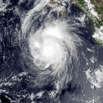
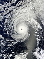
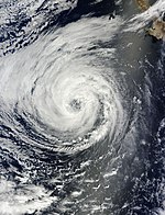
User:Wxtrackercody/2014 Pacific hurricane season
| Wxtrackercody/2014 Pacific hurricane season | |
|---|---|
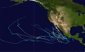 Season summary map | |
| Seasonal boundaries | |
| First system formed | May 22, 2014 |
| Last system dissipated | Currently active |
| Strongest storm | |
| Name | Marie |
| • Maximum winds | 160 mph (260 km/h) |
| • Lowest pressure | 918 mbar (hPa; 27.11 inHg) |
| Seasonal statistics | |
| Total depressions | 16 |
| Total storms | 16 |
| Hurricanes | 11 |
| Major hurricanes (Cat. 3+) | 8 |
| Total fatalities | 18 total |
| Total damage | $80 million (2014 USD) |
| Related article | |
Seasonal forecasts
[edit]Seasonal summary
[edit]
Storms
[edit]Hurricane Amanda
[edit]| Category 4 hurricane (SSHWS) | |
| Duration | May 22 – May 29 |
|---|---|
| Peak intensity | 155 mph (250 km/h) (1-min); 932 mbar (hPa) |
On May 19, the National Hurricane Center (NHC) began monitoring an area of disturbed weather south-southwest of the Gulf of Tehuantepec for potential tropical cyclogenesis. Steered west-northwest around a mid-level ridge over Mexico, the system steadily organized as deep convection increased and the low-pressure center became better defined; in accordance with a scatterometer pass, advisories were initiated on the first tropical depression of the season at 21:00 UTC on May 22.[1] The depression was upgraded to Tropical Storm Amanda eighteen hours later.[2] Amid a favorable atmospheric environment, the cyclone began a period of rapid deepening, marked by an increase in winds from 75 mph (120 km/h) at 15:00 UTC on May 24 to winds of 155 mph (255 km/h) at 15:00 UTC the next day. Shortly thereafter, an increase in wind shear and decrease in moisture and sea surface temperatures, led Amanda to a steady weakening trend. The cyclone weakened below major hurricane intensity at 03:00 UTC on May 27,[3] below hurricane intensity at 03:00 UTC on May 28,[4] and below tropical storm intensity at 15:00 UTC on May 29.[5] Six hours later, Amanda degenerated into a non-convective remnant low.[6]
Tropical Storm Boris
[edit]| Tropical storm (SSHWS) | |
| Duration | June 2 – June 4 |
|---|---|
| Peak intensity | 45 mph (75 km/h) (1-min); 998 mbar (hPa) |
The formation of Boris is attributed to a low-level trough that entered the East Pacific from the southwestern Caribbean Sea on May 28. A broad area of low pressure developed in association with the trough south of the Mexico–Guatemala border two days later, and the disturbance steadily organized with aid from an eastward-moving convectively-coupled kelvin wave. By 18:00 UTC on June 2, the system acquired enough organization to be deemed a tropical depression. Tracking northward, the depression steadily became better defined as spiral bands developed over the eastern semicircle of the circulation. After intensifying into a tropical storm at 12:00 UTC on June 3 and attaining peak winds of 45 mph (75 km/h) six hours later, increasing land interaction caused Boris to begin weakening. It was downgraded to a tropical storm early on June 4 and subsequently degenerated into a remnant low at 18:00 UTC. The remnant low turned northwestward and dissipated shortly thereafter.[7]
Hurricane Cristina
[edit]| Category 4 hurricane (SSHWS) | |
| Duration | June 9 – June 15 |
|---|---|
| Peak intensity | 150 mph (240 km/h) (1-min); 935 mbar (hPa) |
A tropical wave emerged off the western coast of Africa on May 26 and traveled quickly westward, entering the East Pacific on June 5. Two days later, the wave merged with a preexisting area of low pressure and began to organize, aided by a convectively-coupled kelvin wave. As convective bands formed near and east of the center, the disturbance acquired enough organization to be declared a tropical depression by 12:00 UTC on June 9. Steered west-northwest around a ridge over Mexico, the depression only slowly organized due to moderate shear and was upgraded to Tropical Storm Cristina early the next day. Following a reprieve in upper-level winds, the cyclone intensified into a Category 1 hurricane at 06:00 UTC on June 11 and began a period of rapid deepening thereafter. After attaining peak winds of 150 mph (240 km/h) early on June 12, an increasingly unfavorable environment caused the system to commence a weakening trend. At 12:00 UTC on June 14, Cristina was downgraded to a tropical storm; at 06:00 UTC the subsequent day, it was declared a remnant low after remaining devoid of deep convection. The remnant low continued west-northwestward until dissipating early on June 19.[8]
Tropical Storm Douglas
[edit]| Tropical storm (SSHWS) | |
| Duration | June 28 – July 5 |
|---|---|
| Peak intensity | 45 mph (75 km/h) (1-min); 1000 mbar (hPa) |
The NHC began monitoring a large area of disturbed weather offshore the coast of southern Mexico on June 25.[9] A broad area of low pressure formed in association with the disturbance two days later, and it steadily organized amid favorable environmental conditions.[10] Steered west-northwest around a ridge over Mexico, the disturbance acquired sufficient organization to be declared a tropical depression at 21:00 UTC on June 28.[11] As convection continued to consolidate over the center and a primitive spiral band organized, the depression was upgraded to Tropical Storm Douglas.[12] After attaining peak winds of at least 45 mph (75 km/h),[13] a track over cooler waters and into a more stable environment caused the storm to weaken to a tropical depression by 09:00 UTC on July 5.[14] Six hours later, the depression degenerated into a remnant low.[15]
Tropical Storm Elida
[edit]| Tropical storm (SSHWS) | |
| Duration | June 30 – July 2 |
|---|---|
| Peak intensity | 50 mph (85 km/h) (1-min); 1003 mbar (hPa) |
A well-defined tropical wave moved emerged off the western coast Africa on June 20. After entering the East Pacific a week later, shower and thunderstorm activity began to increase. Although the system lacked a closed low initially, a small circulation was noted by 06:00 UTC on June 30, and the system was declared Tropical Storm Elida accordingly. Paralleling the southwestern coast of Mexico, the cyclone attained peak winds of 45 mph (75 km/h) before strong northwesterly wind shear from nearby Tropical Storm Douglas caused the storm to become disheveled. It weakened to a tropical depression at 00:00 UTC on July 2 and degenerated into a remnant low six hours later. The remnant low drifted southeastward before dissipating early on July 3.[16]
Tropical Storm Fausto
[edit]| Tropical storm (SSHWS) | |
| Duration | July 7 – July 9 |
|---|---|
| Peak intensity | 45 mph (75 km/h) (1-min); 1004 mbar (hPa) |
A tropical wave moved off the western coast of Africa on June 22 and entered the East Pacific eight days later. On July 4, convection increased with the aid of a convectively-coupled kelvin wave, and two days later, a broad area of low pressure formed along the wave axis well south-southwest of Baja California. After further organization, the disturbance was declared a tropical depression at 12:00 UTC on July 7. Steered westward around a subtropical ridge, the depression intensified into Tropical Storm Fausto six hours later and simultaneously attained peak winds of 45 mph (75 km/h). By early on July 9, Fausto weakened to a tropical depression as dry air became entrained into the circulation. The low-level center opened up into a trough by 12:00 UTC, marking the demise of the cyclone.[17]
Tropical Storm Wali
[edit]| Tropical storm (SSHWS) | |
| Duration | July 17 – July 19 |
|---|---|
| Peak intensity | 45 mph (75 km/h) (1-min); 1001 mbar (hPa) |
The NHC began monitoring a large area of disturbed weather in association with a tropical wave well southwest of the southern tip of the Baja California peninsula on July 13.[18] After crossing into the central Pacific, the disturbance gradually organized, and it acquired enough organization to be declared a tropical depression at 21:00 UTC on July 17.[19] An hour later, data from an ASCAT pass revealed winds up to 45 mph (75 km/h), and the depression was upgraded to Tropical Storm Wali.[20] Steered west-northwestward around a mid-level ridge to the cyclone's northeast, increasing wind shear caused the cloud pattern associated with Wali to become disorganized; at 21:00 UTC on July 18, the system was downgraded to a tropical depression,[21] and by 03:00 UTC the following afternoon, Wali was declared a remnant low after having been devoid of deep convection.[22]
Hurricane Genevieve
[edit]| Category 4 hurricane (SSHWS) | |
| Duration | July 25 – August 7 (Exited basin) |
|---|---|
| Peak intensity | 135 mph (215 km/h) (1-min); 960 mbar (hPa) |
A small area of disturbed weather formed well south of Manzanillo, Mexico on July 20.[23] Tracking west-northwestward, deep convection developed about an area of low pressure, leading to the designation of Tropical Storm Genevieve at 09:00 UTC on July 25.[24] Persistent westerly wind shear caused the low-level center to become exposed to view by early the next day, and in junction with satellite intensity estimates, Genevieve weakened to a tropical depression at 15:00 UTC.[25] The center remained exposed as the storm entered the central Pacific, and the Central Pacific Hurricane Center declared the cyclone a remnant low at 03:00 UTC on July 28.[26] In spite of this, deep convection developed near the circulation once again during the afternoon hours of July 29, and Genevieve was upgraded to a tropical depression.[27] Although intensity guidance suggested the cyclone would slowly intensify into a tropical storm, deep convection faltered by 21:00 UTC on July 31, once again leading to the designation of a remnant low.[28]
Travelling west-southwestward around the south side of a subtropical ridge, deep convection became invigorated once again early on August 2, leading to the classification of Tropical Depression Genevieve for a second time at 15:00 UTC; amid a much improved upper-level pattern, gradual intensification was forecast.[29] The CPHC upgraded Genevieve to a tropical storm at 21:00 UTC on August 5 as curved bands developed north and west of the center.[30] Thereafter, the cyclone began an extraordinary period of intensification, with maximum sustained winds increasing from 75 mph (120 km/h) to 135 mph (215 km/h) in a 12-hour period.[31][32] Genevieve further intensified into a Category 5-equivalent typhoon as it crossed the International Dateline into the West Pacific.[33]
Hurricane Hernan
[edit]| Category 1 hurricane (SSHWS) | |
| Duration | July 26 – July 29 |
|---|---|
| Peak intensity | 75 mph (120 km/h) (1-min); 992 mbar (hPa) |
On July 24, an area of showers and thunderstorms formed off the coast of southeastern Mexico, and upper-level winds were expected to become more conducive for its development over subsequent days.[34] Given an increase in convection and the formation of banding features, advisories were initiated on a tropical depression at 09:00 UTC on July 26;[35] twelve hours later, it intensified into Tropical Storm Hernan.[36] Steered west-northwest by a ridge over the southwestern United States, the cyclone steadily organized and acquired enough organization to be declared a Category 1 hurricane by 2100 UTC on July 27.[37] Immediately after attaining peak winds of 75 mph (120 km/h), a track over cooler sea surface temperatures and an increase in wind shear caused Hernan to weaken; at 0900 UTC on July 28, it deteriorated into a tropical storm.[38] After having been devoid of deep convection for more than 12 hours, Hernan was declared a remnant low at 15:00 UTC on July 29.[39]
Hurricane Iselle
[edit]| Category 4 hurricane (SSHWS) | |
| Duration | July 31 – August 9 |
|---|---|
| Peak intensity | 140 mph (220 km/h) (1-min); 947 mbar (hPa) |
Hurricane Julio
[edit]| Category 3 hurricane (SSHWS) | |
| Duration | August 4 – August 15 |
|---|---|
| Peak intensity | 120 mph (195 km/h) (1-min); 962 mbar (hPa) |
On July 31, the NHC began monitoring disorganized convection in association with a tropical wave south of Acapulco, Mexico.[40] Thunderstorm activity increased and organized over subsequent days, leading to the formation of a tropical depression at 03:00 UTC on August 4,[41] and the designation of Tropical Storm Julio six hours later.[42] In conjunction with moderate northeasterly shear, little change in strength was observed initially; by early on August 6, however, atmospheric conditions became more favorable, and the cyclone was upgraded to a Category 1 hurricane.[43] With an improving satellite presentation, including a warm eye, Julio was upgraded to a Category 2 hurricane at 09:00 UTC on August 7,[44] and further to a Category 3 hurricane at 03:00 UTC the next day as the storm began to move into the Central Pacific.[45]
Hurricane Karina
[edit]| Category 1 hurricane (SSHWS) | |
| Duration | August 13 – August 27 |
|---|---|
| Peak intensity | 80 mph (130 km/h) (1-min); 988 mbar (hPa) |
Hurricane Lowell
[edit]| Category 1 hurricane (SSHWS) | |
| Duration | August 18 – August 24 |
|---|---|
| Peak intensity | 75 mph (120 km/h) (1-min); 982 mbar (hPa) |
The NHC began monitoring a trough of low pressure well west-southwest of Manzanillo, Mexico on August 15.[46] Within a favorable environment for development, the disturbance was upgraded to Tropical Depression Twelve-E at 03:00 UTC on August 18,[47] and further to Tropical Storm Lowell at 03:00 UTC the following day.[48] Steered northwestward in response to an upper-level trough over California, the cyclone steadily organized, with its satellite appearance consisting of a large ragged eye; at 15:00 UTC on August 21, Lowell intensified into a Category 1 hurricane and reached peak winds of 75 mph (120 km/h).[49] Thereafter, a track over cooler sea surface temperatures led to a steady weakening trend. At 03:00 UTC on August 22, the system was downgraded to a tropical storm,[50] and by early on August 24, Lowell no longer maintained the coverage and duration of convection to be considered a tropical cyclone.[51]
Hurricane Marie
[edit]| Category 5 hurricane (SSHWS) | |
| Duration | August 22 – August 29 |
|---|---|
| Peak intensity | 160 mph (260 km/h) (1-min); 927 mbar (hPa) |
A broad area of low pressure formed several hundred miles south-southeast of the Gulf of Tehuantepec on August 19.[52] Tracking west-northwestward south of a mid-level ridge over the southern United States and northern Mexico, curved bands of deep convection organized about a well-defined center, leading to the formation of a tropical depression at 03:00 UTC on August 22;[53] six hours later, the depression was upgraded to Tropical Storm Marie.[54] With the storm situated over warm sea surface temperatures and in a low wind shear environment, Marie rapidly intensified almost immediately after being upgraded, becoming a Category 1 hurricane at 09:00 UTC on August 23,[55] a Category 2 hurricane at 03:00 UTC on August 24,[56] and a Category 4 hurricane at 09:00 UTC on August 25.[57] With satellite intensity estimates rising to T7.0/140kt, Marie was upgraded to a Category 5 hurricane at 21:00 UTC that day, the first since Hurricane Celia in 2010.[58] Succeeding peak intensity, a combination of drier air, cooler ocean temperatures, and the start of an eyewall replacement cycle all caused Marie to begin weakening: at 09:00 UTC on August 26, the storm fell below major hurricane intensity,[59] and at 21:00 UTC on August 27, the storm weakened below hurricane intensity.[60] After lacking deep convection over the center for many hours, Marie was classified as a remnant low early on August 29.[61]
Hurricane Norbert
[edit]| Category 3 hurricane (SSHWS) | |
| Duration | September 2 – September 8 |
|---|---|
| Peak intensity | 120 mph (195 km/h) (1-min); 957 mbar (hPa) |
The NHC began monitoring a large area of disturbed weather in association with a trough of low pressure near the south-central coast of Mexico on August 31.[62] Amid a favorable atmospheric environment, the disturbance steadily organized and was acquired sufficient organization to be declared Tropical Storm Norbert at 15:00 UTC on September 2.[63] The cyclone moved generally northwestward following formation, steered on the southwestern side of a mid-level ridge over northern Mexico.[64] With a symmetric central dense overcast and curved bands wrapping into the center, Norbert was upgraded to a Category 1 hurricane at 03:00 UTC on September 4.[65] Initially steady state, the cyclone began a period of rapid deepening early on September 5, becoming a Category 2 hurricane at 00:00 UTC and a Category 3 hurricane at 06:00 UTC.[66][67] After attaining peak winds of 120 mph (195 km/h), the effects of cooler ocean temperatures began to weaken the system. Norbert weakened below major hurricane intensity at 21:00 UTC on September 6 and below hurricane intensity at 15:00 UTC on September 7.[68][69] After lacking deep, organized convection for over 12 hours, Norbert was declared post-tropical cyclone at 09:00 UTC on September 8.[70]
Storm names
[edit]The following names will be used for named storms that form in the northeastern Pacific Ocean during 2014. Retired names, if any, will be announced by the World Meteorological Organization in the spring of 2015. The names not retired from this list will be used again in the 2020 season.[71] This is the same list used in the 2008 season with the exception of Amanda, which replaced Alma; the name Amanda was used for the first time in 2014.
|
For storms that form in the Central Pacific Hurricane Center's area of responsibility, encompassing the area between 140 degrees west and the International Date Line, all names are used in a series of four rotating lists.[72] The next four names slated for use are shown below.
|
|
|
|
Season effects
[edit]This is a table of all of the storms that have formed in the 2014 Pacific hurricane season. It includes their duration, names, landfall(s), denoted in parenthesis, damages, and death totals. Deaths in parentheses are additional and indirect (an example of an indirect death would be a traffic accident), but were still related to that storm. Damage and deaths include totals while the storm was extratropical, a wave, or a low, and all of the damage figures are in 2014 USD.
| Storm name |
Dates active | Storm category at peak intensity |
Max 1-min wind mph (km/h) |
Min. press. (mbar) |
Areas affected | Damage (USD) |
Deaths | Ref(s). | ||
|---|---|---|---|---|---|---|---|---|---|---|
| Amanda | May 22 – May 29 | Category 4 hurricane | 155 (250) | 932 | Western Mexico | Minimal | 3 | |||
| Boris | June 2 – June 4 | Tropical storm | 45 (75) | 998 | Southwestern Mexico, Guatemala | Unknown | 6 | |||
| Cristina | June 9 – June 15 | Category 4 hurricane | 150 (240) | 935 | Western Mexico, Revillagigedo Islands | Minimal | None | |||
| Douglas | June 28 – July 5 | Tropical storm | 45 (75) | 1000 | None | Minor | None | |||
| Elida | June 30 – July 2 | Tropical storm | 50 (85) | 1003 | Western Mexico | None | None | |||
| Fausto | July 7 – July 9 | Tropical storm | 45 (75) | 1004 | None | None | None | |||
| Wali | July 17 – July 19 | Tropical storm | 45 (75) | 1001 | None | None | None | |||
| Genevieve | July 25 – August 7[nb 1] | Category 4 hurricane | 135 (215) | 960 | None | None | None | |||
| Hernan | July 26 – July 29 | Category 1 hurricane | 75 (120) | 992 | Revillagigedo Islands | None | None | |||
| Iselle | July 31 – August 9 | Category 4 hurricane | 140 (220) | 947 | Hawaiian Islands | 66 | 1 | |||
| Julio | August 4 – August 15 | Category 3 hurricane | 120 (195) | 962 | None | None | None | |||
| Karina | August 13 – August 27 | Category 1 hurricane | 80 (130) | 988 | None | None | None | |||
| Lowell | August 18 – August 24 | Category 1 hurricane | 75 (120) | 982 | None | None | None | |||
| Marie | August 22 – August 29 | Category 5 hurricane | 160 (260) | 918 | Southwestern Mexico, California | 14 | 3 | |||
| Norbert | September 2 – September 8 | Category 3 hurricane | 120 (195) | 957 | Western Mexico, Baja California, Southwestern United States | Unknown | 5 | |||
| Odile | September 10 – Currently active | Tropical storm | 135 (215) | 922 | Southwestern Mexico, Western Mexico, Baja California Sur | Unknown | 0 | |||
| Season aggregates | ||||||||||
| 16 systems | May 22 – Currently active | 160 (260) | 918 | 80 | 18 | |||||
See also
[edit]- List of Pacific hurricanes
- List of Pacific hurricane seasons
- 2014 Atlantic hurricane season
- 2014 Pacific typhoon season
- 2014 North Indian Ocean cyclone season
- South-West Indian Ocean cyclone seasons: 2013–14, 2014–15
- Australian region cyclone seasons: 2013–14, 2014–15
- South Pacific cyclone seasons: 2013–14, 2014–15
Footnotes
[edit]- ^ Genevieve did not dissipate on August 7. It crossed the International Date Line and became known as Typhoon Genevieve.
References
[edit]- ^ Robbie J. Berg (May 22, 2014). "Tropical Depression One Discussion Number 1". National Hurricane Center. Miami, Florida: National Oceanic and Atmospheric Administration. Retrieved August 28, 2014.
- ^ Robbie J. Berg (May 23, 2014). "Tropical Storm Amanda Discussion Number 4". National Hurricane Center. Miami, Florida: National Oceanic and Atmospheric Administration. Retrieved August 28, 2014.
- ^ Todd B. Kimberlain (May 26, 2014). "Hurricane Amanda Discussion Number 18". National Hurricane Center. Miami, Florida: National Oceanic and Atmospheric Administration. Retrieved August 28, 2014.
- ^ Todd B. Kimberlain (May 27, 2014). "Tropical Storm Amanda Discussion Number 22". National Hurricane Center. Miami, Florida: National Oceanic and Atmospheric Administration. Retrieved August 28, 2014.
- ^ John P. Cangialosi (May 29, 2014). "Tropical Depression Amanda Discussion Number 28". National Hurricane Center. Miami, Florida: National Oceanic and Atmospheric Administration. Retrieved August 28, 2014.
- ^ John P. Cangialosi (May 29, 2014). "Post-Tropical Cyclone Amanda Discussion Number 29". National Hurricane Center. Miami, Florida: National Oceanic and Atmospheric Administration. Retrieved August 28, 2014.
- ^ Daniel P. Brown (August 12, 2014). Tropical Cyclone Report: Tropical Storm Boris (PDF). National Hurricane Center (Report). Miami, Florida: National Oceanic and Atmospheric Administration. Retrieved September 9, 2014.
- ^ Eric S. Blake (August 21, 2014). Tropical Cyclone Report: Hurricane Cristina (PDF). National Hurricane Center (Report). Miami, Florida: National Oceanic and Atmospheric Administration. Retrieved September 9, 2014.
- ^ Michael J. Brennan (June 25, 2014). "Tropical Weather Outlook" (TXT). National Hurricane Center. Miami, Florida: National Oceanic and Atmospheric Administration. Retrieved June 30, 2014.
- ^ Daniel P. Brown (June 27, 2014). "Tropical Weather Outlook" (TXT). National Hurricane Center. Miami, Florida: National Oceanic and Atmospheric Administration. Retrieved June 30, 2014.
- ^ Eric S. Blake (June 28, 2014). "Tropical Depression Four-E Discussion Number 1". National Hurricane Center. Miami, Florida: National Oceanic and Atmospheric Administration. Retrieved June 30, 2014.
- ^ Eric S. Blake (June 28, 2014). "Tropical Storm Douglas Discussion Number 6". National Hurricane Center. Miami, Florida: National Oceanic and Atmospheric Administration. Retrieved June 30, 2014.
- ^ Cristopher W. Landsea (June 30, 2014). "Tropical Storm Douglas Discussion Number 10". National Hurricane Center. Miami, Florida: National Oceanic and Atmospheric Administration. Retrieved September 9, 2014.
- ^ Cristopher W. Landsea (July 5, 2014). "Tropical Storm Douglas Discussion Number 27". National Hurricane Center. Miami, Florida: National Oceanic and Atmospheric Administration. Retrieved September 9, 2014.
- ^ Richard J. Pasch (July 5, 2014). "Tropical Storm Douglas Discussion Number 28". National Hurricane Center. Miami, Florida: National Oceanic and Atmospheric Administration. Retrieved September 9, 2014.
- ^ Lixion A. Avila (August 8, 2014). Tropical Cyclone Report: Tropical Storm Elida (PDF). National Hurricane Center (Report). Miami, Florida: National Oceanic and Atmospheric Administration. Retrieved September 9, 2014.
- ^ John P. Cangialosi (August 31, 2014). Tropical Cyclone Report: Tropical Storm Fausto (PDF). National Hurricane Center (Report). Miami, Florida: National Oceanic and Atmospheric Administration. Retrieved September 9, 2014.
- ^ Eric S. Blake (July 13, 2014). "Tropical Weather Outlook" (PDF). National Hurricane Center. Miami, Florida: National Oceanic and Atmospheric Administration. Retrieved September 13, 2014.
- ^ Derek Wroe (July 17, 2014). "Tropical Depression One-C Discussion Number 1". Central Pacific Hurricane Center. Honolulu, Hawaii: National Oceanic and Atmospheric Administration. Retrieved September 13, 2014.
- ^ Derek Wroe (July 17, 2014). "Tropical Storm Wali Special Discussion Number 2". Central Pacific Hurricane Center. Honolulu, Hawaii: National Oceanic and Atmospheric Administration. Retrieved September 13, 2014.
- ^ Peter Donaldson (July 18, 2014). "Tropical Depression Wali Discussion Number 6". Central Pacific Hurricane Center. Honolulu, Hawaii: National Oceanic and Atmospheric Administration. Retrieved September 13, 2014.
- ^ Peter Donaldson (July 18, 2014). "Post-Tropical Cyclone Wali Discussion Number 7". Central Pacific Hurricane Center. Honolulu, Hawaii: National Oceanic and Atmospheric Administration. Retrieved September 13, 2014.
- ^ Richard J. Pasch (July 20, 2014). "Tropical Weather Outlook". National Hurricane Center. Miami, Florida: National Oceanic and Atmospheric Administration. Retrieved September 14, 2014.
- ^ Robbie J. Berg (July 25, 2014). "Tropical Storm Genevieve Discussion Number 1". National Hurricane Center. Miami, Florida: National Oceanic and Atmospheric Administration. Retrieved September 14, 2014.
- ^ Lixion A. Avila (July 26, 2014). "Tropical Depression Genevieve Discussion Number 6". National Hurricane Center. Miami, Florida: National Oceanic and Atmospheric Administration. Retrieved September 14, 2014.
- ^ Tom Brichard (July 28, 2014). "Post-Tropical Cyclone Genevieve Discussion Number 12". Central Pacific Hurricane Center. Honolulu, Hawaii: National Oceanic and Atmospheric Administration. Retrieved September 14, 2014.
- ^ Bob Burke (July 29, 2014). "Tropical Depression Genevieve Discussion Number 13". Central Pacific Hurricane Center. Honolulu, Hawaii: National Oceanic and Atmospheric Administration. Retrieved September 14, 2014.
- ^ Bob Burke (July 29, 2014). "Post-Tropical Cyclone Genevieve Discussion Number 21". Central Pacific Hurricane Center. Honolulu, Hawaii: National Oceanic and Atmospheric Administration. Retrieved September 14, 2014.
- ^ Samuel H. Houston (August 2, 2014). "Tropical Depression Genevieve Discussion Number 22". Central Pacific Hurricane Center. Honolulu, Hawaii: National Oceanic and Atmospheric Administration. Retrieved September 14, 2014.
- ^ Tom Brichard (August 5, 2014). "Tropical Storm Genevieve Discussion Number 35". Central Pacific Hurricane Center. Honolulu, Hawaii: National Oceanic and Atmospheric Administration. Retrieved September 14, 2014.
- ^ Samuel Houston; Chris Jacobson (August 6, 2014). "Hurricane Genevieve Discussion Number 38". Central Pacific Hurricane Center. Honolulu, Hawaii: National Oceanic and Atmospheric Administration. Retrieved September 14, 2014.
- ^ Kevin Kodama (August 7, 2014). "Hurricane Genevieve Discussion Number 40". Central Pacific Hurricane Center. Honolulu, Hawaii: National Oceanic and Atmospheric Administration. Retrieved September 14, 2014.
- ^ "Prognostic Reasoning for Super Typhoon 11W (Genevieve) Warning NR 42". Joint Typhoon Warning Center. Pearl Harbor, Hawaii: National Oceanic and Atmospheric Administration. August 7, 2014. Retrieved September 14, 2014.
- ^ Eric S. Blake (July 24, 2014). "Tropical Weather Outlook" (TXT). National Hurricane Center. Miami, Florida: National Oceanic and Atmospheric Administration. Retrieved August 7, 2014.
- ^ Stacy R. Stewart (July 26, 2014). "Tropical Depression Eight-E Discussion Number 1". National Hurricane Center. Miami, Florida: National Oceanic and Atmospheric Administration. Retrieved August 7, 2014.
- ^ John P. Cangialosi (July 26, 2014). "Tropical Storm Hernan Discussion Number 3". National Hurricane Center. Miami, Florida: National Oceanic and Atmospheric Administration. Retrieved August 7, 2014.
- ^ Richard J. Pasch (July 27, 2014). "Hurricane Hernan Discussion Number 7". National Hurricane Center. Miami, Florida: National Oceanic and Atmospheric Administration. Retrieved August 7, 2014.
- ^ John P. Cangialosi (July 28, 2014). "Tropical Storm Hernan Discussion Number 9". National Hurricane Center. Miami, Florida: National Oceanic and Atmospheric Administration. Retrieved August 7, 2014.
- ^ Dave Roberts (July 29, 2014). "Post-Tropical Cyclone Hernan Discussion Number 14". National Hurricane Center. Miami, Florida: National Oceanic and Atmospheric Administration. Retrieved August 7, 2014.
- ^ Robbie J. Berg (July 31, 2014). "Tropical Weather Outlook". National Hurricane Center. Miami, Florida: National Oceanic and Atmospheric Administration. Retrieved September 10, 2014.
- ^ Todd B. Kimberlain (August 4, 2014). "Tropical Depression Ten-E Discussion Number 1". National Hurricane Center. Miami, Florida: National Oceanic and Atmospheric Administration. Retrieved September 10, 2014.
- ^ Eric S. Blake (August 4, 2014). "Tropical Storm Julio Discussion Number 2". National Hurricane Center. Miami, Florida: National Oceanic and Atmospheric Administration. Retrieved September 10, 2014.
- ^ Stacy R. Stewart (August 6, 2014). "Hurricane Julio Discussion Number 10". National Hurricane Center. Miami, Florida: National Oceanic and Atmospheric Administration. Retrieved September 10, 2014.
- ^ Robbie J. Berg (August 7, 2014). "Hurricane Julio Discussion Number 14". National Hurricane Center. Miami, Florida: National Oceanic and Atmospheric Administration. Retrieved September 10, 2014.
- ^ Eric S. Blake (August 8, 2014). "Hurricane Julio Discussion Number 17". National Hurricane Center. Miami, Florida: National Oceanic and Atmospheric Administration. Retrieved September 10, 2014.
- ^ Robbie J. Berg (August 15, 2014). "Tropical Weather Outlook". National Hurricane Center. Miami, Florida: National Oceanic and Atmospheric Administration. Retrieved September 13, 2014.
- ^ Eric S. Blake (August 18, 2014). "Tropical Depression Twelve-E Discussion Number 1". National Hurricane Center. Miami, Florida: National Oceanic and Atmospheric Administration. Retrieved September 13, 2014.
- ^ Eric S. Blake (August 19, 2014). "Tropical Storm Lowell Discussion Number 5". National Hurricane Center. Miami, Florida: National Oceanic and Atmospheric Administration. Retrieved September 13, 2014.
- ^ Michael J. Brennan (August 21, 2014). "Hurricane Lowell Discussion Number 15". National Hurricane Center. Miami, Florida: National Oceanic and Atmospheric Administration. Retrieved September 13, 2014.
- ^ Jack L. Beven II (August 22, 2014). "Tropical Storm Lowell Discussion Number 17". National Hurricane Center. Miami, Florida: National Oceanic and Atmospheric Administration. Retrieved September 13, 2014.
- ^ Jack L. Beven II (August 24, 2014). "Post-Tropical Cyclone Lowell Discussion Number 25". National Hurricane Center. Miami, Florida: National Oceanic and Atmospheric Administration. Retrieved September 13, 2014.
- ^ Stacy R. Stewart (August 19, 2014). "Tropical Weather Outlook". National Hurricane Center. Miami, Florida: National Oceanic and Atmospheric Administration. Retrieved September 13, 2014.
- ^ Stacy R. Stewart (August 22, 2014). "Tropical Depression Thirteen-E Discussion Number 1". National Hurricane Center. Miami, Florida: National Oceanic and Atmospheric Administration. Retrieved September 13, 2014.
- ^ Robbie J. Berg (August 22, 2014). "Tropical Storm Marie Discussion Number 2". National Hurricane Center. Miami, Florida: National Oceanic and Atmospheric Administration. Retrieved September 13, 2014.
- ^ Dave Roberts (August 23, 2014). "Hurricane Marie Discussion Number 6". National Hurricane Center. Miami, Florida: National Oceanic and Atmospheric Administration. Retrieved September 13, 2014.
- ^ Todd B. Kimberlain (August 24, 2014). "Hurricane Marie Discussion Number 9". National Hurricane Center. Miami, Florida: National Oceanic and Atmospheric Administration. Retrieved September 13, 2014.
- ^ John P. Cangialosi (August 25, 2014). "Hurricane Marie Discussion Number 10". National Hurricane Center. Miami, Florida: National Oceanic and Atmospheric Administration. Retrieved September 13, 2014.
- ^ Robbie J. Berg (August 24, 2014). "Hurricane Marie Discussion Number 12". National Hurricane Center. Miami, Florida: National Oceanic and Atmospheric Administration. Retrieved September 13, 2014.
- ^ John P. Cangialosi (August 26, 2014). "Hurricane Marie Discussion Number 18". National Hurricane Center. Miami, Florida: National Oceanic and Atmospheric Administration. Retrieved September 13, 2014.
- ^ Daniel P. Brown (August 27, 2014). "Tropical Storm Marie Discussion Number 24". National Hurricane Center. Miami, Florida: National Oceanic and Atmospheric Administration. Retrieved September 13, 2014.
- ^ Eric S. Blake (August 29, 2014). "Post-Tropical Cyclone Marie Discussion Number 30". National Hurricane Center. Miami, Florida: National Oceanic and Atmospheric Administration. Retrieved September 13, 2014.
- ^ Todd B. Kimberlain (August 31, 2014). "Tropical Weather Outlook". National Hurricane Center. Miami, Florida: National Oceanic and Atmospheric Administration. Retrieved September 7, 2014.
- ^ Eric S. Blake (September 2, 2014). "Tropical Storm Norbert Discussion Number 1". National Hurricane Center. Miami, Florida: National Oceanic and Administration. Retrieved September 7, 2014.
- ^ Stacy R. Stewart (September 3, 2014). "Tropical Storm Norbert Discussion Number 4". National Hurricane Center. Miami, Florida: National Oceanic and Atmospheric Administration. Retrieved September 7, 2014.
- ^ Daniel P. Brown (September 4, 2014). "Hurricane Norbert Discussion Number 7". National Hurricane Center. Miami, Florida: National Oceanic and Atmospheric Administration. Retrieved September 7, 2014.
- ^ Michael J. Brennan (September 6, 2014). "Hurricane Norbert Intermediate Advisory Number 14A". National Hurricane Center. Miami, Florida: National Oceanic and Atmospheric Administration. Retrieved September 7, 2014.
- ^ Jack L. Beven II (September 6, 2014). "Hurricane Norbert Intermediate Advisory Number 15A". National Hurricane Center. Miami, Florida: National Oceanic and Atmospheric Administration. Retrieved September 7, 2014.
- ^ Lixion A. Avila (September 6, 2014). "Hurricane Norbert Discussion Number 18". National Hurricane Center. Miami, Florida: National Oceanic and Atmospheric Administration. Retrieved September 7, 2014.
- ^ John P. Cangialosi (September 4, 2014). "Tropical Storm Norbert Discussion Number 21". National Hurricane Center. Miami, Florida: National Oceanic and Atmospheric Administration. Retrieved September 7, 2014.
- ^ Todd B. Kimberlain (September 8, 2014). "Post-Tropical Cyclone Norbert Discussion Number 24". National Hurricane Center. Miami, Florida: National Oceanic and Atmospheric Administration. Retrieved September 8, 2014.
- ^ "Tropical Cyclone Names". National Hurricane Center. National Oceanic and Atmospheric Administration. 2013-04-11. Archived from the original on May 8, 2013. Retrieved May 8, 2013.
- ^ "Pacific Tropical Cyclone Names". Central Pacific Hurricane Center. National Oceanic and Atmospheric Administration. April 11, 2013. Archived from the original (PHP) on May 8, 2013. Retrieved May 8, 2013.


