User:Thetrotel/sandbox
| Hindu Kush | |
|---|---|
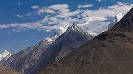 The Hindu Kush mountains at the Afghanistan-Pakistan border | |
| Highest point | |
| Peak | Tirich Mir (Pakistan) |
| Elevation | 7,708 m (25,289 ft) |
| Coordinates | 36°14′45″N 71°50′38″E / 36.24583°N 71.84389°E |
| Dimensions | |
| Length | 800 km (500 mi) |
| Geography | |
 Topography of the Hindu Kush range[1] | |
| Countries | Afghanistan, Pakistan and Tajikistan |
| Region | South and Central Asia |
| Parent range | Himalayas |
| Lua error in Module:Mapframe at line 389: attempt to perform arithmetic on local 'lat_d' (a nil value). | |
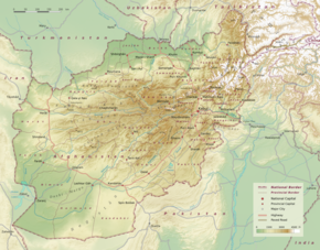
The Hindu Kush is an 800-kilometre-long (500 mi) mountain range on the Iranian Plateau in Central and South Asia to the west of the Himalayas. It stretches from central and eastern Afghanistan[2][3] into northwestern Pakistan and far southeastern Tajikistan. The range forms the western section of the Hindu Kush Himalayan Region (HKH);[4][5][6] to the north, near its northeastern end, the Hindu Kush buttresses the Pamir Mountains near the point where the borders of China, Pakistan and Afghanistan meet, after which it runs southwest through Pakistan and into Afghanistan near their border.[2]
The eastern end of the Hindu Kush in the north merges with the Karakoram Range.[7][8] Towards its southern end, it connects with the White Mountains near the Kabul River.[9][10] It divides the valley of the Amu Darya (the ancient Oxus) to the north from the Indus River valley to the south. The range has numerous high snow-capped peaks, with the highest point being Tirich Mir or Terichmir at 7,708 metres (25,289 ft) in the Chitral District of Khyber Pakhtunkhwa, Pakistan.
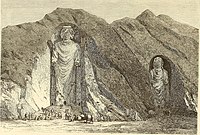
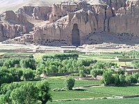
The Hindu Kush range region was a historically significant center of Buddhism, with sites such as the Bamiyan Buddhas.[11][12] The range and communities settled in it hosted ancient monasteries, important trade networks and travelers between Central Asia and South Asia.[13][14] While the vast majority of the region has been majority-Muslim for several centuries now, certain portions of the Hindu Kush only became Islamized relatively recently, such as Kafiristan,[15] which retained ancient polytheistic beliefs until the 19th century when it was converted to Islam by the Durrani Empire and renamed Nuristan ("land of light").[16] The Hindu Kush range has also been the passageway for invasions of the Indian subcontinent,[17][18] and continues to be important to contemporary warfare in Afghanistan.[19][20]
Name origin
[edit]The earliest known usage of the Persian name Hindu Kush occurs on a map published about 1000 CE.[21] Some modern scholars remove the space and refer to the mountain range as Hindukush.[22][23]
Etymology
[edit]Hindu Kush is generally translated as "Killer of Hindu"[24][25][26][27][28][29][30] or "Hindu-Killer" by most writers.[31][32][33][34][35] Boyle's Persian–English dictionary indicates that the Persian suffix -koš [koʃ] is the present stem of the verb 'to kill' (koštan کشتن).[36] According to linguist Francis Joseph Steingass, the suffix -kush means "a male; (imp. of kushtan in comp.) a killer, who kills, slays, murders, oppresses as azhdaha-kush ['dragon-slayer']."[37]
The term was earliest used by Ibn Battuta. According to him, Hindu Kush means Hindu Killer as slaves from the Indian subcontinent died in the harsh climatic conditions of the mountains while being taken from India to Turkestan.[38][39][40][41][a]
Several other theories have been propounded as to the origins of the name.[43] According to Nigel Allan, the term Hindu Kush has two alternate meanings i.e 'sparkling snows of India' and 'mountains of India', with Kush possibly being a soft variant of the Persian kuh ('mountain'). Allan states that Hindu Kush was the frontier boundary to Arab geographers.[44] Yet others suggest that the name may be derived from ancient Avestan, meaning 'water mountain'.[45]
According to Hobson-Jobson, a 19th-century British dictionary, Hindukush might be a corruption of the ancient Latin Indicus (Caucasus); the entry mentions the interpretation first given by Ibn Batuta as a popular theory already at that time, despite doubts cast upon it.[46]
Other names
[edit]In Vedic Sanskrit, the range was known as upariśyena, and in Avestan, as upāirisaēna (from Proto-Iranian *upārisaina- 'covered with juniper').[47][48] It can alternatively be interpreted as "beyond the reach of eagles".[49] In the time of Alexander the Great, the mountain range was referred to as the Caucasus Indicus (as opposed to the Greater Caucasus range between the Caspian and Black Seas), and as Paropamisos (see Paropamisadae) by Hellenic Greeks in the late first millennium BCE.[50]
Some 19th-century encyclopedias and gazetteers state that the term Hindu Kush originally applied only to the peak in the area of the Kushan Pass, which had become a center of the Kushan Empire by the first century.[51]
Geography
[edit]
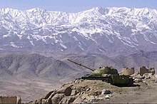
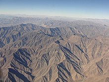

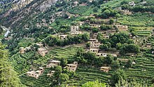
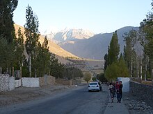
The range forms the western section of the Hindu Kush Himalayan Region (HKH)[4][5][6] and is the westernmost extension of the Pamir Mountains, the Karakoram and the Himalayas. It divides the valley of the Amu Darya (the ancient Oxus) to the north from the Indus River valley to the south. The range has numerous high snow-capped peaks, with the highest point being Tirich Mir or Terichmir at 7,708 metres (25,289 ft) in the Chitral District of Khyber Pakhtunkhwa, Pakistan. To the north, near its northeastern end, the Hindu Kush buttresses the Pamir Mountains near the point where the borders of China, Pakistan and Afghanistan meet, after which it runs southwest through Pakistan and into Afghanistan near their border.[2] The eastern end of the Hindu Kush in the north merges with the Karakoram Range.[7][8] Towards its southern end, it connects with the Spin Ghar Range near the Kabul River.[9][10]
Peaks
[edit]Many peaks of the range are between 4,400 and 5,200 m (14,500 and 17,000 ft), and some are much higher, with an average peak height of 4,500 metres (14,800 feet).[52] The mountains of the Hindu Kush range diminish in height as they stretch westward. Near Kabul, in the west, they attain heights of 3,500 to 4,000 metres (11,500 to 13,100 ft); in the east they extend from 4,500 to 6,000 metres (14,800 to 19,700 ft).[citation needed]
| Name | Height | Country |
|---|---|---|
| Tirich Mir | 7,708 metres (25,289 ft) | Pakistan |
| Noshak | 7,492 metres (24,580 ft) | Afghanistan, Pakistan |
| Istor-o-Nal | 7,403 metres (24,288 ft) | Pakistan |
| Saraghrar | 7,338 metres (24,075 ft) | Pakistan |
| Udren Zom | 7,140 metres (23,430 ft) | Pakistan |
| Kohe Shakhawr | 7,084 metres (23,241 ft) | Afghanistan |
| Lunkho e Dosare | 6,901 metres (22,641 ft) | Afghanistan, Pakistan |
| Kuh-e Bandaka | 6,843 metres (22,451 ft) | Afghanistan |
| Koh-e Keshni Khan | 6,743 metres (22,123 ft) | Afghanistan |
| Sakar Sar | 6,272 metres (20,577 ft) | Afghanistan, Pakistan |
| Kohe Mondi | 6,234 metres (20,453 ft) | Afghanistan |
Passes
[edit]Numerous high passes ("kotal") transect the mountains, forming a strategically important network for the transit of caravans. The most important mountain pass in Afghanistan is the Salang Pass (Kotal-e Salang) (3,878 m or 12,723 ft) north of Kabul, which links southern Afghanistan to northern Afghanistan. The Salang Tunnel at 3,363 m (11,033 ft) and the extensive network of galleries on the approach roads was constructed with Soviet financial and technological assistance and involved drilling 2.7 km (1.7 mi) through the heart of the Hindu Kush; since the start of the wars in Afghanistan it has been an active area of armed conflict with various parties trying to control the strategic tunnel.[53] The range has several other passes in Afghanistan, the lowest of which is the southern Shibar pass (2,700 m or 9,000 ft) where the Hindu Kush range terminates.[19]
Before the Salang Tunnel, another feat of engineering was the road constructed through the Tang-e Gharu gorge near Kabul, replacing the ancient Lataband Pass and greatly reducing travel time towards the Pakistani border at the Khyber Pass.
Other mountain passes are at altitudes of about 3,700 m (12,000 ft) or higher,[19] including the Broghil Pass at 12,460 feet in Pakistan,[54] and the Dorah Pass between Pakistan and Afghanistan at 14,000 feet. Other high passes in Pakistan include the Lowari Pass at 10,200 feet,[55] the Gomal Pass. The Darmodar Aghost Pass is at elevation of 4,371 m (14,341 ft). The Ishkoman Aghost Pass is at elevation of 4,587 m (15,049 ft).
Watershed
[edit]The Hindu Kush form the boundary between the Indus watershed in South Asia, and Amu Darya watershed in Central Asia.[56] Melt water from snow and ice feeds major river systems in Central Asia: the Amu Darya (which feeds the Aral Sea), Helmand River (which is a major source of water for the Sistan Basin in southern Afghanistan and Iran), and the Kabul River[56] – the last of which is a major tributary of the Indus River. Smaller rivers with headwaters in the range include the Khash, the Farah and the Arashkan (Harut) rivers. The basins of these rivers serve the ecology and economy of the region, but the water flow in these rivers greatly fluctuates, and reliance on these has been a historical problem with extended droughts being commonplace.[57] The eastern end of the range, with the highest peaks, high snow accumulation allows to long-term water storage.[58]
Geology
[edit]Geologically, the range is rooted in the formation of the subcontinent from a region of Gondwana that drifted away from East Africa about 160 million years ago, around the Middle Jurassic period.[59][60] The Indian subcontinent, Australia and islands of the Indian Ocean rifted further, drifting northeastwards, with the Indian subcontinent colliding with the Eurasian Plate nearly 55 million years ago, towards the end of Palaeocene.[59] This collision gradually formed the Himalayas, including the Hindu Kush.[61]
The Hindu Kush are a part of the "young Eurasian mountain range consisting of metamorphic rocks such as schist, gneiss and marble, as well as of intrusives such as granite, diorite of different age and size". The northern regions of the Hindu Kush witness Himalayan winter and have glaciers, while its southeastern end witnesses the fringe of Indian subcontinent summer monsoons.[62]
The Hindu Kush range remains geologically active and is still rising;[63] it is prone to earthquakes.[64][65] The Hindu Kush system stretches about 966 kilometres (600 mi) laterally,[52] and its median north–south measurement is about 240 kilometres (150 mi). The mountains are orographically described in several parts.[62] Peaks in the western Hindu Kush rise to over 5,100 m (16,700 ft) and stretch between Darra-ye Sekari and the Shibar Pass in the west and the Khawak Pass in the east.[62] The central Hindu Kush peaks rise to over 6,800 m (22,300 ft), and this section has numerous spurs between the Khawak Pass in the east and the Durāh Pass in the west. In 2005 and 2015 there were some major earthquakes.
The eastern Hindu Kush, also known as the "High Hindu Kush", is mostly located in northern Pakistan and the Nuristan and Badakhshan provinces of Afghanistan with peaks over 7,000 m (23,000 ft). This section extends from the Durāh Pass to the Baroghil Pass at the border between northeastern Afghanistan and north Pakistan. The Chitral District of Pakistan is home to Tirich Mir, Noshaq, and Istoro Nal – the highest peaks in the Hindu Kush. The ridges between Khawak Pass and Badakshan is over 5,800 m (19,000 ft) and are called the Kaja Mohammed range.[62]
Land cover and land use
[edit]
ICIMOD’s first annual regional 30-meter resolution land cover database of HKH[66] generated using public domain Landsat images demonstrated that grassland was the most dominant land cover, followed by barren land, which includes areas with bare areas. In 2000, 2005, 2010, and 2015, grassland covered 37.2%, 37.6%, 38.7%, and 38.23%, respectively, of the total area of the HKH region. During the same years, the second dominant land cover was barren areas, including bare soil and bare rock. In 2000, 2005, 2010, and 2015, bare soil and bare rock covered 32.1, 31.37, 30.35, and 30.69%. The cropland cover in 2000 was about 5.1% and about 5.41% in 2015. Snow and glacier areas covered about 4% of the high-elevation section in 2018, while waterbodies and riverbeds/channels together accounted for 2%. The weather conditions also have an impact on the land cover patterns across the regions. In the HKH, forest cover is mostly distributed in the south and south-eastern areas, where precipitation is more; the grasslands are mostly distributed in the north and north-western parts, while cropland is mostly found in the southern part of the region.
Flora and fauna
[edit]The mountainous areas of Hindu Kush range are mostly barren or at the most sparsely sprinkled with trees and stunted bushes. From about 1,300 to 2,300 m (4,300 to 7,500 ft), states Yarshater, "sclerophyllous forests are predominant with Quercus and Olea (wild olive); above that, up to a height of about 3,300 m (10,800 ft) one finds coniferous forests with Cedrus, Picea, Abies, Pinus, and junipers". The inner valleys of the Hindu Kush see little rain and have desert vegetation.[62] On the other hand, Eastern Himalaya is home to multiple biodiversity hotspots, and 353 new species (242 plants, 16 amphibians, 16 reptiles, 14 fish, two birds, two mammals and 61+ invertebrates) have been discovered there in between 1998 and 2008, with an average of 35 new species finds every year. With Eastern Himalaya included, the entire Hindu Kush Himalaya region is home to an estimated 35,000+ species of plants and 200+ species of animals.[67]
History
[edit]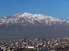
The high altitudes of the mountains have historical significance in South and Central Asia. The Hindu Kush range was a major center of Buddhism with sites such as the Bamiyan Buddhas.[68] It has also been the passageway during the invasions of the Indian subcontinent,[17][18] a region where the Taliban and al-Qaeda grew,[20][69] and a scene of modern era warfare in Afghanistan.[19] Ancient mines producing lapis lazuli are found in Kowkcheh Valley, while gem-grade emeralds are found north of Kabul in the valley of the Panjsher River and some of its tributaries. According to Walter Schumann, the West Hindu Kush mountains have been the source of the finest Lapis lazuli for thousands of years.[70]
Buddhism was widespread in the ancient Hindu Kush region. The ancient artwork of Buddhism includes the giant rock-carved statues called the Bamiyan Buddhas, in the southern and western end of the Hindu Kush.[11] These statues were destroyed by Taliban Islamists in 2001.[71] The southeastern valleys of Hindu Kush connecting towards the Indus Valley region were a major center that hosted monasteries, religious scholars from distant lands, trade networks and merchants of the ancient Indian subcontinent.[13]
One of the early Buddhist schools, the Mahāsāṃghika-Lokottaravāda, was prominent in the area of Bamiyan. The Chinese Buddhist monk Xuanzang visited a Lokottaravāda monastery in the 7th century CE, at Bamiyan, Afghanistan. Birchbark and palm leaf manuscripts of texts in this monastery's collection, including Mahāyāna sūtras, have been discovered in the caves of Hindu Kush,[72] and these are now a part of the Schøyen Collection. Some manuscripts are in the Gāndhārī language and Kharoṣṭhī script, while others are in Sanskrit and written in forms of the Gupta script.[73][74]
According to Alfred Foucher, the Hindu Kush and nearby regions gradually converted to Buddhism by the 1st century CE, and this region was the base from where Buddhism crossed the Hindu Kush expanding into the Oxus valley region of Central Asia.[75] Buddhism later disappeared and locals were forced to convert to Islam. Richard Bulliet also proposes that the area north of Hindu Kush was center of a new sect that had spread as far as Kurdistan, remaining in existence until the Abbasid times.[76][77] The area eventually came under the control of the Hindu Shahi dynasty of Kabul.[78] The Islamic conquest of the area happened under Sabuktigin who conquered Jayapala's dominion west of Peshawar in the 10th century.[79]
Ancient
[edit]The significance of the Hindu Kush mountain ranges has been recorded since the time of Darius I of the Achaemenid Empire. Alexander entered the Indian subcontinent through the Hindu Kush as his army moved past the Afghan Valleys in the spring of 329 BCE.[80] He moved towards the Indus Valley river region in the Indian subcontinent in 327 BCE, his armies building several towns in this region over the intervening two years.[81]
After Alexander died in 323 BCE, the region became part of the Seleucid Empire, according to the ancient history of Strabo written in the 1st century BCE, before it became a part of the Indian Maurya Empire around 305 BCE.[82] The region became a part of the Kushan Empire around the start of the common era.[83]
Medieval era
[edit]The lands north of the Hindu Kush, in the Hephthalite dominion, Buddhism was the predominant religion by mid 1st millennium CE.[84] These Buddhists were religiously tolerant and they co-existed with followers of Zoroastrianism, Manichaeism, and Nestorian Christianity.[84][85] This Central Asia region along the Hindu Kush was taken over by Western Turks and Arabs by the eighth century, facing wars with mostly Iranians.[84] One major exception was the period in the mid to late seventh century when the Tang dynasty from China destroyed the Northern Turks and extended its rule all the way to the Oxus River valley and regions of Central Asia bordering all along the Hindu Kush.[86]

The subcontinent and valleys of the Hindu Kush remained unconquered by the Islamic armies until the 9th century, even though they had conquered the southern regions of the Indus River valley such as Sind.[87] Kabul fell to the army of Al-Ma'mun, the seventh Abbasid caliph, in 808 and the local king agreed to accept Islam and pay annual tributes to the caliph.[87] However, states André Wink, inscriptional evidence suggests that the Kabul area near Hindu Kush had an early presence of Islam.[88] When the extraction of silver from the mines in the Hindu Kush was at its greatest (c.850), the value of silver in relation to gold dropped, and the content of silver in the Carolingian denarius was increased so that it should maintain its intrinsic value.[89]
The range came under the control of the Hindu Shahi dynasty of Kabul[78] but was conquered by Sabuktigin who took all of Jayapala's dominion west of Peshawar.[79]
Mahmud of Ghazni came to power in 998 CE, in Ghazna, Afghanistan, south of Kabul and the Hindu Kush range.[90] He began a military campaign that rapidly brought both sides of the Hindu Kush range under his rule. From his mountainous Afghani base, he systematically raided and plundered kingdoms in north India from east of the Indus river to west of Yamuna river seventeen times between 997 and 1030.[91]
Mahmud of Ghazni raided the treasuries of kingdoms, sacked cities, and destroyed Hindu temples, with each campaign starting every spring, but he and his army returned to Ghazni and the Hindu Kush base before monsoons arrived in the northwestern part of the subcontinent.[90][91] He retracted each time, only extending Islamic rule into western Punjab.[92][93]
In 1017, the Iranian Islamic historian Al-Biruni was deported after a war that Mahmud of Ghazni won,[94] to the northwest Indian subcontinent under Mahmud's rule. Al Biruni stayed in the region for about fifteen years, learnt Sanskrit, and translated many Indian texts, and wrote about Indian society, culture, sciences, and religion in Persian and Arabic. He stayed for some time in the Hindu Kush region, particularly near Kabul. In 1019, he recorded and described a solar eclipse in what is the modern era Laghman Province of Afghanistan through which Hindu Kush pass.[94] Al Biruni also wrote about early history of the Hindu Kush region and Kabul kings, who ruled the region long before he arrived, but this history is inconsistent with other records available from that era.[88] Al Biruni was supported by Sultan Mahmud.[94] Al Biruni found it difficult to get access to Indian literature locally in the Hindu Kush area, and to explain this he wrote, "Mahmud utterly ruined the prosperity of the country, and performed wonderful exploits by which the Hindus became the atoms scattered in all directions, and like a tale of old in the mouth of the people. (...) This is the reason, too, why Hindu sciences have retired far from those parts of the country conquered by us, and have fled to places which our hand cannot yet reach, to Kashmir, Benares and other places".[95]
In the late 12th century, the historically influential Ghurid empire led by Mu'izz al-Din ruled the Hindu Kush region.[96] He was influential in seeding the Delhi Sultanate, shifting the base of his Sultanate from south of the Hindu Kush range and Ghazni towards the Yamuna River and Delhi. He thus helped bring Islamic rule to the northern plains of the Indian subcontinent.[97] In the Mongol invasion of the Khwarazmian Empire, Genghis Khan invaded the region from the northeast in one of his many conquests to create the huge Mongol Empire.

The Moroccan traveler Ibn Battuta arrived in the Delhi Sultanate by passing through the Hindu Kush.[14] The mountain passes of the Hindu Kush range were used by Timur and his army and they crossed to launch the 1398 invasion of the northern Indian subcontinent.[98] Timur, also known as Temur or Tamerlane in Western scholarly literature, marched with his army to Delhi, plundering and killing all the way.[99][100][101] He arrived in the capital Delhi where his army.[102] Then he carried the wealth and the captured slaves, returning to his capital through the Hindu Kush.[99][101][103]
Babur, the founder of the Mughal Empire, was a patrilineal descendant of Timur with roots in Central Asia.[104] He first established himself and his army in Kabul and the Hindu Kush region. In 1526, he made his move into north India, and won the Battle of Panipat, ending the last Delhi Sultanate dynasty, and starting the era of the Mughals.[105]
Slavery
[edit]Slavery, as with all major ancient and medieval societies, has been a part of Central Asia and South Asia history. The Hindu Kush mountain passes connected the slave markets of Central Asia with slaves seized in South Asia.[106][107][108] The seizure and transportation of slaves from the Indian subcontinent became intense in and after the 8th century CE, with evidence suggesting that the slave transport involved "hundreds of thousands" of slaves from India in different periods of Islamic rule era.[107] According to John Coatsworth and others, the slave trading operations during the pre-Akbar Mughal and Delhi Sultanate era "sent thousands of Hindus every year north to Central Asia to pay for horses and other goods".[109][110] However, the interaction between Central Asia and South Asia through the Hindu Kush was not limited to slavery, it included trading in food, goods, horses and weapons.[111]
The practice of raiding tribes, hunting, and kidnapping people for slave trading continued through the 19th century, at an extensive scale, around the Hindu Kush. According to a British Anti-Slavery Society report of 1874, the governor of Faizabad, Mir Ghulam Bey, kept 8,000 horses and cavalrymen who routinely captured non-Muslims as well as Shia Muslims as slaves. Others alleged to be involved in the slave trade were feudal lords such as Ameer Sheer Ali. The isolated communities in the Hindu Kush were one of the targets of these slave-hunting expeditions.[112]
Modern era
[edit]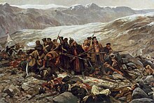
The people of Kafiristan practiced had ancient polytheistic traditions until the 1896 invasion and conversion to Islam at the hands of Afghans under Amir Abdur Rahman Khan.[16]
British era
The Hindu Kush served as a geographical barrier to the British Empire, leading to a paucity of information and scarce direct interaction between the British colonial officials and Central Asian peoples. The British had to rely on tribal chiefs, Sadozai and Barakzai noblemen for information, and they generally downplayed the reports of slavery and other violence for geo-political strategic considerations.[113] The first British invasion of Afghanistan ended in disaster in 1842, when 16,000 British soldiers and camp followers were massacred as they retreated through the Hindu Kush back to India.[114]
After 1947
In the colonial era, the Hindu Kush was considered, informally, the dividing line between Russian and British areas of influence in Afghanistan. During the Cold War the Hindu Kush range became a strategic theatre, especially during the 1980s when Soviet forces and their Afghan allies fought the Afghan mujahideen channelled through Pakistan.[115][116][117] After the Soviet withdrawal and the end of the Cold War, many mujahideen morphed into Taliban and al-Qaeda forces imposing a strict interpretation of Islamic law (Sharia), with Kabul, these mountains, and other parts of Afghanistan as their base.[118][119] Other Mujahideen joined the Northern Alliance to oppose the Taliban rule.[119]
After the 11 September 2001 terror attacks in New York City and Washington D.C., the American and ISAF campaign against Al Qaeda and their Taliban allies made the Hindu Kush once again a militarised conflict zone.[119][120][121]
Climate change
[edit]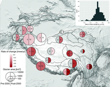
The 2019 Hindu Kush Himalaya Assessment[67] concluded that between 1901 and 2014, the Hindu Kush Himalaya (or HKH) region had already experienced warming of 0.1 °C per decade, with the warming rate accelerating to 0.2 °C per decade over the past 50 years. Over the past 50 years, the frequency of warm days and nights had also increased by 1.2 days and 1.7 nights per decade, while the frequency of extreme warm days and nights had increased by 1.26 days and 2.54 nights per decade. There was also a corresponding decline of 0.5 cold days, 0.85 extreme cold days, 1 cold night, and 2.4 extreme cold nights per decade. The length of the growing season has increased by 4.25 days per decade.
There is less conclusive evidence of light precipitation becoming less frequent while heavy precipitation became both more frequent and more intense. Finally, since 1970s glaciers have retreated everywhere in the region beside Karakoram, eastern Pamir, and western Kunlun, where there has been an unexpected increase in snowfall. Glacier retreat had been followed by an increase in the number of glacial lakes, some of which may be prone to dangerous floods.[122]
In the future, if the Paris Agreement goal of 1.5 °C of global warming is not exceeded, warming in the HKH will be at least 0.3 °C higher, and at least 0.7 °C higher in the hotspots of northwest Himalaya and Karakoram. If the Paris Agreement goals are broken, then the region is expected to warm by 1.7–2.4 °C in the near future (2036–2065) and by 2.2–3.3 °C (2066–2095) near the end of the century under the "intermediate" Representative Concentration Pathway 4.5 (RCP4.5).
Under the high-warming RCP8.5 scenario where the annual emissions continue to increase for the rest of the century, the expected regional warming is 2.3–3.2 °C and 4.2–6.5 °C, respectively. Under all scenarios, winters will warm more than the summers, and the Tibetan Plateau, the central Himalayan Range, and the Karakoram will continue to warm more than the rest of the region. Climate change will also lead to the degradation of up to 81% of the region's permafrost by the end of the century.[122]
Future precipitation is projected to increase as well, but CMIP5 models struggle to make specific projections due to the region's topography: the most certain finding is that the monsoon precipitation in the region will increase by 4–12% in the near future and by 4–25% in the long term.[122] There has also been modelling of the changes in snow cover, but it is limited to the end of century under the RCP 8.5 scenario: it projects declines of 30–50% in the Indus Basin, 50–60% in the Ganges basin, and 50–70% in the Brahmaputra Basin, as the snowline elevation in these regions will rise by between 4.4 and 10.0 m/yr. There has been more extensive modelling of glacier trends: it is projected that one third of all glaciers in the extended HKH region will be lost by 2100 even if the warming is limited to 1.5 °C (with over half of that loss in the Eastern Himalaya region), while RCP 4.5 and RCP 8.5 are likely to lead to the losses of 50% and >67% of the region's glaciers over the same timeframe.
Glacier melt is projected to accelerate regional river flows until the amount of meltwater peaks around 2060, going into an irreversible decline afterwards. Since precipitation will continue to increase even as the glacier meltwater contribution declines, annual river flows are only expected to diminish in the western basins where contribution from the monsoon is low: however, irrigation and hydropower generation would still have to adjust to greater interannual variability and lower pre-monsoon flows in all of the region's rivers.[123][124][125]
Glacier Melt
[edit]The Hindu Kush Himalayas (HKH) indeed face a critical environmental challenge due to accelerated glacier melt, which has significant implications for the entire region. This mountain range spans approximately 3,500 kilometers across Afghanistan, Bhutan, China, India, Nepal, and Pakistan. The glaciers in the HKH are a crucial source of water for millions of people, serving as the headwaters for major rivers like the Indus, Ganges, and Brahmaputra. This occurrence is closely tied to the wider issues associated with global climate change. The increase in temperatures, a direct effect of climate change, has a notable impact on the glaciers in the area, accelerating their withdrawal. Complicating the situation is the deposition of black carbon, stemming from industrial and biomass burning. The existence of black carbon on the glacier surfaces diminishes their albedo, or reflective capacity, heightening the absorption of sunlight and intensifying the process of melting.[126] This accelerated glacier melt has profound implications for the entire ecosystem of the Hindu Kush Himalayas and the downstream communities dependent on the region's water resources.Current observational data on HKH glaciers are limited, but time series synthetic aperture radar (SAR) imagery has enabled the detection and analysis of seasonal glacier melting.[127]The duration of seasonal glacier melting varies with elevation, with melt signals persisting for over two-thirds of the year below 4000 m a.s.l. and nearly half of the calendar year above 7000 m a.s.l.[128] The rapid melting of glaciers in the HKH poses a threat to water security for large parts of Asia, and if this melting persists, the entire Himalayan glaciers are estimated to disappear by the end of the 21st century.[129][130].The precise ways in which glaciers will respond to future climate change are still unknown, but understanding the paraglacial response of mountain systems to deglaciation is crucial for predicting future glacier recession in the
Future development and adaptation
[edit]A range of adaptation efforts are already undertaken across the HKH region: however, they suffer from underinvestment and insufficient coordination between the various state, institutional and other non-state efforts, and need to be "urgently" strengthened in order to be commensurate with the challenges ahead.[131]
The 2019 Hindu Kush Himalaya Assessment outlined three main "storylines" for the region between now and 2080: "business-as-usual" (or "muddling through"), with no significant change from the current trends and development/adaptation initiatives proceeding as they do now; "downhill", where the intensity of global climate change is high, local initiatives fail and regional cooperation breaks down; and "prosperous".
Where extensive cooperation allows region's communities to weather "moderate" climate change and increase their living standards while also preserving the region's biodiversity. In addition, it described two alternate pathways through which the "prosperous" future can be achieved: the first focuses on top-down, large-scale development and the latter describes a bottom-up, decentralized alternative.[132]
| Actions | Benefits | Need | Risk | ||||
|---|---|---|---|---|---|---|---|
| Economic | Social | Environmental/climate | Cross sectoral | Finance and human resources | Governance | Source | |
| Large hydro power generating capacity | Leapfrog in economic prosperity for the region as a whole, high potential for power trade | New skill development, diversified livelihood options | Air pollution reduction, both adaptation and mitigation | Large water storage to manage seasonal variability and strategic cross-sector allocation | Large corporate, global finance, sustained climate finance | HKH institution, regional tariff, cross-border policy coordination | Lack of transboundary sustainable political cooperation; lack of cross-sector water sharing formal arrangements; lack of ecosystem-based design of reservoirs/power plants; public acceptance, silt accumulation |
| HKH and non-HKH electric grid | Very high economic prosperity for the region and beyond | New skill, non-farm diversified livelihood options | Unplanned local resource extraction will decrease | Reliable power supply for all sectors | Large corporate, global finance, climate finance | HKH electric distribution corporation | Transboundary sustainable political cooperation;lack of ecosystem-based design |
| HKH ICT (information and communications technology) network | Boost to regional and local economic growth | New skill, non-farm diversified livelihood options | Connectivity across mountainous terrain without ecological impact | Extent of market cutting across sectors and regions | Large corporations, global finance, climate finance | HKH communications corporation | Transboundary sustainable political cooperation; lack of biodiversity-sensitive design |
| Cross-border trade corridors e.g., silk route re-development | Income, consumption, production leapfrogs as per comparative advantage, benefit to large-scale tourism industry | Food security, energy security, health service, social interdependence, non-farm livelihood generation | Comparative advantage will lead to biodiversity conservation, enhance payment for ecosystem service | Multiple opportunities across sectors emerge | Regional, global | HKH trade authority | Transboundary sustainable political cooperation; lack of biodiversity-sensitive design in transport corridor development |
| Large water storage and supply | Income, consumption, production leapfrog | Food security, energy security, non-farm water sector livelihood generation | Less GLOF, less flash floods, pump storage facility | Multiple opportunities across sectors emerge | Regional, global | HKH water council | Transboundary sustainable political cooperation; lack of ecosystem-sensitive development |
| Large water treatment facilities | Leapfrog in water resource management | Water security, non-farm water sector livelihood generation | Reduction in waste disposal | Multiple opportunities across sectors emerge | Regional, global | HKH water council | Transboundary sustainable political cooperation; lack of ecosystem sensitive development |
| Large-scale urbanization | Leapfrog in economic growth centers | Non-farm water sector livelihood generation | Reserve nature for biodiversity conservation | Multiple opportunities across sectors emerge | Local, national, regional, and global | National urban development authorities | Lack of ecosystem-sensitive development |
| Large contract farming | Leapfrog in farm-level activity and income | Income, livelihood security | Investment in environmental management | Farming based industrial/trade growth | Local, national, regional, and global | National farming development authorities | Lack of ecosystem-sensitive development; lack of public acceptance, possibility of food crop reduction, crop monoculture |
| Actions | Benefits | Need | Risk | ||||
|---|---|---|---|---|---|---|---|
| Economic | Social | Environmental/climate | Cross sectoral | Finance and human resources | Governance | Source | |
| Distributed small hydro power generating capacity | Incremental national, local economic prosperity through self-sufficiency | Traditional skill utilization | Air pollution reduction, both adaptation and mitigation | Water flow uninterrupted | Small to medium national scale finance, programmatic finance by bundling, climate finance | Community level, local, national, multilevel coordination for tariff, etc. to ensure equity | Lack of local capacity for multi-level governance; lack of upstream- downstream water sharing arrangements; lack of ecosystem-based design |
| Micro grids | Local economic prosperity | Lack of ecosystem-sensitive development | Small infrastructure with less environmental impact | Reliable power supply for target group | Specialized medium-scale global finance, climate finance | Private, local electric distribution companies | Without multilevel governance, inequality may arise across social groups; not a tried and tested technology; maintenance will need local skill building |
| National ICT (information and communications technology) network | Incremental national growth | Lack of ecosystem-sensitive development | National connectivity in mountainous terrain improves without ecological impact | Extent of market cutting across sectors | National/global investment negotiated competitively | National institutions | Lack of local/national skill, national negotiation capacity |
| National culture based products, tourism | Incremental progress | Traditional skill, non-farm livelihood | Environmental conservation | Tourism related infrastructure expansion | Local, national | Local and national institutions | Lack of capacity to integrate with the rest of the world |
| Decentralized water storage and supply | Incremental progress | Traditional systems to be revived | Environmental conservation | Local infrastructure expansion | Local, national | Local, national | New modern technology to be developed; lack of local/national skill |
| Decentralized water treatment | Incremental Progress | Traditional systems to be revived | Environmental conservation | Local infrastructure expansion | Local, national | Local, national | New modern technology to be developed; lack of local/national skill |
| Small settlement planning | Less displacement cost | Less displacement and migration | No change in large-scale land use pattern | Local infrastructure expansion | Local, national | Local, national regulations | Localized environmental impact might go unregulated |
| Small farming practices | Incremental progress | Continuation of traditional practices | No change in large-scale land use pattern | Local infrastructure expansion | Local, national | Local, national regulations | Localized environmental impact might go unregulated |
Ethnography
[edit]Pre-Islamic populations of the Hindu Kush included Shins, Yeshkuns,[133][134] Chiliss, Neemchas[135] Koli,[136] Palus,[136] Gaware,[137] and Krammins.[133]
See also
[edit]- Mount Imeon
- Paropamisus Mountains
- A Short Walk in the Hindu Kush
- Geography of Afghanistan
- Geography of Pakistan
- Karakoram
- Hindustan
- List of highest mountains (a list of mountains above 7,200m)
- List of mountain ranges
- 2002 Hindu Kush earthquakes
- 2005 Hindu Kush earthquake
Notes
[edit]- ^ Boyle's Persian-English dictionary indicates that the suffix -koš [koʃ] is the present stem of the verb 'to kill' (koštan کشتن).[42] According to linguist Francis Joseph Steingass, the suffix -kush means 'a male; (imp. of kushtan in comp.) a killer, who kills, slays, murders, oppresses as azhdaha-kush.'[37]
References
[edit]Citations
[edit]- ^ Hindu Kush, Encyclopedia Iranica
- ^ a b c Mike Searle (2013). Colliding Continents: A geological exploration of the Himalaya, Karakoram, and Tibet. Oxford University Press. p. 157. ISBN 978-0-19-165248-6., Quote: "The Hindu Kush mountains run along the Afghan border with the North-West Frontier Province of Pakistan".
- ^ George C. Kohn (2006). Dictionary of Wars. Infobase Publishing. p. 10. ISBN 978-1-4381-2916-7.
- ^ a b "Hindu Kush Himalayan Region". ICIMOD. Retrieved 17 October 2014.
- ^ a b Elalem, Shada; Pal, Indrani (2015). "Mapping the vulnerability hotspots over Hindu-Kush Himalaya region to flooding disasters". Weather and Climate Extremes. 8: 46–58. Bibcode:2015WCE.....8...46E. doi:10.1016/j.wace.2014.12.001.
- ^ a b "Development of an ASSESSment system to evaluate the ecological status of rivers in the Hindu Kush-Himalayan region" (PDF). Assess-HKH.at. Archived (PDF) from the original on 22 September 2015. Retrieved 6 September 2015.
- ^ a b Karakoram Range: MOUNTAINS, ASIA, Encyclopædia Britannica
- ^ a b Stefan Heuberger (2004). The Karakoram-Kohistan Suture Zone in NW Pakistan – Hindu Kush Mountain Range. vdf Hochschulverlag AG. pp. 25–26. ISBN 978-3-7281-2965-9.
- ^ a b Spīn Ghar Range, MOUNTAINS, PAKISTAN-AFGHANISTAN, Encyclopædia Britannica
- ^ a b Jonathan M. Bloom; Sheila S. Blair (2009). The Grove Encyclopedia of Islamic Art and Architecture. Oxford University Press. pp. 389–390. ISBN 978-0-19-530991-1.
- ^ a b Deborah Klimburg-Salter (1989), The Kingdom of Bamiyan: Buddhist art and culture of the Hindu Kush, Naples – Rome: Istituto Universitario Orientale & Istituto Italiano per il Medio ed Estremo Oriente, ISBN 978-0877737650 (Reprinted by Shambala)
- ^ Claudio Margottini (2013). After the Destruction of Giant Buddha Statues in Bamiyan (Afghanistan) in 2001: A UNESCO's Emergency Activity for the Recovering and Rehabilitation of Cliff and Niches. Springer. pp. 5–6. ISBN 978-3-642-30051-6.
- ^ a b Jason Neelis (2010). Early Buddhist Transmission and Trade Networks: Mobility and Exchange Within and Beyond the Northwestern Borderlands of South Asia. BRILL Academic. pp. 114–115, 144, 160–163, 170–176, 249–250. ISBN 978-90-04-18159-5.
- ^ a b Ibn Battuta; Samuel Lee (Translator) (2010). The Travels of Ibn Battuta: In the Near East, Asia and Africa. Cosimo (Reprint). pp. 97–98. ISBN 978-1-61640-262-4.; Columbia University Archive
- ^ Cacopardo, Augusto S. (15 February 2017). Pagan Christmas: Winter Feasts of the Kalasha of the Hindu Kush. Gingko Library. ISBN 9781909942851.
- ^ a b Augusto S. Cacopardo (15 February 2017). Pagan Christmas: Winter Feasts of the Kalasha of the Hindu Kush. Gingko Library. ISBN 978-1-90-994285-1.
- ^ a b Konrad H. Kinzl (2010). A Companion to the Classical Greek World. John Wiley & Sons. p. 577. ISBN 978-1-4443-3412-8.
- ^ a b André Wink (2002). Al-Hind: The Slavic Kings and the Islamic Conquest, 11th–13th Centuries. BRILL Academic. pp. 52–53. ISBN 978-0-391-04174-5.
- ^ a b c d Frank Clements (2003). Conflict in Afghanistan: A Historical Encyclopedia. ABC-CLIO. pp. 109–110. ISBN 978-1-85109-402-8.
- ^ a b Michael Ryan (2013). Decoding Al-Qaeda's Strategy: The Deep Battle Against America. Columbia University Press. pp. 54–55. ISBN 978-0-231-16384-2.
- ^ Fosco Maraini et al., Hindu Kush, Encyclopædia Britannica
- ^ Karl Jettmar; Schuyler Jones (1986). The Religions of the Hindukush: The religion of the Kafirs. Aris & Phillips. ISBN 978-0-85668-163-9.
- ^ Winiger, M.; Gumpert, M.; Yamout, H. (2005). "Karakorum-Hindukush-western Himalaya: assessing high-altitude water resources". Hydrological Processes. 19 (12). Wiley-Blackwell: 2329–2338. Bibcode:2005HyPr...19.2329W. doi:10.1002/hyp.5887. S2CID 130210677.
- ^ The National Geographic Magazine. National Geographic Society. 1958.
Such bitter journeys gave the range its name, Hindu Kush — "Killer of Hindus."
- ^ Metha, Arun (2004). History of medieval India. ABD Publishers. ISBN 9788185771953.
of the Shahis from Kabul to behind the Hindu Kush mountains (Hindu Kush is literally "killer of Hindus"
- ^ R. W. McColl (2014). Encyclopedia of World Geography. Infobase Publishing. pp. 413–414. ISBN 978-0-8160-7229-3.
- ^ Allan, Nigel (2001). "Defining Place and People in Afghanistan". Post-Soviet Geography and Economics. 8. 42 (8): 546. doi:10.1080/10889388.2001.10641186. S2CID 152546226.
- ^ Runion, Meredith L. (24 April 2017). The History of Afghanistan, 2nd Edition. ABC-CLIO. ISBN 978-1-61069-778-1.
The literal translation of the name "Hindu Kush" is a true reflection of its forbidding topography, as this difficult and jagged section of Afghanistan translates to "Killer of Hindus."
- ^ Weston, Christine (1962). Afghanistan. Scribner.
To the north and northeast, magnificent and frightening, stretched the mountains of the Hindu Kush, or Hindu Killers, a name derived from the fact that in ancient times slaves brought from India perished here like flies from exposure and cold.
- ^ Knox, Barbara (2004). Afghanistan. Capstone. ISBN 978-0-7368-2448-4.
Hindu Kush means "killer of Hindus." Many people have died trying to cross these mountains.
- ^ [a] Michael Franzak (2010). A Nightmare's Prayer: A Marine Harrier Pilot's War in Afghanistan. Simon and Schuster. p. 241. ISBN 978-1-4391-9499-7.; [b] Ehsan Yarshater (2003). Encyclopædia Iranica. The Encyclopaedia Iranica Foundation. p. 312. ISBN 978-0-933273-76-4. [c] James Wynbrandt (2009). A Brief History of Pakistan. Infobase Publishing. p. 5. ISBN 978-0-8160-6184-6.; [d] Encyclopedia Americana. Vol. 14. 1993. p. 206.; [e] André Wink (2002). Al-Hind, the Making of the Indo-Islamic World: Early Medieval India and the Expansion of Islam 7th–11th Centuries. BRILL Academic. p. 110. ISBN 978-0-391-04173-8., Quote: "(..) the Muslim Arabs also applied the name 'Khurasan' to all the Muslim provinces to the east of the Great Desert and up to the Hindu-Kush ('Hindu killer') mountains, the Chinese desert and the Pamir mountains".
- ^ Runion, Meredith L. (24 April 2017). The History of Afghanistan, 2nd Edition. ABC-CLIO. ISBN 978-1-61069-778-1.
The literal translation of the name "Hindu Kush" is a true reflection of its forbidding topography, as this difficult and jagged section of Afghanistan translates to "Killer of Hindus."
- ^ Weston, Christine (1962). Afghanistan. Scribner.
To the north and northeast, magnificent and frightening, stretched the mountains of the Hindu Kush, or Hindu Killers, a name derived from the fact that in ancient times slaves brought from India perished here like flies from exposure and cold.
- ^ Knox, Barbara (2004). Afghanistan. Capstone. ISBN 978-0-7368-2448-4.
Hindu Kush means "killer of Hindus." Many people have died trying to cross these mountains.
- ^ The World Book Encyclopedia. Vol. 9 (1994 ed.). World Book Inc. 1990. p. 235.
- ^ Boyle, J.A. (1949). A Practical Dictionary of the Persian Language. Luzac & Co. p. 129.
- ^ a b Francis Joseph Steingass (1992). A Comprehensive Persian–English Dictionary. Asian Educational Services. pp. 1030–1031 (kush means "killer, kills, slays, murders, oppresses"), p. 455 (khirs–kush means "bear killer"), p. 734 (shutur–kush means "camel butcher"), p. 1213 (mardum–kush means "man slaughter"). ISBN 978-81-206-0670-8.
- ^ Ervin Grötzbach (2012 Edition, Original: 2003), Hindu Kush, Encyclopædia Iranica
- ^ Allan, Nigel (2001). "Defining Place and People in Afghanistan". Post-Soviet Geography and Economics. 8. 42 (8): 546. doi:10.1080/10889388.2001.10641186. S2CID 152546226.
- ^ Dunn, Ross E. (2005). The Adventures of Ibn Battuta. University of California Press. pp. 171–178. ISBN 978-0-520-24385-9.
- ^ André Wink (2002). Al-Hind, the Making of the Indo-Islamic World: Early Medieval India and the Expansion of Islam 7th–11th Centuries. BRILL Academic. p. 110. ISBN 978-0-391-04173-8., Quote: "(..) the Muslim Arabs also applied the name 'Khurasan' to all the Muslim provinces to the east of the Great Desert and up to the Hindu-Kush ('Hindu killer') mountains, the Chinese desert and the Pamir mountains".
- ^ Boyle, J.A. (1949). A Practical Dictionary of the Persian Language. Luzac & Co. p. 129.
- ^ R. W. McColl (2014). Encyclopedia of World Geography. Infobase Publishing. pp. 413–414. ISBN 978-0-8160-7229-3.
- ^ Allan, Nigel (2001). "Defining Place and People in Afghanistan". Post-Soviet Geography and Economics. 8. 42 (8): 545–560. doi:10.1080/10889388.2001.10641186. S2CID 152546226.
- ^ R. W. McColl (2014). Encyclopedia of World Geography. Infobase Publishing. pp. 413–414. ISBN 978-0-8160-7229-3.
- ^ Henry Yule; A. C. Burnell (13 June 2013). Kate Teltscher (ed.). Hobson-Jobson: The Definitive Glossary of British India. Oxford University Press. p. 258. ISBN 9780199601134.
- ^ Thapar, Romila (2019). Which of Us are Aryans?: Rethinking the Concept of Our Origins. Aleph. p. 1. ISBN 978-93-88292-38-2.
- ^ Schmitt, Rüdiger (2007). "Iškata". Encyclopaedia Iranica.
- ^ Griffiths, Arlo (2004). The Vedas: Texts, Language & Ritual (PDF). Groningen: Egbert Forsten. p. 594. ISBN 90-6980-149-3. OCLC 57477186. Archived (PDF) from the original on 30 July 2012.
- ^ Vogelsang, Willem (2002). The Afghans. Wiley-Blackwell. ISBN 978-0-631-19841-3. Retrieved 22 August 2010.
- ^ 1890,1896 Encyclopædia Britannica s.v. "Afghanistan", Vol I p.228.;
1893, 1899 Johnson's Universal Encyclopedia Vol I p.61.;
1885 Imperial Gazetteer of India, V. I p. 30.;
1850 A Gazetteer of the World Vol I p. 62. - ^ a b Scott-Macnab, David (1994). On the roof of the world. London: Reader's Digest Assiciation Ldt. p. 22.
- ^ John Laffin (1997). The World in Conflict: War Annual 8 : Contemporary Warfare Described and Analysed. Brassey's. pp. 24–25. ISBN 978-1-85753-216-6.
- ^ Burrard, Sir Sidney Gerald (1908). A Sketch of the Geography and Geology of the Himalaya Mountains and Tibet. Superintendent government printing, India. p. 102.
- ^ Authority, West Pakistan Water and Power Development (1971). WAPDA Annual Report. The Authority.
- ^ a b Ahmad, Masood; Wasiq, Mahwash (1 January 2004). Water Resource Development in Northern Afghanistan and Its Implications for Amu Darya Basin. World Bank Publications. p. 9. ISBN 978-0-8213-5890-0.
- ^ History of Environmental Change in the Sistan Basin, UNEP, United Nations, pages 5, 12-14
- ^ Ahmad, Masood; Wasiq, Mahwash (1 January 2004). Water Resource Development in Northern Afghanistan and Its Implications for Amu Darya Basin. World Bank Publications. ISBN 978-0-8213-5890-0.
- ^ a b Robert Wynn Jones (2011). Applications of Palaeontology: Techniques and Case Studies. Cambridge University Press. pp. 267–271. ISBN 978-1-139-49920-0.
- ^ Hinsbergen, D. J. J. van; Lippert, P. C.; Dupont-Nivet, G.; McQuarrie, N.; Doubrovine; et al. (2012). "Greater India Basin hypothesis and a two-stage Cenozoic collision between India and Asia". Proceedings of the National Academy of Sciences. 109 (20): 7659–7664, for geologic Indian subcontinent see Figure 1. Bibcode:2012PNAS..109.7659V. doi:10.1073/pnas.1117262109. PMC 3356651. PMID 22547792.
- ^ S. Mukherjee; R. Carosi; P.A. van der Beek; et al. (2015). Tectonics of the Himalaya. Geological Society of London. pp. 55–57. ISBN 978-1-86239-703-3.
- ^ a b c d e Ehsan Yarshater (2003). Encyclopædia Iranica. The Encyclopaedia Iranica Foundation. p. 312. ISBN 978-0-933273-76-4.
- ^ Martin Beniston (2002). Mountain Environments in Changing Climates. Routledge. p. 320. ISBN 978-1-134-85236-9.
- ^ Frank Clements (2003). Conflict in Afghanistan: A Historical Encyclopedia. ABC-CLIO. pp. 90–91. ISBN 978-1-85109-402-8.
- ^ Afghanistan Pakistan Earthquake National Geographic;
Afghanistan earthquake BBC News; See also October 2015 Hindu Kush earthquake and 2016 Afghanistan earthquake. - ^ a b Uddin, Kabir; Matin, Mir A.; Khanal, Nishanta; Maharjan, Sajana; Bajracharya, Birendra; Tenneson, Karis; Poortinga, Ate; Quyen, Nguyen Hanh; Aryal, Raja Ram (2021), Bajracharya, Birendra; Thapa, Rajesh Bahadur; Matin, Mir A. (eds.), "Regional Land Cover Monitoring System for Hindu Kush Himalaya", Earth Observation Science and Applications for Risk Reduction and Enhanced Resilience in Hindu Kush Himalaya Region: A Decade of Experience from SERVIR, Cham: Springer International Publishing, pp. 103–125, doi:10.1007/978-3-030-73569-2_6, ISBN 978-3-030-73569-2, S2CID 238902124
- ^ a b Wester, Philippus; Mishra, Arabinda; Mukherji, Aditi; Shrestha, Arun Bhakta (2019). The Hindu Kush Himalaya Assessment: Mountains, Climate Change, Sustainability and People. doi:10.1007/978-3-319-92288-1. ISBN 978-3-319-92288-1. S2CID 199491088. }}
- ^ Claudio Margottini (2013). After the Destruction of Giant Buddha Statues in Bamiyan (Afghanistan) in 2001: A UNESCO's Emergency Activity for the Recovering and Rehabilitation of Cliff and Niches. Springer. pp. 5–6. ISBN 978-3-642-30051-6.
- ^ Magnus, Ralph H. (1998). "Afghanistan in 1997: The War Moves North". Asian Survey. 38 (2). University of California Press: 109–115. doi:10.2307/2645667. JSTOR 2645667.
- ^ Walter Schumann (2009). Gemstones of the World. Sterling. p. 188. ISBN 978-1-4027-6829-3.
- ^ a b Jan Goldman (2014). The War on Terror Encyclopedia. ABC-CLIO. pp. 360–362. ISBN 978-1-61069-511-4.
- ^ ASOKA MUKHANAGAVINAYAPARICCHEDA, The Schoyen Collection, Quote: "Provenance: 1. Buddhist monastery of Mahasanghika, Bamiyan, Afghanistan (−7th c.); 2. Cave in Hindu Kush, Bamiyan."
- ^ "Schøyen Collection: Buddhism". Retrieved 23 June 2012.
- ^ "Afghan archaeologists find Buddhist site as war rages". Sayed Salahuddin. News Daily. 17 August 2010. Archived from the original on 18 August 2010. Retrieved 16 August 2010.
- ^ Jason Neelis (2010). Early Buddhist Transmission and Trade Networks: Mobility and Exchange Within and Beyond the Northwestern Borderlands of South Asia. BRILL Academic. pp. 234–235. ISBN 978-90-04-18159-5.
- ^ Sheila Canby (1993). "Depictions of Buddha Sakyamuni in the Jami al-Tavarikh and the Majma al-Tavarikh". Muqarnas. 10: 299–310. doi:10.2307/1523195. JSTOR 1523195.
- ^ Michael Jerryson (2016). The Oxford Handbook of Contemporary Buddhism. Oxford University Press. p. 464. ISBN 978-0-19-936239-4.
- ^ a b The History and Culture of the Indian People: The struggle for empire.-2d ed, Page 3
- ^ a b Keay, John (12 April 2011). India: A History. Open Road + Grove/Atlantic. ISBN 9780802195500.
- ^ Peter Marsden (1998). The Taliban: War, Religion and the New Order in Afghanistan. Palgrave Macmillan. p. 12. ISBN 978-1-85649-522-6.
- ^ Peter Marsden (1998). The Taliban: War, Religion and the New Order in Afghanistan. Palgrave Macmillan. pp. 1–2. ISBN 978-1-85649-522-6.
- ^ Nancy Hatch Dupree / Aḥmad ʻAlī Kuhzād (1972). "An Historical Guide to Kabul – The Name". American International School of Kabul. Archived from the original on 30 August 2010. Retrieved 18 September 2010.
- ^ Houtsma, Martijn Theodoor (1987). E.J. Brill's first encyclopaedia of Islam, 1913–1936. Vol. 2. BRILL. p. 159. ISBN 978-90-04-08265-6. Retrieved 23 August 2010.
- ^ a b c André Wink (2002). Al-Hind, the Making of the Indo-Islamic World: Early Medieval India and the Expansion of Islam 7th–11th Centuries. BRILL Academic. pp. 110–111. ISBN 978-0-391-04173-8.
- ^ M. A. Shaban (1979). The 'Abbāsid Revolution. Cambridge University Press. pp. 8–9. ISBN 978-0-521-29534-5.
- ^ André Wink (2002). Al-Hind, the Making of the Indo-Islamic World: Early Medieval India and the Expansion of Islam 7th–11th Centuries. BRILL Academic. pp. 114–115. ISBN 978-0-391-04173-8.
- ^ a b André Wink (2002). Al-Hind, the Making of the Indo-Islamic World: Early Medieval India and the Expansion of Islam 7th–11th Centuries. BRILL Academic. pp. 9–10, 123. ISBN 978-0-391-04173-8.
- ^ a b André Wink (2002). Al-Hind, the Making of the Indo-Islamic World: Early Medieval India and the Expansion of Islam 7th–11th Centuries. BRILL Academic. p. 124. ISBN 978-0-391-04173-8.
- ^ Ralph Henry Carless, Davis (1957). A History of Medieval Europe - From Constantine to Saint Louis. Great Britain: A LONGMAN PAPERBACK. pp. 183–184. ISBN 0582482089.
- ^ a b Hermann Kulke; Dietmar Rothermund (2004). A History of India. Routledge. pp. 164–165. ISBN 978-0-415-32919-4.
- ^ a b Peter Jackson (2003). The Delhi Sultanate: A Political and Military History. Cambridge University Press. pp. 3–4, 6–7. ISBN 978-0-521-54329-3.
- ^ T. A. Heathcote, The Military in British India: The Development of British Forces in South Asia:1600–1947, (Manchester University Press, 1995), pp 5–7
- ^ Barnett, Lionel (1999), Antiquities of India: An Account of the History and Culture of Ancient Hindustan, p. 1, at Google Books, Atlantic pp. 73–79
- ^ a b c Al-Biruni Bobojan Gafurov (June 1974), The Courier Journal, UNESCO, page 13
- ^ William J. Duiker; Jackson J. Spielvogel (2013). The Essential World History, Volume I: To 1800. Cengage. p. 228. ISBN 978-1-133-60772-4.
- ^ K.A. Nizami (1998). History of Civilizations of Central Asia. UNESCO. p. 186. ISBN 978-92-3-103467-1.
- ^ Peter Jackson (2003). The Delhi Sultanate: A Political and Military History. Cambridge University Press. pp. 7–15, 24–27. ISBN 978-0-521-54329-3.
- ^ Francis Robinson (1996). The Cambridge Illustrated History of the Islamic World. Cambridge University Press. p. 56. ISBN 978-0-521-66993-1.
- ^ a b Peter Jackson (2003). The Delhi Sultanate: A Political and Military History. Cambridge University Press. pp. 311–319. ISBN 978-0-521-54329-3.
- ^ Beatrice F. Manz (2000). "Tīmūr Lang". In P. J. Bearman; Th. Bianquis; C. E. Bosworth; E. van Donzel; W. P. Heinrichs (eds.). Encyclopaedia of Islam. Vol. 10 (2 ed.). Brill.
- ^ a b Annemarie Schimmel (1980). Islam in the Indian Subcontinent. BRILL. pp. 36–44. ISBN 978-90-04-06117-0.
- ^ Hermann Kulke; Dietmar Rothermund (2004). A History of India. Routledge. p. 178. ISBN 978-0-415-32919-4.
- ^ Paddy Docherty (2007). The Khyber Pass: A History of Empire and Invasion. London: Union Square. pp. 160–162. ISBN 978-1-4027-5696-2.
- ^ Gerhard Bowering; Patricia Crone; Wadad Kadi; et al. (2012). The Princeton Encyclopedia of Islamic Political Thought. Princeton University Press. p. 60. ISBN 978-0691134840.
- ^ Scott Cameron Levi; Muzaffar Alam (2007). India and Central Asia: Commerce and Culture, 1500–1800. Oxford University Press. pp. 19–20. ISBN 978-0-19-568647-0.
- ^ Scott C. Levi (2002), Hindus beyond the Hindu Kush: Indians in the Central Asian Slave Trade, Journal of the Royal Asiatic Society, Cambridge University Press, Volume 12, Number 3 (Nov. 2002), pages 277–288
- ^ a b Christoph Witzenrath (2016). Eurasian Slavery, Ransom and Abolition in World History, 1200–1860. Routledge. pp. 10–11 with footnotes. ISBN 978-1-317-14002-3.
- ^ Scott Cameron Levi; Muzaffar Alam (2007). India and Central Asia: Commerce and Culture, 1500–1800. Oxford University Press. pp. 11–12, 43–49, 86 note 7, 87 note 18. ISBN 978-0-19-568647-0.
- ^ John Coatsworth; Juan Cole; Michael P. Hanagan; et al. (2015). Global Connections: Volume 2, Since 1500: Politics, Exchange, and Social Life in World History. Cambridge University Press. p. 18. ISBN 978-1-316-29790-2.
- ^ According to Clarence-Smith, the practice was curtailed but continued during Akbar's era, and returned after Akbar's death; W. G. Clarence-Smith (2006). Islam and the Abolition of Slavery. Oxford University Press. pp. 90–91. ISBN 978-0-19-522151-0.
- ^ Scott Cameron Levi; Muzaffar Alam (2007). India and Central Asia: Commerce and Culture, 1500–1800. Oxford University Press. pp. 9–10, 53, 126, 160–161. ISBN 978-0-19-568647-0.
- ^ Junius P. Rodriguez (2015). Encyclopedia of Emancipation and Abolition in the Transatlantic World. Routledge. pp. 666–667. ISBN 978-1-317-47180-6.
- ^ Jonathan L. Lee (1996). The "Ancient Supremacy": Bukhara, Afghanistan and the Battle for Balkh, 1731–1901. BRILL Academic. pp. 74 with footnote. ISBN 978-90-04-10399-3.
- ^ Stewart, Terry. "Britain's Retreat from Kabul 1842". Historic UK.
- ^ Mohammed Kakar (1995). Afghanistan: The Soviet Invasion and the Afghan Response, 1979–1982. University of California Press. pp. 130–133. ISBN 978-0-520-91914-3.
- ^ Scott Gates; Kaushik Roy (2016). Unconventional Warfare in South Asia: Shadow Warriors and Counterinsurgency. Routledge. pp. 142–144. ISBN 978-1-317-00541-4.
- ^ Mark Silinsky (2014). The Taliban: Afghanistan's Most Lethal Insurgents. ABC-CLIO. pp. 6–7. ISBN 978-0-313-39898-8.
- ^ Mark Silinsky (2014). The Taliban: Afghanistan's Most Lethal Insurgents. ABC-CLIO. pp. 8, 37–39, 81–82. ISBN 978-0-313-39898-8.
- ^ a b c Nicola Barber (2015). Changing World: Afghanistan. Encyclopaedia Britannica. p. 15. ISBN 978-1-62513-318-2.
- ^ A Short March to the Hindu Kush, Alpinist 18.
- ^ "Alexander in the Hindu Kush". Livius. Articles on Ancient History. Retrieved 12 September 2007.
- ^ a b c Krishnan, Raghavan; Shrestha, Arun Bhakta; Ren, Guoyu; Rajbhandari, Rupak; Saeed, Sajjad; Sanjay, Jayanarayanan; Syed, Md. Abu.; Vellore, Ramesh; Xu, Ying; You, Qinglong; Ren, Yuyu (5 January 2019). "Unravelling Climate Change in the Hindu Kush Himalaya: Rapid Warming in the Mountains and Increasing Extremes". The Hindu Kush Himalaya Assessment. pp. 57–97. doi:10.1007/978-3-319-92288-1_3. ISBN 978-3-319-92287-4. S2CID 134572569.
- ^ Damian Carrington (4 February 2019). "A third of Himalayan ice cap doomed, finds report". TheGuardian.com. Retrieved 20 October 2022.
- ^ Bolch, Tobias; Shea, Joseph M.; Liu, Shiyin; Azam, Farooq M.; Gao, Yang; Gruber, Stephan; Immerzeel, Walter W.; Kulkarni, Anil; Li, Huilin; Tahir, Adnan A.; Zhang, Guoqing; Zhang, Yinsheng (5 January 2019). "Status and Change of the Cryosphere in the Extended Hindu Kush Himalaya Region". The Hindu Kush Himalaya Assessment. pp. 209–255. doi:10.1007/978-3-319-92288-1_7. ISBN 978-3-319-92287-4. S2CID 134814572.
- ^ Scott, Christopher A.; Zhang, Fan; Mukherji, Aditi; Immerzeel, Walter; Mustafa, Daanish; Bharati, Luna (5 January 2019). "Water in the Hindu Kush Himalaya". The Hindu Kush Himalaya Assessment. pp. 257–299. doi:10.1007/978-3-319-92288-1_8. ISBN 978-3-319-92287-4. S2CID 133800578.
- ^ M., Mani (2021). "Glaciers of the Himalayas: Climate change, black carbon, and regional resilience. World Bank Publications".
{{cite journal}}: Cite journal requires|journal=(help) - ^ Scher, C. S (2021). "Mapping seasonal glacier melt across the Hindu Kush Himalaya with time series synthetic aperture radar (SAR)". The Cryosphere.
- ^ Joseph, A.H (2021). "Reply on RC1. Lechner, G. (2022). Comment on egusphere. Parry, L. H. (2020). Impacts of Climate Change on Himalayan Glaciers: Processes, Predictions and Uncertainties. Himalayan Weather and Climate and their Impact on the Environment, 331-349. Scher, C. S. (2021). Mapping seasonal glacier melt across the Hindu Kush Himalaya with time series synthetic aperture radar (SAR). The Cryosphere, 15(9), 4465-4482".
{{cite journal}}: Cite journal requires|journal=(help) - ^ Parry, L.H (2020). "Impacts of Climate Change on Himalayan Glaciers: Processes, Predictions and Uncertainties". Himalayan Weather and Climate and their Impact on the Environment.
- ^ Lechner,, G. (2022). "Comment on egusphere". Comment on egusphere.
{{cite journal}}: CS1 maint: extra punctuation (link) - ^ Mishra, Arabinda; Appadurai, Arivudai Nambi; Choudhury, Dhrupad; Regmi, Bimal Raj; Kelkar, Ulka; Alam, Mozaharul; Chaudhary, Pashupati; Mu, Seinn Seinn; Ahmed, Ahsan Uddin; Lotia, Hina; Fu, Chao; Namgyel, Thinley; Sharma, Upasna (5 January 2019). "Adaptation to Climate Change in the Hindu Kush Himalaya: Stronger Action Urgently Needed". The Hindu Kush Himalaya Assessment. pp. 457–490. doi:10.1007/978-3-319-92288-1_13. ISBN 978-3-319-92287-4. S2CID 133625937.
- ^ a b c Roy, Joyashree; Moors, Eddy; Murthy, M. S. R.; Prabhakar, V. R. K.; Khattak, Bahadar Nawab; Shi, Peili; Huggel, Christian; Chitale, Vishwas (5 January 2019). "Exploring Futures of the Hindu Kush Himalaya: Scenarios and Pathways". The Hindu Kush Himalaya Assessment. pp. 99–125. doi:10.1007/978-3-319-92288-1_4. ISBN 978-3-319-92287-4. S2CID 158743152.
- ^ a b Biddulph, p.12
- ^ Biddulph, p.38
- ^ Biddulph, p.7
- ^ a b Biddulph, p.9
- ^ Biddulph, p.11
Sources
[edit]- Works cited
- Biddulph, John (2001) [1880]. Tribes of the Hindoo Koosh. Lahore: Sang-e-Meel. ISBN 9789693505825. OCLC 223434311. Tribes of the Hindoo Koosh at Google Books (facsimile of the original edition).
Further reading
[edit]- Drew, Frederic (1877). The Northern Barrier of India: A Popular Account of the Jammoo and Kashmir Territories with Illustrations. Frederic Drew. 1st edition: Edward Stanford, London. Reprint: Light & Life Publishers, Jammu, 1971
- Gibb, H. A. R. (1929). Ibn Battūta: Travels in Asia and Africa, 1325–1354. Translated and selected by H. A. R. Gibb. Reprint: Asian Educational Services, New Delhi and Madras, 1992
- Gordon, T. E. (1876). The Roof of the World: Being the Narrative of a Journey over the High Plateau of Tibet to the Russian Frontier and the Oxus Sources on Pamir. Edinburgh. Edmonston and Douglas. Reprint: Ch’eng Wen Publishing Company. Tapei, 1971
- Leitner, Gottlieb Wilhelm (1890). Dardistan in 1866, 1886 and 1893: Being An Account of the History, Religions, Customs, Legends, Fables and Songs of Gilgit, Chilas, Kandia (Gabrial) Yasin, Chitral, Hunza, Nagyr and other parts of the Hindukush, as also a supplement to the second edition of The Hunza and Nagyr Handbook. And An Epitome of Part III of the author's 'The Languages and Races of Dardistan'. Reprint, 1978. Manjusri Publishing House, New Delhi. ISBN 81-206-1217-5
- Newby, Eric. (1958). A Short Walk in the Hindu Kush. Secker, London. Reprint: Lonely Planet. ISBN 978-0-86442-604-8
- Yule, Henry and Burnell, A. C. (1886). Hobson-Jobson: The Anglo-Indian Dictionary. 1996 reprint by Wordsworth Editions Ltd. ISBN 1-85326-363-X
- A Country Study: Afghanistan, Library of Congress
- Ervin Grötzbach, "Thetrotel/sandbox" at Encyclopædia Iranica
- Encyclopædia Britannica, 15th Ed., Vol. 21, pp. 54–55, 65, 1987
- An Advanced History of India, by R. C. Majumdar, H. C. Raychaudhuri, K.Datta, 2nd Ed., MacMillan and Co., London, pp. 336–37, 1965
- The Cambridge History of India, Vol. IV: The Mughul Period, by W. Haig & R. Burn, S. Chand & Co., New Delhi, pp. 98–99, 1963
External links
[edit]- Khyber Pass
- Early Explorers of the Hindu Kush Archived 3 July 2012 at the Wayback Machine
- Geology
- More geology
- And more geology
Category:Geography of Afghanistan Category:History of Pakistan Category:Iranian Plateau Category:Landforms of Badakhshan Province Category:Landforms of Baghlan Province Category:Landforms of Bamyan Province Category:Landforms of Kabul Province Category:Landforms of Kapisa Province Category:Landforms of Nuristan Province Category:Landforms of Panjshir Province Category:Landforms of Parwan Province Category:Landforms of South Asia Category:Mountain ranges of Afghanistan Category:Mountain ranges of Asia Category:Mountain ranges of Khyber Pakhtunkhwa Category:Mountain ranges of Pakistan Category:Mountain ranges of the Himalayas Category:Physiographic provinces Category:Sites along the Silk Road


