User:Jarda2020/2023 Atlantic hurricane season
| 2023 Atlantic hurricane season | |
|---|---|
 Season summary map | |
| Seasonal boundaries | |
| First system formed | May 29, 2023 |
| Last system dissipated | Season ongoing |
| Strongest storm | |
| Name | Georgette |
| • Maximum winds | 175 mph (280 km/h) (1-minute sustained) |
| • Lowest pressure | 913 mbar (hPa; 26.96 inHg) |
| Seasonal statistics | |
| Total depressions | 8 |
| Total storms | 8 |
| Hurricanes | 5 |
| Major hurricanes (Cat. 3+) | 1 |
| Total fatalities | 36 |
| Total damage | > $450 million (2023 USD) |
| Related articles | |
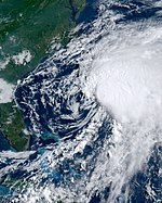
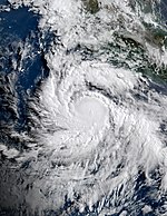
The 2023 Atlantic hurricane season is an ongoing Atlantic hurricane season, which is part of the annual tropical cyclone season in the Northern Hemisphere. It will officially begin on June 1, 2023, and end on November 30, 2023 These dates, adopted by convention, historically describe the period in each year when most Atlantic tropical cyclones form. However, subtropical or tropical cyclogenesis is possible at any time of the year, as demonstrated by Tropical Storm Ava's development on May 29, making 2023 the first year that a storm developed before the official beginning of a season.
Starting with this season, the National Hurricane Center (NHC) began to issue regular Tropical Weather Outlooks on May 15, two weeks earlier than it did in the past. This change was implemented in light of the fact that named systems had formed in the Atlantic Ocean prior to the official start of the season in each of the preceding six seasons.
Seasonal forecasts
[edit]| Source | Date | Named storms |
Hurricanes | Major hurricanes |
Ref |
| Average (1991–2020) | 14.4 | 7.2 | 3.2 | ||
| Record high activity | 30 | 15 | 7† | ||
| Record low activity | 4 | 2† | 0† | ||
|
| |||||
| CSU | December 10, 2022 | 15–18 | 8–10 | 4–5 | |
| TSR | December 11, 2022 | 19 | 9 | 4 | |
| TSR | April 6, 2023 | 21 | 8 | 4 | |
| CSU | April 7, 2023 | 19 | 7 | 3 | |
| TWC | April 14, 2023 | 19 | 7 | 3 | |
| UA | April 15, 2023 | 14 | 7 | 3 | |
| NCSU | April 21, 2023 | 17–21 | 7–9 | 3–5 | |
| PSU | May 9, 2023 | 15-23 | N/A | N/A | |
| UKMO* | May 23, 2023 | 22 | 11 | 6 | |
| NOAA | May 24, 2023 | 18–25 | 10–14 | 6–9 | |
|
| |||||
| Actual activity |
8 | 5 | 1 | ||
| * June–November only † Most recent of several such occurrences. (See all) | |||||
In advance of, and during, each hurricane season, several forecasts of hurricane activity are issued by national meteorological services, scientific agencies, and noted hurricane experts. These include forecasters from the United States National Oceanic and Atmospheric Administration (NOAA)'s Climate Prediction Center, Tropical Storm Risk (TSR), the United Kingdom's Met Office (UKMO), and Philip J. Klotzbach, William M. Gray and their associates at Colorado State University (CSU). The forecasts include weekly and monthly changes in significant factors that help determine the number of tropical storms, hurricanes, and major hurricanes within a particular year. According to NOAA and CSU, the average Atlantic hurricane season between 1991 and 2020 contained roughly 14 tropical storms, seven hurricanes, three major hurricanes, and an accumulated cyclone energy (ACE) index of 72–111 units. Broadly speaking, ACE is a measure of the power of a tropical or subtropical storm multiplied by the length of time it existed. It is only calculated for full advisories on specific tropical and subtropical systems reaching or exceeding wind speeds of 39 mph (63 km/h). NOAA typically categorizes a season as above-average, average, or below-average based on the cumulative ACE index, but the number of tropical storms, hurricanes, and major hurricanes within a hurricane season is sometimes also considered.
Pre-season forecasts
[edit]On December 10, 2022, TSR issued an extended range forecast for the 2023 hurricane season, predicting way above-average activity with 15–18 named storms, 8–10 hurricanes, 4–5 major hurricanes, and an ACE index of about 158 units. On December 12, 2022, CSU also issued forecast for the 2023 hurricane season, predicting way above-average activity with 21 named storms, 7 hurricanes and 3 major hurricanes, the ACE index is forecasted by the agency to 150 units.
On April 6, CSU issued their first extended range seasonal forecast for the 2023 Atlantic hurricane season, predicting well above-average activity, with 21 named storms, 8 hurricanes, 4 major hurricanes and an ACE index of 155 units. Their factors supporting an active hurricane season included above average-sea surface temperatures in the subtropical Atlantic Ocean and Caribbean Sea, and a cool neutral ENSO or weak La Niña pattern, corresponding to a low chance of an El Niño. On April 15, 2023, University of Arizona (UA) issued its seasonal prediction for a slightly above-average hurricane season, with 14 named storms, seven hurricanes, three major hurricanes, and an ACE index of 129 units. North Carolina State University (NCSU) made its prediction for the season on April 21, calling for an above-average season with 17 to 21 named storms, 7 to 9 hurricanes, and 3 to 5 major hurricanes.
Seasonal summary
[edit]
Systems
[edit]Tropical Storm Ava
[edit]| Tropical storm (SSHWS) | |
| Duration | May 29 – June 1 |
|---|---|
| Peak intensity | 45 mph (75 km/h) (1-min); 994 mbar (hPa) |
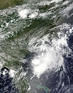
On May 23, a large low-pressure area developed near the Yucatán Peninsula, partially related to the Pacific basin remnants of Tropical Storm Anthony interacting with an upper-level trough over the Gulf of Mexico. The low moved eastward over the Yucatán Peninsula, producing a large area of disorganized showers and thunderstorms over the peninsula and northwestern Caribbean Sea on May 25–26. Due to the threat the developing system posed to Cuba, the Florida Keys and South Florida, the National Hurricane Center initiated advisories on it, designating it as Potential Tropical Cyclone One at 21:00 UTC on May 27. As it proceeded northeastward over the Gulf of Mexico, the disturbance was being buffeted by 25–35 mph (35–55 km/h) southwesterly shear, which limited its ability to intensify. On May 28, two Hurricane Hunters missions into the system found deep convection ongoing near and to the east of the estimated center, but no conclusive evidence of a closed circulation. Early the following day, the broad and poorly-defined center of the disturbance moved over southwestern Florida. Then, after moving into the Atlantic later that same day, a well-defined center formed with sufficient convection, resulting in it being upgraded to Tropical Storm Ava at 06:00 UTC on May 29. The storm intensified some later that same day, attaining sustained winds of 70 mph (110 km/h) as it passed west of Bermuda. Soon thereafter, Ava began its extra-tropical transition, a process that was complete by 02:00 UTC on June 1. Several days later, the system passed to the west of Scotland and near the Faroe Islands, before rapidly weakening while moving toward Norway, which it reached on June 7.
Hurricane Boris
[edit]| Category 2 hurricane (SSHWS) | |
| Duration | June 26 – July 3 |
|---|---|
| Peak intensity | 105 mph (165 km/h) (1-min); 959 mbar (hPa) |
A disturbance developed within the Intertropical Convergence Zone on June 24 and remained well defined as it tracked westward. An area of low pressure developed in association with the system over the northwestern Caribbean on June 25 and further organized into a tropical depression by 15:00 UTC the following day, supported by data from a reconnaissance aircraft. Steered west and eventually west-northwest by an expansive ridge across the Bahamas and Gulf of Mexico, the depression intensified into Tropical Storm Boris at 15:00 UTC on June 27. Boris maintained tropical storm intensity as it crossed the Yucatán Peninsula, and upon executing a northward turn and a second westward turn began to steadily intensify. The cyclone intensified into the season's first hurricane at 08:00 UTC on June 29 and attained peak winds of 105 mph (165 km/h) as it made landfall near Veracruz, Mexico at 21:00 UTC on June 30.
Tropical Storm Charlotte
[edit]| Tropical storm (SSHWS) | |
| Duration | July 11 – July 13 |
|---|---|
| Peak intensity | 40 mph (65 km/h) (1-min); 1014 mbar (hPa) |
An area of low pressure formed offshore of Savannah, Georgia, on the morning of July 10, and moved inland across coastal South Carolina later that same day. During this time the system unexpectedly developed with persistent deep convection forming close to the center and quickly becoming well organized. On July 11, at 09:00 UTC, Tropical Storm Charlotte formed about 50 mi (80 km) southwest of Myrtle Beach, South Carolina, with sustained winds of 40 mph (65 km/h) and an estimated central pressure of 1014 mbar (29.94 inHg). The storm became increasingly disorganized later that day, with its circulation becoming elongated from north-northeast to south-southwest. By 03:00 UTC on July 12, after passing Wilmington, North Carolina, Charlotte had weakened to a tropical depression. The system dissipated over eastern North Carolina the next day.
Hurricane Desmond
[edit]| Category 1 hurricane (SSHWS) | |
| Duration | August 26 – September 3 |
|---|---|
| Peak intensity | 85 mph (140 km/h) (1-min); 979 mbar (hPa) |
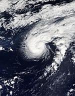
On August 25, an area of low pressure formed along a decaying frontal zone over the central subtropical Atlantic. The disturbance quickly organized and developed into Tropical Depression Four early on August 26 before strengthening into Tropical Storm Desmond later that evening. The storm continued to strengthen and became a Category 1 hurricane on August 28. It stalled the following day, caught south of a blocking high, and weakened back into a tropical storm due to upwelling of cooler waters and some dry air. Later, the storm began drifting toward the west, where it again strengthened into a hurricane overnight August 30–31. After turning northwestward, Desmond reached its peak intensity with sustained winds of 85 mph (140 km/h) early on September 1, It then moved over a relatively cool part of the Gulf Stream and weakened to a low-end Category 1 hurricane. Desmond briefly re-intensified when it moved over marginally warm waters on September 2, but resumed a weakening trend shortly afterwards. Desmond weakened to a tropical storm on September 3 before transitioning into an extratropical cyclone later that day.
Hurricane Elsa
[edit]| Category 2 hurricane (SSHWS) | |
| Duration | September 6 – September 13 |
|---|---|
| Peak intensity | 110 mph (175 km/h) (1-min); 953 mbar (hPa) |
A tropical wave producing widespread disorganized showers and thunderstorms moved off the west coast of Africa on August 28. After moving across the eastern and central tropical Atlantic, the disturbance encountered environmental conditions east of the Leeward Islands that were only marginally conducive for tropical cyclone development. After struggling against high wind shear for several days, the disturbance was finally able to become better organized and developed into Tropical Storm Elsa early on September 6. A burst of deep convection occurred near Elsa's center during the evening of September 8, and a Hurricane Hunters mission into the storm later that night reported that it briefly strengthened to very near hurricane strength. Elsa's intensity continued to fluctuate throughout much of the next day due to continued effects of westerly deep-layer shear. Later that day, the shear began to quickly diminish, and Elsa became better organized, strengthening into a hurricane around 00:00 UTC on September 10. By 03:00 UTC on September 11, Elsa reached Category 2 strength while moving northward; Hurricane Hunters data showed it to have an eye of almost 60 mi (90 km) and a fairly symmetric wind field. Three hours later the hurricane attained peak sustained winds of 110 mph (175 km/h). Despite being forecasted to continue strengthening into a Category 3 hurricane, Elsa's inner core was repeatedly interrupted due to dry air entrainment and it fluctuated in strength the following day while passing well to the east of Bermuda despite being over very warm sea surface temperatures of around 84–86 °F (28–29 °C). It briefly weakened to Category 1 strength early on September 12, before rebounding to Category 2 strength with a peak intensity of 105 mph (165 km/h) sustained winds and a minimum barometric pressure of 953 mbar (28.14 inHg). At this time, Elsa had become a large hurricane, with hurricane-force winds extending outward up to 80 miles (130 km) from the center and tropical-storm-force winds extend outward up to 275 miles (445 km). After maintaining this intensity for several hours, Elsa weakened to a Category 1 hurricane again at 15:00 UTC on September 13, then transitioned into an extratropical low south of Cape Race, Newfoundland six hours later.
Hurricane Frank
[edit]| Category 1 hurricane (SSHWS) | |
| Duration | September 15 – September 21 |
|---|---|
| Peak intensity | 75 mph (120 km/h) (1-min); 978 mbar (hPa) |
On September 8, a tropical wave emerged into the Atlantic from the west coast of Africa. Dry air limited convection associated with the wave for several days, before convection increased as the system reached the western Caribbean on September 14. A surface low-pressure area developed early on September 15, and then the convection became sufficiently organized, resulting in the formation of Tropical Depression Six by 06:00 UTC that day about 300 mi (485 km) southeast of Cozumel, Quintana Roo. The depression strengthened into Tropical Storm Frank about 12 hours later. Thereafter, Frank quickly intensified as it moved across the northwestern Caribbean Sea, reaching Category 1 hurricane strength and peaking with maximum sustained winds of 75 mph (120 km/h) and a minimum pressure of 978 mbar (28.88 inHg) as it made landfall near Tulum, Quintana Roo, at 16:45 UTC on September 17. It quickly weakened to a tropical storm while crossing the northern Yucatán Peninsula. After emerging over the southern Gulf of Mexico near Río Lagartos early on September 18, deep convection redeveloped over the center, enabling FRank to re-strengthen and briefly reach a secondary peak intensity of 70 mph (110 km/h) at 18:00 UTC on September 19. The storm then stalled for several hours before slowly commencing a move southwestward. During this time, increasing shear and intrusions of dry air weakened the storm, leaving its center exposed by early on September 20. By 18:00 UTC that day, Frank weakened to a tropical depression. It continued to produce disorganized convection through its final landfall, which occurred at 03:00 UTC on September 21, near San Felipe, Yucatán, with winds of 35 mph (55 km/h). The storm was absorbed by frontal system by a late on September 21, while its circulation promptly dissipated over land.
Hurricane Georgette
[edit]| Category 5 hurricane (SSHWS) | |
| Duration | September 18 – October 1 |
|---|---|
| Peak intensity | 175 mph (280 km/h) (1-min); 913 mbar (hPa) |
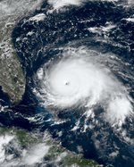
A tropical wave exited the west coast of Africa on September 17 and organized as it moved westward, becoming a tropical depression early on September 18 approximately 805 mi (1,295 km) east-southeast of Barbados. The depression quickly developed curved banding features and intensified into Tropical Storm Georgette later that day while heading west-northwestward. Dry air prevented any significant further intensification and organization for several days. Early on September 19, Georgette struck Barbados as a very compact cyclone with winds of 60 mph (95km/h) and then passed over Saint Lucia later that day. The mountainous terrain of Saint Lucia disrupted the storm's circulation, though a new circulation formed farther to the north. Georgette resumed organizing while moving northeastward over the Caribbean, with a partial eyewall and inner core developing by September 21. The cyclone reached hurricane intensity at 15:30 UTC on September 21 while striking the eastern tip of Saint Croix in the U.S. Virgin Islands; another landfall occurred on Saint Thomas a few hours later. After emerging into the Atlantic on September 21 Georgette eventually began moving west-northwestward due to an upper-level low moving to the south and a subtropical ridge expanding westward.
Encountering very warm water temperatures, ample moisture, and low wind shear, Georgette began rapidly intensifying on September 22, reaching major hurricane intensity around 18:00 UTC the next day. Strengthening further, the cyclone became a Category 5 hurricane at 00:00 UTC on September 25, a few hours prior to making landfall on Elbow Cay in the Abaco Islands with winds of 175 mph (280 km/h); Georgette became the second strongest tropical cyclone on record to strike the Bahamas, just behind Hurricane Dorian in 2019. A weakening high pressure area to the north and collapsing steering currents caused Georgette to move very slowly. The cyclone struck Grand Bahama early on September 26 while still a Category 5 hurricane. The storm weakened due to land interaction and upwelling, falling below major hurricane late on September 27. An eastward-moving, large mid-level trough forced Georgette to move north-northwestward and then northward, causing it to remain offshore Florida. The cyclone re-strengthened into a Category 3 hurricane over the Gulf Stream on September 28, but weakened back to a Category 2 later that day. Georgette then curved northeastward and scraped the Outer Banks of North Carolina on September 29 before moving ashore at Cape Hatteras with winds of 100 mph (155 km/h). Embedded within the mid-latitude flow, the cyclone accelerated northeastward and transitioned into an extratropical cyclone late on October 1. The remnant extratropical storm struck Nova Scotia and later Newfoundland before being absorbed by an extratropical cyclone on October 3.
Tropical Storm Henry
[edit]| Tropical storm (SSHWS) | |
| Duration | September 20 – September 26 |
|---|---|
| Peak intensity | 70 mph (110 km/h) (1-min); 989 mbar (hPa) |
A tropical wave moved off the coast of West Africa into the tropical Atlantic on September 11, producing disorganized showers and thunderstorms, but doing so in an environment just marginally favorable for development. By September 16, the wave had moved generally westward to about midway between Africa and the Lesser Antilles. There the showers and thunderstorms continued within the northern portion of the wave. The disturbance then transitioned into a trough of low pressure on September 17, as it moved slowly northward. After showing little signs of development over the next two day, a low-pressure formed within the trough and convection began to organize around it. Upon producing a well-defined center and persistent deep convection, became Tropical Depression Eight at 15:00 UTC on September 20. The depression strengthened into Tropical Storm Henry six hours later while it was located about 990 mi (1595 km) west of the Azores. Henry quickly intensified, attaining peak sustained winds of 70 mph (110 km/h) on the afternoon of September 22, just 36 hours after formation. However, additional strengthening was prevented as dry air became entrained into the eastern portion of the circulation. Henry then maintained its intensity for two days as it accelerated northeastward toward the western Azores despite being in an environment of moderate to strong shear, relatively dry air, and cool sea surface temperatures. On September 23, Henry began to interact with a shortwave trough/baroclinic zone, which shunted all of its the deep convection to the northeastern portion of the storm and it weakened slightly as it slowed down and began an anticyclonic loop through the central Azores along the southern side of a mid-level ridge. However, Henry restrenghtened later that day as convection reformed over northern and western sides of its circulation and it reached its peak intensity with sustained winds of 70 mph (110 km/h) and a minimum barometric pressure of 989 mbar (29.20 inHg) at 15:00 UTC. Relentless wind shear then stripped Henry of its deep convection and the storm began to weaken again early the next morning as it continued its loop, which it completed later that day as it passed just west of the central Azores. Now moving westward away from the Azores, Henry dropped to minimal tropical storm strength, but restrengthened for a third time as a large burst of convection developed over the northern portion of the circulation as it interacted with an upper-level trough. Its winds increased to 50 mph (80 km/h) on the morning of September 25 and it maintained this intensity for most of the day as it center reformed under the convective mass. However, Henry soon moved away from the trough and wind shear quickly removed the remaining deep convection from the storm late that afternoon. Convection did not reform over Henry and it weakened for the final time before being declared a post-tropical cyclone at 03:00 UTC on September 26.
Heavy rainfall and tropical storm forced winds was reported across the Azores, especially in the western and central islands. A weather station at Horta on Faial Island measured a wind gust to 41 mph (66 km/h) as Henry passed through.
Hurricane Bonnie
[edit]| Category 1 hurricane (SSHWS) | |
| Duration | June 2 – June 8 |
|---|---|
| Peak intensity | 75 mph (120 km/h) (1-min); 984 mbar (hPa) |
On May 25, the NHC began monitoring the southeastern Pacific south of the coast of Central America, where a low pressure area was expected to form within a few days. The anticipated disturbance formed on May 30, far south of the coasts of Guatemala and El Salvador, producing some disorganized showers. By June 2, the disturbance had become sufficiently organized to be classified as a tropical depression by the NHC. By 03:00 UTC on June 3, the depression had strengthened, with a well defined low-level structure and a tight band of persistent deep convection near the center, and was upgraded to Tropical Storm Bonnie. Then, after being hindered by northeasterly shear later that same day, intense convection was able to wrapped completely around the center and Bonnie rapidly intensified into a hurricane by 03:00 UTC on June 4. Twelve hours later, the sustained winds near the system's center were at 75 mph (120 km/h). It became weaker, however, as the day went on, apparently due to the inflow of dry air into its core and the effects of wind shear, and its winds fell to 70 mph (115 km/h) by day's end. The gradual weakening continued, and at 09:00 UTC on July 19, Bonnie weakened further to 60 mph (95 km/h) when its center was located just north of Clarion Island. Bonnie's upper-level cloud shield became more symmetric later that day, due to reduced wind shear and increased convection that had wrapped around the storm's northern region. By 15:00 UTC on June 8, however, the storm had weakened to a tropical depression as it moved west-northwestward over the open ocean. Later that day the system became a remnant low.
Though Bonnie remained well off shore, heavy rains fell in coastal areas of Baja California Sur, Jalisco, Nayarit and Sinaloa, causing localized flooding and landslides.
Storm names
[edit]The following list of names will be used for named storms that form in the North Atlantic in 2023. Retired names, if any, will be announced by the World Meteorological Organization in the spring of 2024. The names not retired from this list will be used again in the 2029 season.
|
|
Season effects
[edit]This is a table of all of the storms that have formed in the 2023 Atlantic hurricane season. It includes their duration, names, damages, and death totals. Deaths in parentheses are additional and indirect (an example of an indirect death would be a traffic accident), but were still related to that storm. Damage and deaths include totals while the storm was extratropical, a wave, or a low, and all of the damage figures are in 2023 USD.
| Saffir–Simpson scale | ||||||
| TD | TS | C1 | C2 | C3 | C4 | C5 |
| Storm name |
Dates active | Storm category at peak intensity |
Max 1-min wind mph (km/h) |
Min. press. (mbar) |
Areas affected | Damage (USD) |
Deaths | Ref(s) | ||
|---|---|---|---|---|---|---|---|---|---|---|
| Ava | May 29–June 1 | Tropical storm | 50 (85) | 994 | Yucatán Peninsula, Western Cuba, Florida, the Bahamas | >$300 million | 1 | |||
| Boris | June 26–July 3 | Category 2 hurricane | 105 (165) | 959 | Greater Antilles, Nicaragua, Honduras, Yucatán Peninsula | Unknown | None | |||
| Charlotte | July 11–13 | Tropical storm | 40 (65) | 1014 | The Carolinas | Unknown | None | |||
| Desmond | August 26–September 3 | Category 1 hurricane | 85 (140) | 979 | None | Unknown | None | |||
| Elsa | September 6–13 | Category 2 hurricane | 110 (175) | 953 | Northern Leeward Islands, Puerto Rico, Bermuda, Newfoundland | Unknown | 6 | |||
| Frank | September 15–21 | Category 1 hurricane | 75 (120) | 978 | Cayman Islands, Central America, Yucatán Peninsula | >150 million | 1 | |||
| Georgette | September 18–October 1 | Category 5 hurricane | 175 (280) | 913 | Barbados, Windward Islands, Leeward Islands, Virgin Islands, Puerto Rico, The Bahamas, East Coast of the United States, Eastern Canada | Unknown | 28 | |||
| Henry | September 20–26 | Tropical storm | 70 (110) | 989 | Azores | Unknown | None | |||
| Season aggregates | ||||||||||
| 8 systems | May 29 – Season ongoing | 145 (230) | 931 | >$450 million | 36 | |||||
See also
[edit]- Weather of 2023
- Tropical cyclones in 2023
- Atlantic hurricane season
- 2023 Pacific hurricane season
- 2023 Pacific typhoon season
- 2023 North Indian Ocean cyclone season
- South-West Indian Ocean cyclone seasons: 2022–23, 2023–24
- Australian region cyclone seasons: 2022–23, 2023–24
- South Pacific cyclone seasons: 2022–23, 2023–24

