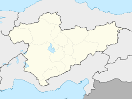
Ulukışla
Appearance
Ulukışla | |
|---|---|
 General view of Ulukışla | |
| Coordinates: 37°32′48″N 34°29′04″E / 37.54667°N 34.48444°E | |
| Country | Turkey |
| Province | Niğde |
| District | Ulukışla |
| Government | |
| • Mayor | Ali Uğurlu (AKP) |
| Elevation | 1,427 m (4,682 ft) |
| Population (2022)[1] | 5,696 |
| Time zone | UTC+3 (TRT) |
| Area code | 0388 |
| Website | www |
Ulukışla is a town in Niğde Province in the Central Anatolia region of Turkey. It is the seat of Ulukışla District.[2] Its population is 5,696 (2022).[1] Its altitude is 1,427 m.
The town of Ulukışla lies in a valley between the Medetsiz and Bolkar ranges of the Taurus Mountains.
History
[edit]According to the Ottoman General Census of 1881/82-1893, the kaza of Ulukışla had a total population of 9,182, consisting of 7,851 Muslims and 1,331 Greeks.[3]
Climate
[edit]Ulukışla has a cold semi-arid climate (Köppen: BSk),[4] with warm, dry summers, and cold winters.
| Climate data for Ulukışla (1991–2020) | |||||||||||||
|---|---|---|---|---|---|---|---|---|---|---|---|---|---|
| Month | Jan | Feb | Mar | Apr | May | Jun | Jul | Aug | Sep | Oct | Nov | Dec | Year |
| Mean daily maximum °C (°F) | 3.5 (38.3) |
5.3 (41.5) |
10.0 (50.0) |
15.1 (59.2) |
20.2 (68.4) |
25.0 (77.0) |
29.0 (84.2) |
29.0 (84.2) |
24.8 (76.6) |
18.5 (65.3) |
11.1 (52.0) |
5.8 (42.4) |
16.5 (61.7) |
| Daily mean °C (°F) | −1.4 (29.5) |
−0.1 (31.8) |
4.1 (39.4) |
9.0 (48.2) |
13.6 (56.5) |
18.0 (64.4) |
21.8 (71.2) |
21.7 (71.1) |
17.4 (63.3) |
11.8 (53.2) |
5.2 (41.4) |
0.7 (33.3) |
10.2 (50.4) |
| Mean daily minimum °C (°F) | −5.3 (22.5) |
−4.4 (24.1) |
−0.7 (30.7) |
3.5 (38.3) |
7.4 (45.3) |
11.1 (52.0) |
14.0 (57.2) |
14.1 (57.4) |
10.3 (50.5) |
6.0 (42.8) |
0.5 (32.9) |
−3.1 (26.4) |
4.5 (40.1) |
| Average precipitation mm (inches) | 29.13 (1.15) |
26.12 (1.03) |
36.24 (1.43) |
45.83 (1.80) |
46.33 (1.82) |
32.8 (1.29) |
8.36 (0.33) |
5.14 (0.20) |
11.11 (0.44) |
24.2 (0.95) |
28.76 (1.13) |
36.95 (1.45) |
330.97 (13.03) |
| Average precipitation days (≥ 1.0 mm) | 5.2 | 5.7 | 6.1 | 7.2 | 7.2 | 4.5 | 2.1 | 1.5 | 2.2 | 4.2 | 4.3 | 5.7 | 55.9 |
| Average relative humidity (%) | 76.1 | 73.2 | 66.2 | 61.5 | 59.0 | 53.0 | 43.9 | 44.0 | 48.6 | 60.0 | 66.9 | 74.4 | 60.5 |
| Source: NOAA[5] | |||||||||||||
References
[edit]- ^ a b "Address-based population registration system (ADNKS) results dated 31 December 2022, Favorite Reports" (XLS). TÜİK. Retrieved 13 March 2023.
- ^ İlçe Belediyesi, Turkey Civil Administration Departments Inventory. Retrieved 1 March 2023.
- ^ Kemal Karpat (1985), Ottoman Population, 1830-1914, Demographic and Social Characteristics, The University of Wisconsin Press, p. 142-143
- ^ "Table 1 Overview of the Köppen-Geiger climate classes including the defining criteria". Nature: Scientific Data.
- ^ "World Meteorological Organization Climate Normals for 1991-2020 — Ulukışla". National Oceanic and Atmospheric Administration. Retrieved January 17, 2024.
External links
[edit]Wikimedia Commons has media related to Ulukışla.
- District municipality's official website (in Turkish)
- A web portal of Niğde (in Turkish)
- Yesilbor.com (in Turkish)


