Two Mile and Two and One-Half Mile Village
Two Mile and Two and One-Half Mile Village | |
|---|---|
Designated place (interim protected land) | |
| Coordinates: 60°07′52″N 128°49′41″W / 60.131°N 128.828°W | |
| Country | Canada |
| Territory | Yukon |
| Area | |
| • Land | 1.24 km2 (0.48 sq mi) |
| Population (2021)[1] | |
• Total | 162 |
| Time zone | UTC−07:00 (MST) |
| Highways | Robert Campbell Highway (Highway 4) |
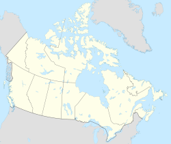
Two Mile and Two and One-Half Mile Village is a designated place within the Town of Watson Lake in southeast Yukon, Canada that includes the Indian settlements of Two Mile Village and Two and One-Half Mile Village.
History
[edit]Two Mile Village and Two and One-Half Mile Village were both separate Indian settlements prior to forming Two Mile and Two and One-Half Mile Village on January 2, 2011.[2] It was subsequently annexed by the Town of Watson Lake on January 2, 2016.[3]
Geography
[edit]Two Mile and Two and One-Half Mile Village is within the Town of Watson Lake on the Robert Campbell Highway (Highway 4) in southeast Yukon.[4]
Demographics
[edit]In the 2021 Census of Population conducted by Statistics Canada, Two Mile and Two and One-Half Mile Village had a population of 162 living in 73 of its 88 total private dwellings, a change of -13.8% from its 2016 population of 188. With a land area of 1.24 km2 (0.48 sq mi), it had a population density of 130.6/km2 (338.4/sq mi) in 2021.[1]
See also
[edit]References
[edit]- ^ a b c d "Population and dwelling counts: Canada and designated places". Statistics Canada. February 9, 2022. Retrieved May 8, 2022.
- ^ "Table 1: Yukon, changes to Census Subdivisions in alphabetical order by province (with 8C & 9C) — Effective dates: From January 2nd, 2011 to January 1st, 2016". Statistics Canada. November 16, 2016. Retrieved May 8, 2022.
- ^ "Interim List of Changes to Municipal Boundaries, Status and Names: From January 2nd, 2016 to January 1st, 2021" (PDF). Statistics Canada. November 17, 2021. p. 74. Retrieved May 8, 2022.
- ^ "Census Subdivision 6001003: Watson Lake, T" (PDF). Statistics Canada. November 16, 2021. Retrieved May 8, 2022.
- ^ "Population and dwelling counts, for Canada, provinces and territories, and census subdivisions (municipalities), 2016 and 2011 censuses – 100% data (Yukon)". Statistics Canada. February 8, 2017. Retrieved May 9, 2022.

