Tuzla Jegen Lug Airport
Appearance
Tuzla Jegin Lug Airport Aerodrom Jegin Lug Tuzla | |||||||||||
|---|---|---|---|---|---|---|---|---|---|---|---|
| Summary | |||||||||||
| Airport type | Public | ||||||||||
| Serves | Tuzla | ||||||||||
| Location | |||||||||||
| Elevation AMSL | 869 ft / 265 m | ||||||||||
| Coordinates | 44°27′27.7″N 18°48′29.8″E / 44.457694°N 18.808278°E | ||||||||||
| Map | |||||||||||
 | |||||||||||
| Runways | |||||||||||
| |||||||||||
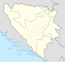
Tuzla Jegin Lug Airport (ICAO: LQJL) is a public use airport located near Tuzla, Bosnia and Herzegovina. Tuzla Jegin Lug Airport is situated in Donji Rainci, about 7 miles far away from Tuzla Town in SE direction (heading 110 degrees). The function of the airport is currently sport flying, recreation and tourism, with BHDCA registered flight training school. Owner and operator of Tuzla Jegin Lug Airport (LQJL) is Aero club Tuzla (BHDCA Certificate no. Е-7-L-004).
In 2017, the airfield underwent major renovation and modernization and is now able to host more recreational events.
See also
[edit]References
[edit]- ^ Airport record for Tuzla Jegin Lug Airport at Landings.com. Retrieved 2013-08-15
- ^ "location of Tuzla Jegin Lug Airport" (Map). Google Maps. Retrieved 2013-08-15.
External links
[edit]- Airport record for Tuzla Jegin Lug Airport Archived 2015-06-23 at the Wayback Machine at Landings.com
- Bosnia and Herzegovina Directorate of Civil Aviation Archived 2016-10-19 at the Wayback Machine at bhdca.gov.ba
- more info from operator of Tuzla Jegin Lug Airport at aeroklubtuzla.ba

