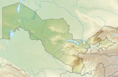
Tuyamuyun Hydro Complex
| THC Main Dam | |
|---|---|
| Official name | Tuyamuyun Hydroengineering Complex |
| Country | Uzbekistan/Turkmenistan |
| Location | Urgench, Xazorasp District, Xorazm Region/Dasoguz, Lebap Region |
| Coordinates | 41°12′48.14″N 61°24′18.76″E / 41.2133722°N 61.4052111°E |
| Purpose | Irrigation, power |
| Status | Operational |
| Construction began | 1969 |
| Opening date | 1983 |
| Dam and spillways | |
| Type of dam | Gravity |
| Impounds | Amu Darya River |
| Height | 25 m (82 ft) |
| Length | 141 m (463 ft) |
| Reservoir | |
| Creates | Channel Reservoir |
| Total capacity | 2,300,000,000 m3 (1,900,000 acre⋅ft) |
| Surface area | 303 km2 (117 sq mi) |
| Maximum length | 102 km (63 mi) |
| Normal elevation | 130 m (430 ft) |
| Commission date | 1983 |
| Turbines | 6 x 25 MW |
| Installed capacity | 150 MW |
| Annual generation | 571 GWh[1] |
The Tuyamuyun Hydro Complex (THC) is a system of four interconnected reservoirs and a series of canals on the lower Amu Darya River, bordering Uzbekistan and Turkmenistan. Its primary purpose is to provide water for irrigation in Xorazm, Karakalpakstan and Daşoguz regions of Uzbekistan, Turkmenistan and as far north as Kazakhstan.[2] The complex is located about 74 km (46 mi) southeast of Urgench in Xorazm Region, Uzbekistan and about 2 km (1.2 mi) north of Gazojak in Lebap Region, Turkmenistan.[3] It was constructed between 1969 and 1983. Aside from irrigation, the complex also provides water for industrial and municipal uses. A 150 MW power station on the main dam contains six 25 MW hydroelectric turbine-generators.[4]
The main dam (THC Main Dam) is located on the Amu Darya, straddling the border of Uzbekistan and Turkmenistan. It is the center-piece of the complex. The main dam is a 141 m (463 ft) long and 25 m (82 ft) high gravity dam. It creates the Channel Reservoir which has a storage capacity of about 2,300,000,000 m3 (1,900,000 acre⋅ft) and length of 102 km (63 mi). Water from the Channel Reservoir can be fed into the adjacent Kaparas and Sultansanjar Reservoirs for later use. The Sultansanjar Reservoir is connected via a canal to the Koshbulak Reservoir which lies just east. When first completed, all four reservoirs had a capacity of about 7,800,000,000 m3 (6,300,000 acre⋅ft) but due to silt build-up, this had been reduced to about 6,700,000,000 m3 (5,400,000 acre⋅ft) by 2001.
A system of canals off the main dam supply a network of irrigation canals to the various regions for irrigation.[2] Diversion of river water into these canals, along with similar diversions of water from the nearby Syr Darya River, has greatly contributed to the desiccation of most of the Aral Sea, an endorrheic lake basin. Prior to damming and diversion, the two rivers were the main sources of surface water that replenished the lake.[5]
References
[edit]- ^ "Building of Small HPP-2 at Andijan water basin". United Nations CDM. 3 February 2010. Retrieved 15 January 2015.
- ^ a b Qi, edited by Jiaguo; Evered, Kyle T. (2008). Environmental problems of Central Asia and their economic, social and security impacts. Dordrecht, the Netherlands: Springer. pp. 284–287. ISBN 978-1402089602. Retrieved 14 January 2015.
{{cite book}}:|first1=has generic name (help) - ^ Olsson, edited by Oliver; Bauer, Melanie (2010). Interstate water resource risk management : towards a sustainable future for the Aral Basin (JAYHUN). London: IWA Publishing. pp. 87–90. ISBN 978-1843393085. Retrieved 14 January 2015.
{{cite book}}:|first1=has generic name (help) - ^ "Irrigation and Drainage Systems in Khorezm, Uzbekistan" (PDF). Zentrum für Entwicklungsforschung Center for Development Research. December 2011. p. 9. Retrieved 15 January 2015.
- ^ "The True Costs of Cotton: Cotton Production and Water Insecurity" (PDF). Environmental Justice Foundation. 2012. Retrieved 2024-07-12.
- Dams in Uzbekistan
- Dams in Turkmenistan
- Gravity dams
- Hydroelectric power stations in Uzbekistan
- Hydroelectric power stations in Turkmenistan
- Dams completed in 1983
- Energy infrastructure completed in 1983
- 1983 establishments in Uzbekistan
- 1983 establishments in the Turkmen Soviet Socialist Republic
- Xorazm Region
- Lebap Region
- Hydroelectric power stations built in the Soviet Union
- Dams in the Aral Sea basin
- Amu Darya

