Tours Métropole Val de Loire
Appearance
Tours Métropole Val de Loire | |
|---|---|
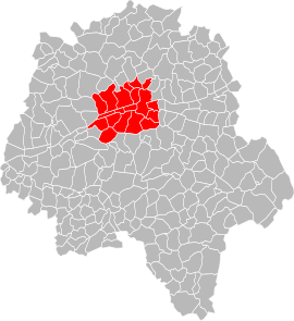
 Location in Indre-et-Loire. | |
| Country | France |
| Region | Centre-Val de Loire |
| Department | Indre-et-Loire |
| No. of communes | 22 |
| Established | 20 March 2017 |
| Seat | Tours |
Area | 389.2 km2 (150.3 sq mi) |
| Population (2018) | 294,220 |
| • Density | 756/km2 (1,960/sq mi) |
| Website | tours-metropole |
Tours Métropole Val de Loire (French pronunciation: [tuʁ metʁɔpɔl val də lwaʁ]) is the métropole, an intercommunal structure, centered on the city of Tours. It is located in the Indre-et-Loire department, in the Centre-Val de Loire region, central France. It was created on 20 March 2017, replacing the previous Communauté urbaine Tour(S) Plus.[1] Its area is 389.2 km2. Its population was 294,220 in 2018, of which 136,463 in Tours proper.[2]
Composition
[edit]Tours Métropole Val de Loire consists of the following 22 communes:[1][3][4]
- Ballan-Miré
- Berthenay
- Chambray-lès-Tours
- Chanceaux-sur-Choisille
- Druye
- Fondettes
- Joué-lès-Tours
- Luynes
- La Membrolle-sur-Choisille
- Mettray
- Notre-Dame-d'Oé
- Parçay-Meslay
- La Riche
- Rochecorbon
- Saint-Avertin
- Saint-Cyr-sur-Loire
- Saint-Étienne-de-Chigny
- Saint-Genouph
- Saint-Pierre-des-Corps
- Savonnières
- Tours
- Villandry
References
[edit]- ^ a b "Décret n° 2017-352 du 20 mars 2017 portant création de la métropole dénommée « Tours Métropole Val de Loire » | Legifrance". Retrieved 29 June 2017.
- ^ Comparateur de territoire, INSEE. 4 April 2022.
- ^ Tours Métropole Val de Loire (N° SIREN : 243700754), BANATIC. Accessed 17 October 2024.
- ^ Intercommunalité : Tours Métropole Val de Loire, INSEE

