
Tiffany, Colorado
Tiffany, Colorado | |
|---|---|
 County Road 321 in Tiffany, August 3029. | |
 Tiffany Location of Tiffany, Colorado.  Tiffany Tiffany (Colorado) | |
| Coordinates: 37°01′58″N 107°32′17″W / 37.0328°N 107.5381°W[2] | |
| Country | United States |
| State | Colorado |
| County | La Plata County[1] |
| Tribe | Southern Ute Indian Tribe |
| Government | |
| • Type | unincorporated community |
| • Body | La Plata County[1] |
| Elevation | 6,342 ft (1,933 m) |
| Time zone | UTC−07:00 (MST) |
| • Summer (DST) | UTC−06:00 (MDT) |
| ZIP code[3] | Ignacio 81137 |
| Area code | 970 |
| GNIS pop ID | 184493 |
Tiffany is an unincorporated community on the Southern Ute Indian Reservation in La Plata County, Colorado, United States.[2] Tiffany is part of the Durango, CO Micropolitan Statistical Area. The Ignacio, Colorado, post office (ZIP Code 81137) now serves Tiffany.
History
[edit]The Tiffany, Colorado, post office operated from December 3, 1907, until November 30, 1954.[4] The community was named after Ed Tiffany, a pioneer settler.[5]
See also
[edit]- Bibliography of Colorado
- Geography of Colorado
- History of Colorado
- Index of Colorado-related articles
- List of Colorado-related lists
- Outline of Colorado
- Ute people
References
[edit]- ^ a b "Colorado Counties". Colorado Department of Local Affairs. Retrieved February 1, 2025.
- ^ a b c "Tiffany, Colorado". Geographic Names Information System. United States Geological Survey, United States Department of the Interior. Retrieved February 1, 2025.
- ^ "ZIP Code Lookup". United States Postal Service. Retrieved February 1, 2025.
- ^ Bauer, William H.; Ozment, James L.; Willard, John H. (1990). Colorado Post Offices 1859–1989. Golden, Colorado: Colorado Railroad Historical Foundation. ISBN 0-918654-42-4.
- ^ Dawson, John Frank. Place names in Colorado: why 700 communities were so named, 150 of Spanish or Indian origin. Denver, CO: The J. Frank Dawson Publishing Co. p. 49.
External links
[edit]Wikimedia Commons has media related to Tiffany, Colorado.
Municipalities and communities of La Plata County, Colorado, United States | ||
|---|---|---|
| City | 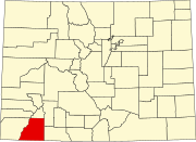 | |
| Towns | ||
| CDPs | ||
| Unincorporated communities | ||
| Ghost towns | ||
| Indian reservations | ||
| Footnotes | ‡This populated place also has portions in an adjacent county or counties | |
This Colorado state location article is a stub. You can help Wikipedia by expanding it. |