Tiébélé Department
Appearance
Tiébélé
Tible (Mossi) | |
|---|---|
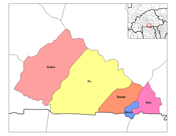
 Tiébélé Department location in the province | |
| Country | |
| Province | Nahouri Province |
| Area | |
• Total | 146.4 sq mi (379.3 km2) |
| Population (2019 census) | |
• Total | 61,007 |
| • Density | 420/sq mi (160/km2) |
| Time zone | UTC+0 (GMT 0) |
Tiébélé (Mossi: Tible) is a department or commune of Nahouri Province in southeastern Burkina Faso. Its capital lies at the town of Tiébélé;[1] the chief, the royal court and the nobility of the Kassena people, who first settled the region in the 15th century, reside there.[2] Located at the foot of a hill in a lowland landscape, the Royal Court of Tiébélé forms an irregular circular space of approximately 1.2 hectares. Several characteristic elements can be distinguished: a sacred hill, an altar of the ancestor and the red fig tree. The courtyard is characterized by a rich traditional architecture of a defensive character. It is surrounded by high perimeter walls connected by residential walls.
References
[edit]- ^ Burkinabé government inforoute communale Archived 2008-01-24 at the Wayback Machine
- ^ MessyNessy (10 Jan 2013). "The African Village where every House is a work of Art".

