Template:Infobox artwork/doc
| This is a documentation subpage for Template:Infobox artwork. It may contain usage information, categories and other content that is not part of the original template page. |
| This template is used on approximately 12,000 pages and changes may be widely noticed. Test changes in the template's /sandbox or /testcases subpages, or in your own user subpage. Consider discussing changes on the talk page before implementing them. |
This infobox should italicize the article title automatically. If this is not required, add |italic title=no to the list of parameters. If this is required but the title is not being italicized, try |italic title=force. |
| This template uses Lua: |
Usage
[edit]| {{{title}}} | |
|---|---|
| {{{other_language_1}}}: {{{other_title_1}}}, {{{other_language_2}}}: {{{other_title_2}}} | |
| [[File:{{{image}}}|frameless|alt={{{alt}}}|upright={{{image_upright}}}]] {{{caption}}} | |
| Artist | {{{artist}}} |
| Year | {{{year}}} |
| Catalogue | {{{catalogue}}} |
| Medium | {{{medium}}} |
| Movement | {{{movement}}} |
| Subject | {{{subject}}} |
| Dimensions | {{{height_metric}}} cm × {{{width_metric}}} cm × {{{length_metric}}} cm ({{{height_imperial}}} in × {{{width_imperial}}} in × {{{length_imperial}}} in); {{{diameter_metric}}} cm diameter ({{{diameter_imperial}}} in); {{{dimensions}}}{{{dimensions_ref}}} |
| Weight | {{{weight}}} |
| Designation | {{{designation}}} |
| Condition | {{{condition}}} |
| Location | {{{museum}}}, {{{city}}} |
| 0°N 0°E / 0°N 0°E | |
| Owner | {{{owner}}} |
| Accession | {{{accession}}} |
| Preceded by | {{{preceded_by}}} |
| Followed by | {{{followed_by}}} |
| {{{module}}} | |
| Website | {{{website}}} |
{{Infobox artwork
| title              =
| other_language_1   =
| other_title_1      =
| other_language_2   =
| other_title_2      =
| wikidata           =
| image              =
| image_upright      =
| alt                =
| caption            =
| artist             =
| year               =  <!-- If after 1583 CE, use {{start date|YYYY}} -->
| completion_date    =  <!-- For a more specific date (post-1583): {{start date|YYYY|MM|DD|df=y}} -->
| catalogue          =
| medium             =
| movement           =
| subject            =
| height_metric      =  <!-- (i.e. in metric units) -->
| width_metric       =
| length_metric      =
| diameter_metric    =
| height_imperial    =  <!-- (i.e. in imperial units) -->
| width_imperial     =
| length_imperial    =
| diameter_imperial  =
| dimensions         =
| dimensions_ref     =
| metric_unit        = cm  <!-- Note: this parameter must either use the value given or not be included -->
| imperial_unit      = in  <!-- Note: this parameter must either use the value given or not be included -->
| weight             =
| designation        =
| condition          =
| museum             =
| city               =
| coordinates        =  <!-- Only use for the coordinates (when known) of the artwork itself, i.e. not for the site, building, structure, etc. where it is kept, otherwise leave blank (or omit): {{coord|LAT|LON|type:landmark|display=inline,title}} -->
| owner              =
| accession          =
| preceded_by        =  <!-- preceding work by the same artist -->
| followed_by        =  <!-- next work by the same artist -->
| module             =
| website            =  <!-- Official webpage/site only: {{URL|example.com}} -->
}}
Parameters
[edit]- title
- The title of the artwork. Defaults to the page name.
- other_language_1
- Language of secondary title
- other_title_1
- Secondary title. Italicized unless
|italic other_title_1=no. - other_language_2
- Language of tertiary title
- other_title_2
- Tertiary title. Italicized unless
|italic other_title_2=no. - italic title
- Special option to adjust page title italics. Set to "no" to remove all page title italics. Set to "all" to italicize the entire title, including parentheses (see, for example, Breezing Up (A Fair Wind))
- wikidata
- QID of the specific Wikidata item
- image
- The name of the image file to display, without the "File:" prefix
- image_upright
- Image scaling factor; see WP:IMGSIZE for the image size policy
- alt
- Alternative text for image
- caption
- Caption for image
- artist
- Name of the artist(s) who created the piece
- year
- Use {{start date}} unless before 1583 CE.
- completion_date
- Use {{start date}}; alternative to
|year=. - catalogue
- Reference in a catalogue raisonné.
- type
- Deprecated due to ambiguity. Use medium and movement instead.
- medium
- Material used by the artist or designer to create the work of art. Examples: "Oil on canvas", "Bronze sculpture", "Ceramic tile"
- movement
- Art movement, or movements, typically associated with work of art or time during artist's career when work of art was created. Must be verifiable through sources. Examples: "Post-Impressionism", "Pop art"
- subject
- Subject(s) of the artwork
- dimensions
- See #Dimensional parameters section below
- weight
- Weight of the artwork ()
- designation
- Legal protection granted to the artwork
- condition
- Condition of the artwork
- museum
- Museum that currently houses the artwork
- city
- City in which the artwork is currently located
- coordinates
- Use {{coord}}, but only for the exact coordinates (when known) of the artwork's own location, i.e. not coordinates for the site, building, structure, etc. where it is kept; leave blank otherwise.
- owner
- Current owner of the artwork
- accession
- Accession or similar reference in the museum's database.
- preceded_by
- Preceding work by the same artist
- followed_by
- Next work by the same artist
- module
- an embedded template
- website
- Use {{URL}}, but only for an official webpage or website.
Dimensional parameters
[edit]This template includes code that allows input of dimensional information: any of height, width, length, and diameter, as well as a freeform parameter for adding nonstandard information.
There are 11 parameters, of which most fall into two groups of unit types:
height_imperialwidth_imperiallength_imperialdiameter_imperial
- These define the respective values for Imperial or US customary units such as the foot or inch. If the imperial unit is set to feet, inch specification can be added with height_inch, width_inch, length_inch, otherwise these _inch-suffixed parameters should not be used.
height_metricwidth_metriclength_metricdiameter_metric
- These define the respective values for SI (metric) units such as the metre (meter) or centimetre (centimeter).
Once raw numerical values are established in the above parameters, the units are set in the imperial_unit and metric_unit parameters, which default to inches and centimetres respectively.
If information is provided in only one unit system, it is automatically converted to the other using the unit that is defined for that system. In general, this should be used, as for most pieces of artwork measurements will only be taken in one unit system. Do not use a comma as decimal indicator for metric units (as used in some European and other countries) since the conversion does not recognize commas and the imperial measurement will be calculated incorrectly (e.g. use 30.8 not 30,8).
Users should take care to avoid false precision: measurements should be provided in the same unit, and with the same number of significant digits, as when they were taken. ("1 metre" is far less precise than "1000.00 millimetres", even though they are, in theory, the same length!)
If additional dimensional data is needed, the dimensions parameter can be used to add freeform information to the end of the rendered string. This parameter accepts raw wikitext and is not subject to any automatic conversion or modification ({{convert}} would have to be used manually).
References concerning artwork dimensions can be appended to the dimensional data by placing them in the optional dimensions_ref parameter.
Map and coordinates
[edit]The coordinates= parameter is used to display coordinates in the infobox, and optionally at the top of the page; use the {{coord}} template.
Two types of maps are available: pushpin maps (static) or mapframe maps (dynamic).
Pushpin maps
[edit]{{Infobox artwork
...
| coordinates = <!-- Use the {{Coord}} template. -->
| pushpin_map = <!-- Location name used for Template:Location map -->
| pushpin_map_alt = <!-- Location name used for Template:Location map -->
| pushpin_relief =
| pushpin_label_position =
| map_dot_label =
| map_size =
| pushpin_map_caption = <!-- Text to be displayed below map; for no caption enter "pushpin_map_caption="; -->
...
}}
Mapframe maps
[edit]A Mapframe map is automatically included if:
- It has been turned on by setting
|mapframe=yes - There are coordinates specified in
|coord=, or if the Wikidata item for the page (or as specified in|qid=) has a value for coordinate location (P625) - No pushpin map has been specified
The following optional parameters can then be used to adjust the map
- Basic parameters:
- mapframe – Specify yes or no to show or hide the map, overriding the default. Default: no
- mapframe-caption – Caption for the map. Default: blank (or if
|mapframe-geomask=is set, "Location in geomask's label") - mapframe-custom – Use a custom map instead of the automatic mapframe. Specify either a
{{maplink}}template, or another template that generates a mapframe map, or an image name. If used, the subsequent mapframe parameters will be ignored. Default: not specified - mapframe-id or id or qid – Id (Q-number) of Wikidata item to use. Default: item for current page
- mapframe-coordinates or mapframe-coord or coordinates or coord – Coordinates to use, instead of any on Wikidata. Use the {{Coord}} template, e.g.
|coord=. Default: coordinates from Wikidata{{Coord|12.34|N|56.78|E}} - mapframe-wikidata – Set to
yesto show shape/line features from the wikidata item, if any, when|coord=is set. Default: not specified
- Customise which features are displayed:
- mapframe-shape – Turn off display of shape feature by setting to
none. Use an inverse shape (geomask) instead of a regular shape by setting toinverse. Default: not specified - mapframe-point – Turn off display of point feature by setting to
none. Force point marker to be displayed by setting toon. Default: not specified - mapframe-line – Turn off display of line feature by setting to
none. Default: not specified - mapframe-geomask – Wikidata item to use as a geomask (everything outside the boundary is shaded darker). Can either be a specific Wikidata item (Q-number), or a property that specifies the item to use (e.g.
P17for country (P17),P131for located in the administrative territorial entity (P131)). Default: not specified - mapframe-switcher – set to
autoorgeomasksorzoomsto enable Template:Switcher-style switching between multiple mapframes. Default: not specifiedauto– switch geomasks found in location (P276) and located in the administrative territorial entity (P131) statements on the page's Wikidata item, searching recursively. E.g. an item's city, that city's state, and that state's country.geomasks– switch between the geomasks specified as a comma-separated list of Wikidata items (Q-numbers) in the mapframe-geomask parameterzooms– switch between "zoomed in"/"zoomed midway"/"zoomed out", where "zoomed in" is the default zoom (with a minimum of3), "zoomed out" is1, and "zoomed midway" is the average
- mapframe-shape – Turn off display of shape feature by setting to
- Other optional parameters:
- mapframe-frame-width or mapframe-width – Frame width. Default: 270
- mapframe-frame-height or mapframe-height – Frame height. Default: 200
- mapframe-shape-fill – Color used to fill shape features. Default: #606060
- mapframe-shape-fill-opacity – Opacity level of shape fill, a number between 0 and 1. Default: 0.5
- mapframe-stroke-color or mapframe-stroke-colour – Color of line features, and outlines of shape features. Default: #ff0000
- mapframe-stroke-width – Width of line features, and outlines of shape features; default is "5". Default: 5
- mapframe-marker – Marker symbol to use for coordinates; see mw:Help:Extension:Kartographer/Icons for options. Default: monument
- Can also be set to
blankto override any default marker symbol
- Can also be set to
- mapframe-marker-color or mapframe-marker-colour – Background color for the marker. Default: #5E74F3
- mapframe-geomask-stroke-color or mapframe-geomask-stroke-colour – Color of outline of geomask shape. Default: #555555
- mapframe-geomask-stroke-width – Width of outline of geomask shape. Default: 2
- mapframe-geomask-fill – Color used to fill outside geomask features. Default: #606060
- mapframe-geomask-fill-opacity – Opacity level of fill outside geomask features, a number between 0 and 1. Default: 0.5
- mapframe-zoom – Set the zoom level, from "1" (map of earth) to "18" (maximum zoom in), to be used if the zoom level cannot be determined automatically from object length or area. Default: 10
- mapframe-length_km or mapframe-length_mi or mapframe-area_km2 or mapframe-area_mi2 – Determine zoom level by passing in object's length (in kilometres or miles) or area (in square kilometres or square miles). Default: not specified
- mapframe-frame-coordinates or mapframe-frame-coord – Alternate latitude and longitude coordinates for initial placement of map, using {{coord}}. Default: derived from item coordinates
Map type
[edit]A list of modules containing maps that may be used can be found at:
Examples
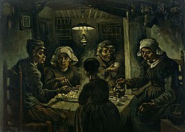
[edit]| The Potato Eaters | |
|---|---|
| Dutch: De Aardappeleters | |
 | |
| Artist | Vincent van Gogh |
| Year | 1885 |
| Catalogue | F123 |
| Medium | Oil on canvas |
| Movement | Post-Impressionism |
| Dimensions | 82 cm × 114 cm (321⁄4 in × 45 in) |
| Condition | lost |
| Location | Van Gogh Museum, Amsterdam |
| 52°21′30″N 4°52′52″E / 52.35833°N 4.88111°E | |
| Owner | Made-up Foundation |
| Accession | 1903-1234 |
| Website | example |
{{Infobox artwork
| title = The Potato Eaters
| other_language_1 = [[Dutch language|Dutch]]
| other_title_1 = {{Lang|nl|De Aardappeleters}}
| image = Vincent Van Gogh - The_Potato_Eaters.png
| alt = Two men and three women eating potatoes
| caption =
| artist = [[Vincent van Gogh]]
| year = {{start date|1885}}
| catalogue = F123
| medium = [[Oil painting|Oil on canvas]]
| movement = [[Post-Impressionism]]
| height_metric = 82
| width_metric = 114
| height_imperial = 32{{1/4}}
| width_imperial = 45
| condition = lost
| museum = [[Van Gogh Museum]]
| city = [[Amsterdam]]
| coordinates = {{coord|52|21|30|N|4|52|52|E|region:NL_type:landmark|display=inline,title}}
| owner = Made-up Foundation
| accession = 1903-1234
| website = {{URL|example.com}}
}}
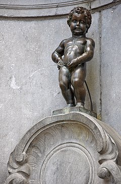
| Manneken Pis | |
|---|---|
 | |
| Artist | Jerome Duquesnoy |
| Year | 1388: original version 1619: current version |
| Medium | Bronze |
| Dimensions | 61 cm (24 in) |
| Location | Brussels |
| 50°50′42″N 4°21′00″E / 50.84499°N 4.34998°E | |
{{Infobox artwork
| title = ''Manneken Pis''
| image = Bruxelles Manneken Pis.jpg
| image_upright = 1.1
| wikidata = Q152072
| artist = [[Jerome Duquesnoy]]
| year = 1388: original version<br />{{Start date|1619}}: current version
| medium = Bronze
| height_metric = 61
| city = [[Brussels]]
| coordinates = {{coord|50.84499|4.34998|display=inline,title}}
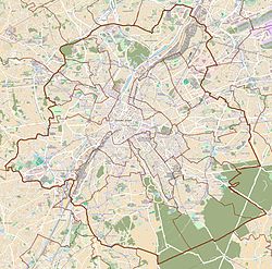
| pushpin_map = Belgium Brussels
| map_size = 250
}}
TemplateData
[edit]TemplateData documentation used by VisualEditor and other tools
| ||||||||||||||||||||||||||||||||||||||||||||||||||||||||||||||||||||||||||||||||||||||||||||||||||||||||||||||||||||||||||||||||||||||||||||||||||||||||||||||||||||||||||||||||||||||||||||||||||||||||||||||||||||||||||||||||||||||
|---|---|---|---|---|---|---|---|---|---|---|---|---|---|---|---|---|---|---|---|---|---|---|---|---|---|---|---|---|---|---|---|---|---|---|---|---|---|---|---|---|---|---|---|---|---|---|---|---|---|---|---|---|---|---|---|---|---|---|---|---|---|---|---|---|---|---|---|---|---|---|---|---|---|---|---|---|---|---|---|---|---|---|---|---|---|---|---|---|---|---|---|---|---|---|---|---|---|---|---|---|---|---|---|---|---|---|---|---|---|---|---|---|---|---|---|---|---|---|---|---|---|---|---|---|---|---|---|---|---|---|---|---|---|---|---|---|---|---|---|---|---|---|---|---|---|---|---|---|---|---|---|---|---|---|---|---|---|---|---|---|---|---|---|---|---|---|---|---|---|---|---|---|---|---|---|---|---|---|---|---|---|---|---|---|---|---|---|---|---|---|---|---|---|---|---|---|---|---|---|---|---|---|---|---|---|---|---|---|---|---|---|---|---|---|---|---|---|---|---|---|---|---|---|---|---|---|---|---|---|---|
|
See a monthly parameter usage report for Template:Infobox artwork in articles based on its TemplateData.
TemplateData for Infobox artwork An infobox for artwork
| ||||||||||||||||||||||||||||||||||||||||||||||||||||||||||||||||||||||||||||||||||||||||||||||||||||||||||||||||||||||||||||||||||||||||||||||||||||||||||||||||||||||||||||||||||||||||||||||||||||||||||||||||||||||||||||||||||||||
Microformat
[edit]The HTML mark-up produced by this template includes an hCalendar microformat that makes event details readily parsable by computer programs. This aids tasks such as the cataloguing of articles and maintenance of databases. For more information about the use of microformats on Wikipedia, please visit the Microformat WikiProject.
- Classes used
The HTML classes of this microformat include:
- attendee
- contact
- description
- dtend
- dtstart
- location
- organiser
- summary
- url
- vevent
nor collapse nested elements which use them.
Tracking categories
[edit]- Category:Pages using infobox artwork with unknown parameters (1)
- Category:Pages using infobox artwork with the backcolor parameter (263) (can be safely removed or ignored)
- Category:Pages using infobox artwork with the material parameter (1,358) (can be replaced with
|medium=) - Category:Pages using infobox artwork with unlinked artist field (144) (for potential linking)
See also
[edit]- {{Infobox artwork/wikidata}}
- {{Infobox artist}}
- {{Image information art}}, for image pages.


