Template:Infobox Indian state or territory/doc
| This is a documentation subpage for Template:Infobox Indian state or territory. It may contain usage information, categories and other content that is not part of the original template page. |
This template is a customized wrapper for {{Infobox settlement}} and as such included in Category:Templates calling Infobox settlement. Any field from {{Infobox settlement}} can work so long as it is added to this template first. It will also emit the same hCard and Geo microformats as {{Infobox settlement}}. Questions? Just ask here or over at Template talk:Infobox settlement. |
| This template uses Lua: |
The {{Infobox Indian state or territory}} is used to display information about a state or union territory in india (present or former) in a standardized format. It is designed to provide a quick overview of key facts and figures related to the state or territory. For the guidelines and additional informations about using perametares see, Basic India Conventions.
Enter |largest_city=capital, if the capital and the largest city are the same. If the state or territory has a winter capital then the largest city should be mentioned, even if it is the same as the capital one.
If the state or territory was formed with/by a bifurcation, then mention Bifurcation:|formation_date3=formation . Similarly, if the state or territory was formed as a state, then mention As State:|formation_date2=formation1.
Values that might be necessitate manually linking ( InterWiki ) are: any person's name, District, Council and Assembly, High court and Languages.
{{{name}}} | |
|---|---|
| {{{official_name}}} | |
| [[File:{{{image_skyline}}}|{{{imagesize}}}|alt={{{image_alt}}}|{{{image_caption}}}]] {{{image_caption}}} | |
|
[[File:{{{image_seal}}}|{{{seal_size}}}|alt=Official emblem of {{{name}}}|Official seal of {{{name}}}]] [[Emblem of {{{name}}}]] | |
| Etymology: {{{etymology}}} | |
| Nickname: {{{nickname}}} | |
| Motto: {{{motto}}} | |
| Anthem: {{{anthem}}} | |
| [[File:{{{image_map}}}|300px|alt=The map of India showing {{{name}}}|Location of {{{name}}} in India]] Location of {{{name}}} in India | |
| Coordinates: {{{coordinates}}} | |
| Country | |
| Region | [[{{{region}}}]] |
| Before was | {{{before_was}}} |
| Admission to union | {{{formation_date}}} |
| As union territory | {{{formation_date1}}} |
| As state | {{{formation_date2}}} |
| Bifurcation | {{{formation_date3}}} |
| Formation | {{{formation_date4}}} |
| Capital | [[{{{capital}}}]] [[{{{winter_capital}}}]] (winter) |
| Largest city | [[{{{largestcity}}}]] |
| Largest metro | [[{{{metro}}}]] |
| Districts | {{{districts}}} |
| Government {{{government_footnotes}}} | |
| • Type | {{{government_type}}} |
| • Body | [[Government of {{{name}}}]] |
| • [[List of governors of {{{name}}}|Governor]] | {{{Governor}}} |
| • Lieutenant governor | {{{Lt_governor}}} |
| • [[List of chief ministers of {{{name}}}|Chief minister]] | {{{Chief_Minister}}} ({{{party}}}) |
| • [[List of deputy chief ministers of {{{name}}}|Deputy chief minister]] | {{{Deputy_CM}}} |
| • Chief secretary | {{{Chief_secretary}}} |
| Legislature | {{{legislature_type}}} |
| • Council | {{{council}}} ([[{{{name}}} Legislative Council|{{{council_seats}}}]]) |
| • Assembly | {{{assembly}}} ([[{{{name}}} Legislative Assembly|{{{assembly_seats}}}]]) |
| National Parliament | Parliament of India |
| • Rajya Sabha | {{{rajya_sabha_seats}}} |
| • Lok Sabha | {{{lok_sabha_seats}}} |
| High Court | {{{judiciary}}} |
| Area | |
• Total | {{{area_total_km2}}} km2 ({{{area_total_sq_mi}}} sq mi) |
| • Rank | {{{area_rank}}} |
| Dimensions | |
| • Length | {{{length_km}}} km ({{{length_mi}}} mi) |
| • Width | {{{width_km}}} km ({{{width_mi}}} mi) |
| Elevation | {{{elevation_m}}} m ({{{elevation_ft}}} ft) |
| Population ({{{population_as_of}}}) | |
• Total | {{{population_total}}} |
| • Rank | {{{population_rank}}} |
| • Urban | {{{population_urban}}} |
| • Rural | {{{population_rural}}} |
| Demonym | {{{population_demonym}}} |
| Language | |
| • Official | {{{0fficial_Langs}}} |
| • Additional official | {{{additional_official}}} |
| • Official script | {{{official_script}}} |
| GDP | |
| • Total ({{{GDP_year}}}) | {{{GDP_total}}} |
| • Rank | {{{GDP_rank}}} |
| • Per capita | {{{GDP_per_capita}}} ({{{GDP_per_capita_rank}}}) |
| Time zone | UTC+05:30 (IST) |
| ISO 3166 code | {{{iso_code}}} |
| Vehicle registration | {{{registration_plate}}} |
| HDI ({{{HDI_year}}}) | {{{HDI}}} ({{{HDI_rank}}}) |
| Literacy ({{{literacy_year}}}) | {{{literacy}}} ({{{literacy_rank}}}) |
| Sex ratio ({{{sexratio_year}}}) | {{{sex_ratio}}} ({{{sexratio_rank}}}) |
| Website | & |
| Symbols of {{{name}}} | |
| [[File:{{{image_seal}}}|80px]] Emblem of {{{name}}} | |
| Song | {{{anthem}}} |
| Foundation day | [[{{{foundation_day}}}]] |
| Bird | {{{bird}}} |
| Butterfly | {{{butterfly}}} |
| Fish | {{{fish}}} |
| Flower | {{{flower}}} |
| Fruit | {{{fruit}}} |
| Mammal | {{{mammal}}} |
| Tree | {{{tree}}} |
| State highway mark | |
| [[File:{{{image_highway}}}|{{{image_size_highway}}}]] | |
| State highway of {{{name}}} {{{SH_numbers}}} | |
| List of Indian state and union territory symbols | |
| {{{footnotes}}} | |
Usage
[edit]Complete empty syntax
[edit]{{Infobox Indian state or territory
| name =
| official_name =
| image_skyline =
| imagesize =
| image_alt =
| image_caption =
| image_seal =
| etymology =
| nickname =
| motto =
| anthem =
| image_map =
| mapsize =
| map_caption =
| coordinates =
| region =
| before_was =
| formation_date =
| formation_date1 =
| formation_date2 =
| formation_date3 =
| formation_date4 =
| capital =
| winter_capital =
| largestcity =
| metro =
| districts =
| government_footnotes =
| government_type =
| Governor =
| Chief_Minister =
| party =
| Lt_governor =
| Administrator =
| Chief_secretary =
| judiciary =
| legislature_type =
| council =
| council_seats =
| assembly =
| assembly_seats =
| rajya_sabha_seats =
| lok_sabha_seats =
| area_rank =
| area_total_sq_mi =
| area_total_km2 =
| length_km =
| width_km =
| elevation_max_m =
| elevation_max_point =
| elevation_min_m =
| elevation_min_point =
| elevation_footnotes =
| elevation_m =
| population_total =
| population_rank =
| population_as_of =
| population_density =
| population_density_rank =
| population_urban =
| population_rural =
| population_demonym =
| 0fficial_Langs =
| Regional_Langs =
| National_Langs =
| official_script
| GDP_total =
| GDP_rank =
| GDP_year =
| GDP_per_capita =
| GDP_per_capita_rank =
| iso_code =
| registration_plate =
| HDI =
| HDI_rank =
| HDI_year =
| literacy =
| literacy_year =
| literacy_rank =
| sex_ratio =
| sexratio_year =
| sexratio_rank =
| website =
| footnotes =
}}
Syntax for Former territory
[edit]These parameters are used to display key information about a geographic area or region that was once a separate political entity within India but is now a part of present-day state/union territory or formed as a new state/territory.
Specify |former=yes, to use/ activate these parameters. Note: all the other parameters can also be used (if needed). See the comments on the syntax to understand which parameters are what for.|country=India and the time zone are defaults.
{{Infobox Indian state or territory
| name              =
| former            = yes
| govfirst_year     = <!--  administration period of the first governor of the state or territory -->
| gov_first         = <!--  name of the first governor of the state or territory -->
| govlast_year      = <!--  administration period of the last governor of the state or territory -->
| gov_last          = <!--  name of the last governor of the state or territory -->
| cmfirst_year      = <!--  administration period of the first chief minister of the state or territory -->
| cm_first          = <!--  name of the first chief minister -->
| cmlast_year       = <!--  administration period of the last chief minister of the state or territory -->
|  cm_last          = <!--  name of the last chief minister -->
| year_start        = <!--  the year in which the territory was established as a separate entity -->
| formation_date4   = <!--  formation date of the state or territory -->
| consolidation     = <!--  date when the states or territories were merged with each other or into another state -->
| formation_date3   = <!-- date when the state or territory was bifurcated -->
| dissolution       = <!-- date when the state or territory was disestablished -->
| year_end          = <!-- the year in which the state or territory was dissolved or merged with another entity -->
}}
Microformat
[edit]The HTML markup produced by this template includes an hCard microformat, which makes the place-name and location parsable by computers, either acting automatically to catalogue articles across Wikipedia, or via a browser tool operated by a person, to (for example) add the subject to an address book. Within the hCard is a Geo microformat, which additionally makes the coordinates (latitude & longitude) parsable, so that they can be, say, looked up on a map, or downloaded to a GPS unit. For more information about the use of microformats on Wikipedia, please see the microformat project.
Sub-templates
[edit]If the place or venue has "established", "founded", "opened" or similar dates, use {{start date}} for the earliest of those dates unless the date is before 1583 CE.
If it has a URL, use {{URL}}.
Please do not remove instances of these sub-templates.
Classes
[edit]hCard uses HTML classes including:
- adr
- agent
- category
- county-name
- extended-address
- fn
- label
- locality
- nickname
- note
- org
- region
- street-address
- uid
- url
- vcard
Geo is produced by calling {{coord}}, and uses HTML classes:
- geo
- latitude
- longitude
Please do not rename or remove these classes nor collapse nested elements which use them.
Precision
[edit]When giving coordinates, please use an appropriate level of precision. Do not use {{coord}}'s |name= parameter.
Template data
[edit]TemplateData for Infobox Indian state or territory
TemplateData
| |||||||||||||||||||||||||||||||||||||||||||||||||||||||||||||||||||||||||||||||||||||||||||||||||||||||||||||||||||||||||||||||||||||||||||||||||||||||||||||||||||||||||||||||||||||||||||||||||||||||||||||||||||||||||||||||||||||||||||||||||||||||||||||||||||||||||||||||||||||||||||||||||||||||||||||||||||||||||||||||||||||||||||||||||||||||||||||||||||||||||||||||||||||||||||||||||||||||||||||||||||||||||||||||||||||||||||||||||||||||||||||||||||||||||||||||||||||||||||||||||||||||||||||||||||||||||||||||||||||||||||||||||||||||||||||||||
|---|---|---|---|---|---|---|---|---|---|---|---|---|---|---|---|---|---|---|---|---|---|---|---|---|---|---|---|---|---|---|---|---|---|---|---|---|---|---|---|---|---|---|---|---|---|---|---|---|---|---|---|---|---|---|---|---|---|---|---|---|---|---|---|---|---|---|---|---|---|---|---|---|---|---|---|---|---|---|---|---|---|---|---|---|---|---|---|---|---|---|---|---|---|---|---|---|---|---|---|---|---|---|---|---|---|---|---|---|---|---|---|---|---|---|---|---|---|---|---|---|---|---|---|---|---|---|---|---|---|---|---|---|---|---|---|---|---|---|---|---|---|---|---|---|---|---|---|---|---|---|---|---|---|---|---|---|---|---|---|---|---|---|---|---|---|---|---|---|---|---|---|---|---|---|---|---|---|---|---|---|---|---|---|---|---|---|---|---|---|---|---|---|---|---|---|---|---|---|---|---|---|---|---|---|---|---|---|---|---|---|---|---|---|---|---|---|---|---|---|---|---|---|---|---|---|---|---|---|---|---|---|---|---|---|---|---|---|---|---|---|---|---|---|---|---|---|---|---|---|---|---|---|---|---|---|---|---|---|---|---|---|---|---|---|---|---|---|---|---|---|---|---|---|---|---|---|---|---|---|---|---|---|---|---|---|---|---|---|---|---|---|---|---|---|---|---|---|---|---|---|---|---|---|---|---|---|---|---|---|---|---|---|---|---|---|---|---|---|---|---|---|---|---|---|---|---|---|---|---|---|---|---|---|---|---|---|---|---|---|---|---|---|---|---|---|---|---|---|---|---|---|---|---|---|---|---|---|---|---|---|---|---|---|---|---|---|---|---|---|---|---|---|---|---|---|---|---|---|---|---|---|---|---|---|---|---|---|---|---|---|---|---|---|---|---|---|---|---|---|---|---|---|---|---|---|---|---|---|---|---|---|---|---|---|---|---|---|---|---|---|---|---|---|---|---|---|---|---|---|---|---|---|---|---|---|---|---|---|---|---|---|---|---|---|---|---|---|---|---|---|---|---|---|---|---|---|---|---|---|---|---|---|---|---|---|---|---|---|---|---|---|---|---|---|---|---|---|---|---|---|---|---|---|---|---|---|---|---|---|---|---|---|---|---|---|---|---|---|---|---|---|---|---|---|---|---|---|---|---|---|---|---|---|---|---|---|---|---|---|---|---|---|---|---|---|---|---|---|---|---|---|---|---|---|---|---|---|---|---|---|---|---|---|---|---|
|
Infobox for Indian States and Union Territories
| |||||||||||||||||||||||||||||||||||||||||||||||||||||||||||||||||||||||||||||||||||||||||||||||||||||||||||||||||||||||||||||||||||||||||||||||||||||||||||||||||||||||||||||||||||||||||||||||||||||||||||||||||||||||||||||||||||||||||||||||||||||||||||||||||||||||||||||||||||||||||||||||||||||||||||||||||||||||||||||||||||||||||||||||||||||||||||||||||||||||||||||||||||||||||||||||||||||||||||||||||||||||||||||||||||||||||||||||||||||||||||||||||||||||||||||||||||||||||||||||||||||||||||||||||||||||||||||||||||||||||||||||||||||||||||||||||
Examples
[edit]1) Example 1
[edit]These are just examples, to show how the {{Infobox Indian state or territory}} can be displayed. The examples may be doesn't have recent and totally accurate information.
Maharashtra | |
|---|---|
| Etymology: Mahā ("great") and Rāṣṭra ("nation/dominion") | |
| Motto: Pratipaccandralēkhēva vardhiṣṇurviśva vanditā Mahārāṣṭrasya rājyasya mudrā bhadrāya rājatē | |
| Anthem: Jai Jai Maharashtra Maza | |
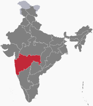
 Location of Maharashtra in India | |
| Coordinates: 18°58′N 72°49′E / 18.97°N 72.82°E | |
| Country | |
| Region | West India |
| Before was | State of Bombay (1950–1960) |
| Formation (by bifurcation) | 1 May 1960 |
| Capital | Mumbai Nagpur (winter) |
| Largest city | Mumbai |
| Largest metro | Mumbai Metropolitan Region |
| Districts | 36 (6 divisions) |
| Government | |
| • Body | Government of Maharashtra |
| • Governor | Ramesh Bais |
| • Chief minister | Eknath Shinde (SS) |
| State Legislature | Bicemiral |
| • Council | Maharashtra Legislative Council (78 seats) |
| • Assembly | Maharashtra Legislative Assembly (228 seats) |
| National Parliament | Parliament of India |
| • Rajya Sabha | 19 seats |
| • Lok Sabha | 48 seats |
| High Court | Bombay High Court |
| Area | |
• Total | 307,713 km2 (118,809 sq mi) |
| • Rank | 3rd |
| Elevation | 14 m (46 ft) |
| Population (2011) | |
• Total | 112,374,333 |
| • Rank | 2nd |
| • Density | 370/km2 (1,000/sq mi) |
| • Urban | 45.22% |
| • Rural | 54.78% |
| Demonym | Maharashtrian |
| Language | |
| • Official | Marathi |
| GDP | |
| • Total (2021–22 est) | ₹31.97 trillion (US$370 billion) |
| • Rank | 1st |
| • Per capita | ₹225,073 (US$2,600) (14th) |
| Time zone | UTC+05:30 (IST) |
| ISO 3166 code | IN-MH |
| Vehicle registration | MH |
| HDI (2022) | 0.750 (9th) |
| Literacy (2017) | 84.8% |
| Sex ratio (2021) | 966 |
| Website | maharashtra |
| Symbols of Maharashtra | |
 | |
| Song | Jai Jai Maharashtra Maza |
| Foundation day | Maharashtra Day |
| Bird | Yellow-footed green pigeon |
| Butterfly | Blue mormon |
| Fish | Rohu |
| Flower | Jarul |
| Tree | Mango tree |
| State highway mark | |
 | |
| State highway of Maharashtra MH SH1-MH SH368 | |
| List of Indian state symbols | |
| Joint High Court with Goa | |
{{Infobox Indian state or territory
| name = Maharashtra
| type = State
| image_seal = Seal of Maharashtra.svg
| seal_type = [[Emblem of Maharashtra]]
| etymology = Mahā ("great") and Rāshtra ("nation/dominion")
| motto = Pratipaccandralēkhēva vardhiṣṇurviśva vanditā Mahārāṣṭrasya rājyasya mudrā bhadrāya rājatē
| anthem = [[Jai Jai Maharashtra Maza]]
| image_map = IN-MH.svg
| map_alt = Map of India highlighting Maharashtra
| coordinates = {{coord|18.97|72.82|region:IN-MH_type:adm1st|display=inline,title}}
| region = West India
| before_was = [[Bombay State|State of Bombay (1950–1960)]]
| formation_date3 = formation
| formation_date4 = 1 May 1960
| capital = Mumbai
| winter_capital = Nagpur
| largestcity = Mumbai
| metro = Mumbai Metropolitan Region
| districts = [[List of districts of Maharashtra|36 (6 divisions)]]
| Governor = [[Bhagat Singh Koshyari]]
| Chief_Minister = [[Eknath Shinde]]
| party = [[Balasahebanchi Shiv Sena|BSS]]
| judiciary = [[Bombay High Court]]
| legislature_type = Bicemiral
| assembly = [[Maharashtra Legislative Assembly]]
| assembly_seats = 228 seats
| council = [[Maharashtra Legislative Council]]
| council_seats = 78 seats
| rajya_sabha_seats = 19 seats
| lok_sabha_seats = 48 seats
| area_total_km2 = 307713
| area_rank = 3rd
| elevation_m = 14
| population_total = 112,374,333
| population_as_of = 2011
| population_rank = 2nd
| population_urban = 45.22%
| population_rural = 54.78%
| population_density = 370
| population_demonym = Maharashtrian
| 0fficial_Langs = Marathi
| GDP_total = {{INRConvert|31.97|t|lk=r}}
| GDP_year = 2021–22 est
| GDP_rank = 1st
| GDP_per_capita = {{INRConvert|225073|lk=r}}
| GDP_per_capita_rank = 14th
| HDI_year = 2022
| HDI = 0.750
| HDI_rank = 9th
| literacy = 84.8%
| literacy_year = 2017
| sex_ratio = 966
| sexratio_year = 2021
| iso_code = IN-MH
| registration_plate = MH
| website = maharashtra.gov.in
| footnotes = Joint High Court with Goa
| foundation_day = Maharashtra Day
| bird = Yellow-footed green pigeon
| fish = Rohu
| butterfly = Blue mormon
| flower = Jarul
| tree = Mango tree
| image_highway = Major State Highway 1 (Maharashtra).png
| image_size_highway = 100
| SH_numbers = [[List of state highways in Maharashtra|MH SH1-MH SH368]]
}}
2) Example 2
[edit]Puducherry | |
|---|---|
| Motto(s): Satyameva Jayate (Truth alone triumphs) | |
| Anthem: Tamil Thai Valthu | |
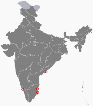
 Location of Puducherry in India | |
| Country | |
| Region | South India |
| Admission to union | 1 November 1954 |
| Formation | 1 July 1963 |
| Capital and largest city | Pondicherry |
| Districts | 4 |
| Government | |
| • Body | Government of Puducherry |
| • Lieutenant governor | Tamilisai Soundararajan |
| • Chief minister | N. Rangaswamy (AINRC) |
| • Chief secretary | Ashwani Kumar, IAS |
| Legislature | Unicameral |
| • Assembly | Puducherry Legislative Assembly (33 seats) |
| National Parliament | Parliament of India |
| • Rajya Sabha | 1 seat |
| • Lok Sabha | 1 seat |
| High Court | Madras High Court |
| Area | |
• Total | 483 km2 (186 sq mi) |
| • Rank | 34th |
| Population (2011) | |
• Total | 1,394,467 |
| • Rank | 29th |
| • Density | 2,900/km2 (8,000/sq mi) |
| • Urban | 68.33% |
| • Rural | 31.67% |
| Language | |
| • Official | Tamil •English •French |
| • Additional official | Malayalam • Telugu |
| GDP | |
| • Total (2019-20) | ₹210 billion (US$2.4 billion) |
| • Rank | 26th |
| • Per capita | ₹206,888 (US$2,400) (10th) |
| Time zone | UTC+05:30 (IST) |
| ISO 3166 code | IN-PY |
| Vehicle registration | PY 01 - PY 05 |
| HDI (2018) | |
| Literacy (2011) | 86.55% |
| Sex ratio (2011) | 1037 |
| Website | py |
| Territories of French India were completely transferred to the Republic of India de facto. | |
{{Template:Infobox Indian state or territory
| name = Puducherry
| type = Union Territory
| image_seal = Emblem of the Government of Puducherry.png
| seal_type = Emblem of Puducherry
| motto = Satyameva Jayate <br/> (Truth alone triumphs)
| anthem = [[Tamil Thai Valthu]]
| image_map = IN-PY.svg
| region = South India
| formation_date = 1 November 1954
| formation_date4 = 1 July 1963
| capital = Pondicherry
| largestcity = capital
| districts = [[List of districts of Puducherry|4]]
| Lt_governor = [[Tamilisai Soundararajan]]
| Chief_Minister = [[N. Rangaswamy]]
| party = [[All India N.R. Congress|AINRC]]
| Chief_secretary = Ashwani Kumar, IAS
| judiciary = [[Madras High Court]]
| legislature_type = Unicameral
| assembly = [[Puducherry Legislative Assembly]]
| assembly_seats = 33 seats
| rajya_sabha_seats = 1 seat
| lok_sabha_seats = 1 seat
| area_total_km2 = 483
| area_rank = 34th
| population_total = 1,394,467
| population_as_of = 2011
| population_rank = 29th
| population_urban = 68.33%
| population_rural = 31.67%
| population_density = 2,900
| 0fficial_Langs = [[Tamil language|Tamil]] •[[English language|English]] •[[French language|French]]
| additional_official = [[Malayalam]] • [[Telugu language|Telugu]]
| GDP_total = {{INRConvert|210|b|lk=r}}
| GDP_year = 2019-20
| GDP_rank = 26th
| GDP_per_capita = {{INRConvert|206888|lk=r}}
| GDP_per_capita_rank = 10th
| coastline = 30.6
| HDI_year = 2018
| HDI = {{increase}}0.740 (<span style="color:#090">High</span>)
| HDI_rank = 7th
| literacy = 86.55%
| literacy_year = 2011
| sex_ratio = 1037
| sexratio_year = 2011
| iso_code = IN-PY
| registration_plate = PY 01 - PY 05
| website = py.gov.in
| footnotes = Territories of French India were completely transferred to the Republic of India de facto.
}}


