Tecuya Mountain
Appearance
| Tecuya Mountain | |
|---|---|
| Highest point | |
| Elevation | 7163+ ft (2183+ m) NAVD 88[1] |
| Coordinates | 34°50′32″N 118°58′53″W / 34.842199°N 118.9814903°W[2] |
| Geography | |
| Location | Kern County, California, U.S. |
| Parent range | San Emigdio Mountains |
| Topo map | USGS Frazier Mountain |
| Climbing | |
| Easiest route | Trail hike |
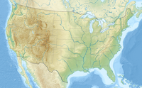
Tecuya Mountain in southern Kern County, California, more than 7,163 feet (2,183 m) high, is the highest point on the Tecuya Ridge of the San Emigdio Mountains in the Transverse Ranges.
References
[edit]- ^ "Tecuya Mountain, California". Peakbagger.com. Retrieved August 5, 2009.
- ^ "Tecuya Mountain". Geographic Names Information System. United States Geological Survey, United States Department of the Interior. Retrieved February 28, 2009.


