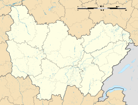
Tannay, Nièvre
Appearance
Tannay | |
|---|---|
 The church in Tannay | |
| Coordinates: 47°22′07″N 3°35′33″E / 47.3686°N 3.59250°E | |
| Country | France |
| Region | Bourgogne-Franche-Comté |
| Department | Nièvre |
| Arrondissement | Clamecy |
| Canton | Clamecy |
| Intercommunality | Tannay-Brinon-Corbigny |
| Government | |
| • Mayor (2020–2026) | Philippe Nolot[1] |
Area 1 | 15.36 km2 (5.93 sq mi) |
| Population (2022)[2] | 546 |
| • Density | 36/km2 (92/sq mi) |
| Time zone | UTC+01:00 (CET) |
| • Summer (DST) | UTC+02:00 (CEST) |
| INSEE/Postal code | 58286 /58190 |
| Elevation | 161–366 m (528–1,201 ft) |
| 1 French Land Register data, which excludes lakes, ponds, glaciers > 1 km2 (0.386 sq mi or 247 acres) and river estuaries. | |
Tannay (French pronunciation: [tanɛ] ⓘ) is a commune in the Nièvre department in central France, region of Bourgogne-Franche-Comté.[3]
Geography
[edit]The village is built on a hill, providing a significant point of view over the Yonne valley. The Canal du Nivernais (Nièvre lock) is navigable.
Points of interest
[edit]Tannay Port (nautical base camp), collegiate church Saint-Léger from the 13th century. This village is on the Vezelay branch of the Route of Saint Jacques de Compostelle, about 5 hours walk from the cathedral of Vézelay Abbey.[citation needed]
Town partnerships
[edit]Tannay fosters partnerships with the following places:[4]
 Norheim, Rhineland-Palatinate, Germany since 1967
Notable people from Tannay
[edit]See also
[edit]References
[edit]- ^ "Répertoire national des élus: les maires". data.gouv.fr, Plateforme ouverte des données publiques françaises (in French). 2 December 2020. Archived from the original on 28 June 2020. Retrieved 27 December 2024.
- ^ "Populations de référence 2022" (in French). The National Institute of Statistics and Economic Studies. 19 December 2024.
- ^ INSEE commune file
- ^ Partnership with Norheim Archived 2013-12-19 at the Wayback Machine
Wikimedia Commons has media related to Tannay, Nièvre.


