Tangará da Serra
Appearance
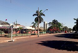
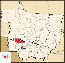
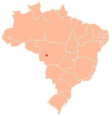
Tangará da Serra is a municipality in the state of Mato Grosso in the Central-West Region of Brazil.[1][2][3][4]
Tangará da Serra | |
|---|---|
Municipality | |
 | |
 | |
| Country | |
| Region | Southeast |
| State | Mato Grosso |
| Mesoregion | MidWest Mato-Grossense |
| Elevation | 1,388 ft (423 m) |
| Population (2020 est.[5]) | |
• Total | 105,711 |
| Time zone | UTC−3 (BRT) |

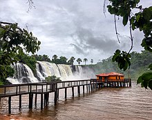
The Sepotuba River, known for its many waterfalls and rapids, is located near Tangará da Serra.

The city is served by Tangará da Serra Airport.
See also
[edit]References
[edit]- ^ "Divisão Territorial do Brasil" (in Portuguese). Divisão Territorial do Brasil e Limites Territoriais, Instituto Brasileiro de Geografia e Estatística (IBGE). July 1, 2008. Retrieved December 17, 2009.
- ^ "Estimativas da população para 1º de julho de 2009" (PDF) (in Portuguese). Estimativas de População, Instituto Brasileiro de Geografia e Estatística (IBGE). August 14, 2009. Retrieved December 17, 2009.
- ^ "Ranking decrescente do IDH-M dos municípios do Brasil" (in Portuguese). Atlas do Desenvolvimento Humano, Programa das Nações Unidas para o Desenvolvimento (PNUD). 2000. Retrieved December 17, 2009.
- ^ "Produto Interno Bruto dos Municípios 2002-2005" (PDF) (in Portuguese). Instituto Brasileiro de Geografia e Estatística (IBGE). December 19, 2007. Retrieved December 17, 2009.
- ^ IBGE 2020


