Suyama Kofun
巣山古墳 | |
 Suyama Kofun | |
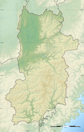
| Location | Kōryō, Nara, Japan |
|---|---|
| Region | Kansai region |
| Coordinates | 34°33′23″N 135°44′27″E / 34.55639°N 135.74083°E |
| Type | Kofun |
| History | |
| Founded | c.4th - 5th century |
| Periods | Kofun period |
| Site notes | |
| Public access | Yes (no facilities) |
 | |
Suyama Kofun (巣山古墳) is a Kofun period burial mound, located ion the border of the Miyoshi neighborhood of the town of Kōryō, Nara Prefecture in the Kansai region of Japan.[1]) is a Kofun that is located in Kōryō, Nara of Japan.[2][3] It is designated as a national Special Historic Site.[4][5][6] The tumulus was designated a National Historic Site of Japan in 1927, with its status elevated to that of a Special National Historic Site in 1952.[7] It the central tumulus of the burial mounds that make up the Umami Kofun cluster and is estimated to have been built between the end of the 4th century and the beginning of the 5th century.
Overview
[edit]The Suyama Kofun is a zenpō-kōen-fun (前方後円墳), which is shaped like a keyhole, having one square end and one circular end, when viewed from above. It is facing north, but its central axis faces slightly northeast. A wide moat surrounds the mound, which is completely filled with water. The mound is built of earth in three tiers, and the slope of each tier steeper than the one before it. The slopes are covered with fukiishi consisting of andesite-based gravel and broken stones. Traces of rows of cylindrical haniwa clay figures have been found. Square projections are attached to the narrow part connecting the anterior and posterior sections. The total length of the tumulus is 202 meters,[8] making it one of a small handful of kofun tombs over 200 meters in length which were not administered by the Imperial Household Agency.[8] Subsequent archaeological excavations evealed a base stone 8 meters wide outside the base of the mound, revising its total length to 220 meters. The posterior circular mound has a diameter of 130 meters, and height of 25 meters; the anterior rectangular portion has a width of 112 meters, and height of 21 meters. The top of the circular mound is flat with a diameter of 45 meters. The moat is shield-shaped, and the width is 33 meters at the circular mound side, 37 meters at the front, and 57 meters around the narrow part. The outer bank of the moat is 27 meters wide at its widest point, and is built on parts of the south, east, and north sides, and is particularly high and wide on the east and northeast sides. Two pit-style stone burial chambers parallel to the main axis of the circular mound were excavated in the circular section, but they were looted during the Meiji period, and most of the many grave goods are now lost.[9]
-
Suyama Kofun
-
Mourning ship excavated from Suyama Tomb
-
Group of excavated haniwa
-
waterfowl-shaped haniwa
-
Enclosure-shaped haniwa
-
Fence-shaped haniwa
The Suyama Kofun is approximately four kilometers southwest of Hashio Station on the Kintetsu Railway Tawaramoto Line.
See also
[edit]References
[edit]- ^ "巣山古墳 | 奈良県歴史文化資源データベース | 奈良県歴史文化資源データベース「いかす・なら」". www.pref.nara.jp. Retrieved 2021-07-17.
- ^ "巣山古墳 文化遺産オンライン". bunka.nii.ac.jp. Retrieved 2021-07-17.
- ^ "観光 巣山古墳概要 | 広陵町". www.town.koryo.nara.jp. Retrieved 2021-07-17.
- ^ 小項目事典, 国指定史跡ガイド,精選版 日本国語大辞典,百科事典マイペディア,知恵蔵,ブリタニカ国際大百科事典. "巣山古墳とは". コトバンク (in Japanese). Retrieved 2021-07-17.
{{cite web}}: CS1 maint: multiple names: authors list (link) - ^ "国指定文化財等データベース". kunishitei.bunka.go.jp. Retrieved 2021-07-17.
- ^ "巣山古墳(すやまこふん)". www.library.pref.nara.jp. Retrieved 2021-07-17.
- ^ "乙女山古墳" (in Japanese). Agency for Cultural Affairs. Retrieved August 20, 2024.
- ^ a b Edwards, Walter (2000). "Contested Access: The Imperial Tombs in the Postwar Period". Journal of Japanese Studies. 26 (2): 375. doi:10.2307/133273. ISSN 0095-6848.
- ^ Isomura, Yukio; Sakai, Hideya (2012). (国指定史跡事典) National Historic Site Encyclopedia. 学生社. ISBN 4311750404.(in Japanese)
External links
[edit]![]() Media related to Suyama Kofun at Wikimedia Commons
Media related to Suyama Kofun at Wikimedia Commons
- Kōryō Town home page(in Japanese)
- Nara Prefectural Library(in Japanese)


