Sunderland Aerodrome
Appearance
Sunderland Aerodrome | |||||||||||
|---|---|---|---|---|---|---|---|---|---|---|---|
| Summary | |||||||||||
| Airport type | Private | ||||||||||
| Operator | Jeff Klimpel | ||||||||||
| Location | Sunderland, Ontario | ||||||||||
| Time zone | EST (UTC−05:00) | ||||||||||
| • Summer (DST) | EDT (UTC−04:00) | ||||||||||
| Elevation AMSL | 950 ft / 290 m | ||||||||||
| Coordinates | 44°13′37″N 079°05′50″W / 44.22694°N 79.09722°W | ||||||||||
| Map | |||||||||||
 | |||||||||||
| Runways | |||||||||||
| |||||||||||
Source: Canada Flight Supplement[1] | |||||||||||
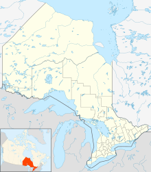
Blackwater Creek (Sunderland) Aerodrome (TC LID: CSD7) is a registered aerodrome located 2.5 nautical miles (4.6 km; 2.9 mi) southwest of Sunderland, Ontario, Canada.
References
[edit]


