Sevenmile Bridge
Appearance
Sevenmile Bridge | |
 The bridge in late 2014. | |
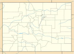
| Location | County Rd. 6 miles SW of Creede, Creede, Colorado |
|---|---|
| Coordinates | 37°47′33″N 106°58′51″W / 37.79250°N 106.98083°W |
| Built | 1935 |
| Architect | Burghardt, King |
| Architectural style | Pratt deck truss |
| MPS | Vehicular Bridges in Colorado TR |
| NRHP reference No. | 85001552[1] |
| Added to NRHP | July 11, 1985 |
The Sevenmile Bridge is a Pratt deck truss bridge bringing a county road over the Rio Grande, 6 miles (10 km) southwest of Creede, Colorado, United States. It was designed by engineer King Burghardt and is unusual for its cantilevered ends. It was built in 1935; it then carried State Highway 149. It has also been known as Bridge over Rio Grande River. It was listed on the National Register of Historic Places in 1985.[1][2]
In 1981 ownership of the bridge was transferred to Mineral County. The bridge provides access to Marshall Park Campground.[2]
References
[edit]- ^ a b "National Register Information System". National Register of Historic Places. National Park Service. July 9, 2010.
- ^ a b Rebecca Herbst (October 11, 1984). "HABS/HAER: Sevenmile Bridge / Bridge over Rio Grande River". National Park Service. and accompanying photo from 1981
Categories:
- Road bridges on the National Register of Historic Places in Colorado
- Bridges completed in 1935
- Transportation buildings and structures in Mineral County, Colorado
- National Register of Historic Places in Mineral County, Colorado
- Truss bridges in the United States
- Colorado Registered Historic Place stubs
- Western United States bridge (structure) stubs
- Colorado building and structure stubs
- Colorado transportation stubs


