Sene District
Appearance
You can help expand this article with text translated from the corresponding article in German. (July 2013) Click [show] for important translation instructions.
|
Sene District | |
|---|---|
Former District | |
 Districts of Brong-Ahafo Region | |
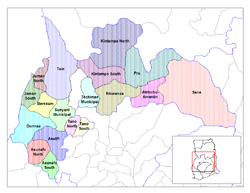
Location of Sene District within Brong-Ahafo | |
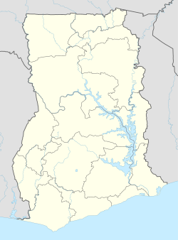
| Coordinates: 7°44′3.12″N 0°40′54.48″W / 7.7342000°N 0.6818000°W | |
| Country | |
| Region | |
| Capital | Kwame Danso |
| Government | |
| • District Executive | Dominic Napare |
| Area | |
• Total | 6,657 km2 (2,570 sq mi) |
| Population (2012) | |
• Total | — |
| Time zone | UTC+0 (GMT) |
Sene District is a former district that was located in Brong-Ahafo Region (now currently in Bono East Region), Ghana.[1] It was originally created as an ordinary district assembly on 10 March 1989. However, on 28 June 2012, it was split off into two new districts: Sene West District (capital: Kwame Danso) and Sene East District (capital: Kajaji). The district assembly was located in the eastern part of Brong-Ahafo Region (now eastern part of Bono East Region) and had Kwame Danso as its capital town.
List of settlements
[edit]| Settlements of Sene District | |||
| No. | Settlement | Population | Population year |
|---|---|---|---|
| 1 | Akyeremade | ||
| 2 | Bantama | ||
| 3 | Bassa | ||
| 4 | Bodinka | ||
| 5 | Chiripo | ||
| 6 | Drobe | ||
| 7 | Kajaji | ||
| 8 | Kirenkuase | ||
| 9 | Kojokrom | ||
| 10 | Kwame Danso | ||
| 11 | Lassi | ||
| 12 | Lemu Intrubuso | ||
| 13 | Mframa | ||
| 14 | Nyankontreh | ||
| 15 | Okyeamekrom | ||
| 16 | Premuase | ||
| 17 | Tato Battor | ||
| 19 | Wiase | ||
Sources
[edit]- "Sene District". Statoids.
- District: Sene District
References
[edit]- ^ Bureau, Communications. ""Bono East Officially Created; Techiman Is Capital" – President Akufo-Addo". presidency.gov.gh. Retrieved 2020-08-13.
{{cite web}}:|last=has generic name (help)
See also
[edit]7°44′3.12″N 0°40′54.48″W / 7.7342000°N 0.6818000°W

