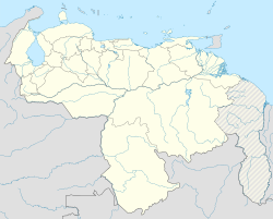
Santo Domingo, Táchira
Appearance
Santo Domingo | |
|---|---|
Town | |
| Coordinates: 7°34′07″N 72°00′56″W / 7.56861°N 72.01556°W | |
| Country | |
| Time zone | UTC−4 (VET) |
| Area code(s) | 5032 |
| Climate | Am |
Santo Domingo, alternatively known as Santo Domingo del Táchira, is a city in Venezuela, located in Táchira.[1]
Climate
[edit]Santo Domingo experiences a tropical rainforest climate (Köppen: Af). The city's climate is characterized by consistently warm temperatures throughout the year and abundant precipitation, particularly during the wet season, which lasts from April to November.
| Climate data for Santo Domingo (1991–2020) | |||||||||||||
|---|---|---|---|---|---|---|---|---|---|---|---|---|---|
| Month | Jan | Feb | Mar | Apr | May | Jun | Jul | Aug | Sep | Oct | Nov | Dec | Year |
| Record high °C (°F) | 36.0 (96.8) |
36.9 (98.4) |
38.5 (101.3) |
38.2 (100.8) |
38.0 (100.4) |
38.0 (100.4) |
36.7 (98.1) |
35.6 (96.1) |
36.0 (96.8) |
36.0 (96.8) |
36.2 (97.2) |
36.7 (98.1) |
38.5 (101.3) |
| Mean daily maximum °C (°F) | 30.5 (86.9) |
31.1 (88.0) |
31.5 (88.7) |
30.8 (87.4) |
30.1 (86.2) |
29.5 (85.1) |
29.1 (84.4) |
29.7 (85.5) |
30.5 (86.9) |
30.4 (86.7) |
29.9 (85.8) |
30.1 (86.2) |
30.3 (86.5) |
| Daily mean °C (°F) | 23.7 (74.7) |
24.4 (75.9) |
24.9 (76.8) |
24.8 (76.6) |
24.4 (75.9) |
23.9 (75.0) |
23.5 (74.3) |
23.8 (74.8) |
24.2 (75.6) |
24.3 (75.7) |
24.0 (75.2) |
23.8 (74.8) |
24.1 (75.4) |
| Mean daily minimum °C (°F) | 19.5 (67.1) |
20.2 (68.4) |
21.0 (69.8) |
21.4 (70.5) |
21.4 (70.5) |
20.8 (69.4) |
20.5 (68.9) |
20.6 (69.1) |
20.8 (69.4) |
21.0 (69.8) |
20.8 (69.4) |
20.1 (68.2) |
20.7 (69.3) |
| Record low °C (°F) | 8.1 (46.6) |
13.3 (55.9) |
12.7 (54.9) |
13.0 (55.4) |
15.9 (60.6) |
15.3 (59.5) |
13.7 (56.7) |
10.2 (50.4) |
15.5 (59.9) |
16.3 (61.3) |
15.8 (60.4) |
11.9 (53.4) |
8.1 (46.6) |
| Average precipitation mm (inches) | 71.0 (2.80) |
63.7 (2.51) |
91.8 (3.61) |
189.1 (7.44) |
266.4 (10.49) |
317.1 (12.48) |
300.7 (11.84) |
239.7 (9.44) |
229.7 (9.04) |
277.2 (10.91) |
218.8 (8.61) |
105.9 (4.17) |
2,371.1 (93.35) |
| Average precipitation days (≥ 1.0 mm) | 7.9 | 8.2 | 9.8 | 15.3 | 19.5 | 21.3 | 21.8 | 19.6 | 16.6 | 18.0 | 15.6 | 9.5 | 183.1 |
| Source: NOAA[2] | |||||||||||||
Transportation
[edit]Santo Domingo is served by Mayor Buenaventura Vivas Airport, which is features limited domestic service on two airlines, Conviasa and Aerolineas Estelar. It is located 13.3km (22 minutes by car) away from the center of Santo Domingo. [3]
References
[edit]- ^ "Bing Maps - Driving Directions, Traffic and Road Conditions". bing.com. Archived from the original on 2014-07-14. Retrieved 2014-07-05.
- ^ "World Meteorological Organization Climate Normals for 1991-2020 — Santo Domingo". National Oceanic and Atmospheric Administration. Archived from the original on January 29, 2024. Retrieved January 29, 2024.
- ^ ".:Aserca Airlines:". asercaairlines.com. Archived from the original on 2014-07-15. Retrieved 2014-07-05.

