Sandstad
Sandstad | |
|---|---|
Village | |
 | |
| Coordinates: 63°31′21″N 9°05′43″E / 63.5224°N 09.0954°E | |
| Country | Norway |
| Region | Trøndelag |
| County | Trøndelag |
| District | Fosen |
| Municipality | Hitra Municipality |
| Area | |
• Total | 0.36 km2 (0.14 sq mi) |
| Elevation | 17 m (56 ft) |
| Population (2024)[1] | |
• Total | 207 |
| • Density | 575/km2 (1,490/sq mi) |
| Time zone | UTC+01:00 (CET) |
| • Summer (DST) | UTC+02:00 (CEST) |
| Post Code | 7246 Sandstad |
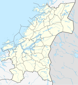
Sandstad[3] is a village in Hitra Municipality in Trøndelag county, Norway. The village is located along the Trondheimsleia on the southeastern coast of the island of Hitra, about 6 kilometres (3.7 mi) southwest of the village of Hestvika. The north entrance to the Hitra Tunnel lies just south of the village of Sandstad. The Terningen lighthouse lies in the Trondheimsleia, about 3 kilometres (1.9 mi) southwest of the village. Sandstad Church is located here.[4]
The 0.36-square-kilometre (89-acre) village has a population (2024) of 207 and a population density of 575 inhabitants per square kilometre (1,490/sq mi).[1]
History
[edit]The village was the administrative centre of the old Sandstad Municipality which existed from 1 July 1914 until its dissolution on 1 January 1964.[5]
References
[edit]- ^ a b c Statistisk sentralbyrå (1 October 2024). "Urban settlements. Population and area, by municipality".
- ^ "Sandstad, Hitra (Trøndelag)". yr.no. Retrieved 15 February 2018.
- ^ "Informasjon om stadnamn". Norgeskart (in Norwegian). Kartverket. Retrieved 25 January 2025.
- ^ Haugen, Morten O., ed. (27 December 2023). "Sandstad (tettsted på Hitra)". Store norske leksikon (in Norwegian). Foreningen Store norske leksikon. Retrieved 25 January 2025.
- ^ Haugen, Morten O., ed. (22 November 2024). "Sandstad (tidligere kommune)". Store norske leksikon (in Norwegian). Foreningen Store norske leksikon. Retrieved 25 January 2025.


