
Rosedale, Washington
Rosedale, Washington | |
|---|---|
 Rosedale, Washington | |
| Coordinates: 47°20′38″N 122°37′39″W / 47.34389°N 122.62750°W | |
| Country | United States |
| State | Washington |
| County | Pierce |
| Area | |
• Total | 4.63 sq mi (12.0 km2) |
| Elevation | 135 ft (41 m) |
| Population (2010) | |
• Total | 4,044 |
| • Density | 870/sq mi (340/km2) |
| Time zone | Pacific |
| Area code | 253 |
| GNIS feature ID | 2585032[1] |
Rosedale is a census-designated place (CDP) located in Pierce County, Washington.
A post office called Rosedale was established in 1887, and remained in operation until 1918.[2] The community was named for roses near the original town site.[3]
Demographics
[edit]In 2010, it had a population of 4,044 inhabitants. 1,478 are male. 2,566 are female.[4]
References
[edit]- ^ a b U.S. Geological Survey Geographic Names Information System: Rosedale, Washington
- ^ "Post Offices". Jim Forte Postal History. Retrieved August 22, 2016.
- ^ Meany, Edmond S. (1923). Origin of Washington geographic names. Seattle: University of Washington Press. p. 249.
- ^ "Rosedale, Washington". Retrieved August 20, 2014.
Municipalities and communities of Pierce County, Washington, United States | ||
|---|---|---|
| Cities | 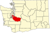 | |
| Towns | ||
| CDPs |
| |
| Other communities | ||
| Indian reservation | ||
| Military bases | ||
| Ghost towns | ||
| Footnotes | ‡This populated place also has portions in an adjacent county or counties | |
This Pierce County, Washington state location article is a stub. You can help Wikipedia by expanding it. |