Qaemabad Rural District (Shahriar County)
Appearance
Qaemabad Rural District
Persian: دهستان قائم آباد | |
|---|---|
| Coordinates: 35°34′44″N 51°06′19″E / 35.57889°N 51.10528°E[1] | |
| Country | Iran |
| Province | Tehran |
| County | Shahriar |
| District | Central |
| Population (2016)[2] | |
• Total | 3,386 |
| Time zone | UTC+3:30 (IRST) |
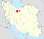
Qaemabad Rural District (Persian: دهستان قائم آباد) is in the Central District of Shahriar County, Tehran province, Iran.[3] Its capital was the village of Qaemabad[4] until it merged with other villages in the formation of the city of Sabashahr.[5]
Demographics
[edit]Population
[edit]At the time of the 2006 National Census, the rural district's population was 30,682 in 7,571 households.[6] There were 3,900 inhabitants in 1,065 households at the following census of 2011.[7] The 2016 census measured the population of the rural district as 3,386 in 1,000 households. The most populous of its two villages was Mahmudabad-e Khalajabad, with 2,433 people.[2]
See also
[edit]References
[edit]- ^ OpenStreetMap contributors (23 September 2024). "Qaemabad Rural District (Shahriar County)" (Map). OpenStreetMap (in Persian). Retrieved 23 September 2024.
- ^ a b Census of the Islamic Republic of Iran, 1395 (2016): Tehran Province. amar.org.ir (Report) (in Persian). The Statistical Center of Iran. Archived from the original (Excel) on 12 December 2021. Retrieved 19 December 2022.
- ^ Habibi, Hassan (10 December 2014) [Approved 21 June 1369]. Approval of the organization and chain of citizenship of the elements and units of the national divisions of Tehran province centered on the city of Tehran. rc.majlis.ir (Report) (in Persian). Ministry of the Interior, Defense Political Commission of the Government Board. Notification 8416/T133K. Archived from the original on 30 November 2014. Retrieved 16 December 2023 – via Islamic Parliament Research Center.
- ^ Mousavi, Mirhossein (30 September 1391) [Approved 10 April 1366]. Creation and formation of 29 rural districts including villages, farms and places in Karaj County under Tehran province. rc.majlis.ir (Report) (in Persian). Ministry of the Interior, Council of Ministers. Notification 118172T943. Archived from the original on 20 December 2012. Retrieved 15 December 2023 – via The Islamic Council Research Center.
- ^ Habibi, Hassan (c. 2024) [Approved 6 July 1375]. The action of several villages in the Central District of Shahriar County and their transformation into Sabashahr. lamtakam.com (Report) (in Persian). Ministry of the Interior, Political-Defense Commission of the Government Board. Proposal 1.4.42.3523; Notification 7038/T16867K. Archived from the original on 23 September 2024. Retrieved 23 September 2024 – via Lam ta Kam.
- ^ Census of the Islamic Republic of Iran, 1385 (2006): Tehran Province. amar.org.ir (Report) (in Persian). The Statistical Center of Iran. Archived from the original (Excel) on 20 September 2011. Retrieved 25 September 2022.
- ^ Census of the Islamic Republic of Iran, 1390 (2011): Tehran Province. irandataportal.syr.edu (Report) (in Persian). The Statistical Center of Iran. Archived from the original (Excel) on 20 January 2023. Retrieved 19 December 2022 – via Iran Data Portal, Syracuse University.


