Pueblo Peak
| Pueblo Peak | |
|---|---|
 West aspect | |
| Highest point | |
| Elevation | 12,303 ft (3,750 m)[1] |
| Prominence | 1,253 ft (382 m)[2] |
| Parent peak | Wheeler Peak[1] |
| Isolation | 3.19 mi (5.13 km)[1] |
| Coordinates | 36°29′28″N 105°28′59″W / 36.4910818°N 105.4830970°W[3] |
| Naming | |
| Etymology | Pueblo |
| Geography | |
| Country | United States |
| State | New Mexico |
| County | Taos |
| Protected area | Pueblo de Taos Reservation[4] |
| Parent range | Taos Mountains[4] Sangre de Cristo Mountains Rocky Mountains |
| Topo map | USGS Pueblo Peak |
| Geology | |
| Rock age | Proterozoic[5] |
| Rock type | Volcanic rock[5] |
| Climbing | |
| Easiest route | class 2 hiking[1] |
Pueblo Peak is a 12,303-foot-elevation (3,750-meter) summit in Taos County, New Mexico, United States.
Description
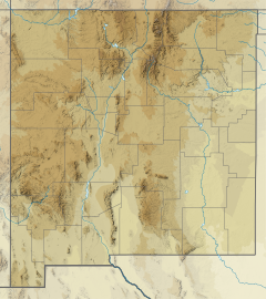
[edit]Pueblo Peak is part of the Taos Mountains which are a subset of the Sangre de Cristo Mountains, and it ranks as the 27th-highest summit in New Mexico.[1] The mountain is located nine miles (14 km) northeast of the city of Taos and six miles southwest of Wheeler Peak, the highest point in the state. Precipitation runoff from the mountain drains into tributaries of the Rio Grande, which is approximately 13 miles (21 km) to the west. Topographic relief is significant as the summit rises over 3,300 feet (1,006 meters) above Lucero Canyon in 1.45 mile (2.33 km). The mountain is especially sacred to the people of Taos Pueblo,[6] and it is named after their pueblo.[7] However, they call the mountain "Maxwaluna" which means "The High One."[8] This mountain's toponym has been officially adopted by the United States Board on Geographic Names.[3]
Climate
[edit]According to the Köppen climate classification system, Pueblo Peak has an alpine climate with cold, snowy winters, and cool to warm summers.[9] Due to its altitude, it receives precipitation all year, as snow in winter and as thunderstorms in summer. Climbers can expect afternoon rain, hail, and lightning from the seasonal monsoon in late July and August.
See also
[edit]References
[edit]- ^ a b c d e "Pueblo Peak - 12,303' NM". listsofjohn.com. Retrieved December 6, 2024.
- ^ "Pueblo Peak, Peakvisor.com". Retrieved December 6, 2024.
- ^ a b "Pueblo Peak". Geographic Names Information System. United States Geological Survey, United States Department of the Interior. Retrieved December 6, 2024.
- ^ a b "Pueblo Peak, New Mexico". Peakbagger.com. Retrieved December 6, 2024.
- ^ a b Geologic map and legend of the Taos Plateau, USGS, 2004, Retrieved 2024-12-06.
- ^ John Peabody Harrington, The Ethnogeography of the Tewa Indians, 1916, Smithsonian Institution Bureau of American Ethnology, p. 178.
- ^ Robert Julyan (1996), The Place Names of New Mexico, University of New Mexico Press, ISBN 9780826351142, p. 277.
- ^ Studying the Mission Indians of California and the Taos of New Mexico, J.P. Harrington, 1929, Explorations and Field-work of the Smithsonian Institution in 1928, Smithsonian Institution, p. 178.
- ^ Peel, M. C.; Finlayson, B. L.; McMahon, T. A. (2007). "Updated world map of the Köppen−Geiger climate classification". Hydrol. Earth Syst. Sci. 11 (5): 1633. Bibcode:2007HESS...11.1633P. doi:10.5194/hess-11-1633-2007. ISSN 1027-5606.
External links
[edit]- Pueblo Peak: weather forecast


