Posidonia Shale
| Sachrang Formation | |
|---|---|
| Stratigraphic range: Early-Late Toarcian[1][2] ~ Possible Latest Pliensbachian records[3] | |
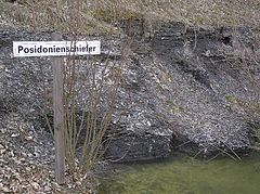 Posidonia Shale (Posidonienschiefer) Outcrop | |
| Type | Geological formation |
| Unit of |
|
| Sub-units |
|
| Underlies | Jurensismergel Formation (Germany) Werkendam Formation (Netherlands) Klaus Formation (Austria) Marnes à Bifrons Formation (Luxembourg) |
| Overlies | Amaltheenton Formation (Germany) Aalburg Formation (Netherlands) Scheibelberg Formation (Austria) |
| Lithology | |
| Primary | Black shale |
| Other | Lime mudstone, nodular claystone |
| Location | |
| Region | Western & Central Europe |
| Country | |
| Extent |
|
| Type section | |
| Named for | The village of Sachrang, Bavaria |
| Named by | Jacobshagen |
| Location | Border with Tyrol above Sachrang |
| Year defined | 1965 |
| Coordinates | 47°41′N 12°14′E / 47.69°N 12.24°E[4] |
Holzmaden, location of the main Outcrop | |
The Posidonia Shale (German: Posidonienschiefer, also called Schistes Bitumineux in Luxembourg) geologically known as the Sachrang Formation, is an Early Jurassic (Early to Late Toarcian) geological formation in Germany, northern Switzerland, northwestern Austria, southern Luxembourg and the Netherlands, including exceptionally well-preserved complete skeletons of fossil marine fish and reptiles.[5][6][7]
The Posidonienschiefer, the German translation, takes its name from the ubiquitous fossils of the oyster-related bivalve "Posidonia bronni" (synonym of Bositra buchii and Steinmannia bronni) that characterize the mollusk faunal component of the formation. The name Posidonia Shale has been used for more than a century, until revisions in 2016 proposed the Sachrang Formation as new name for the Germanic unit, in a same way Altmühltal Formation is the official name of the Solnhofen Limestone.[8] The Posidonia Shales where stablished as a valid vulgar name for this regions lower Toarcian Black Shales. The name Posidonienschiefer, while valid, represents another vulgar nomination, as Posidonia is an invalid genus and junior synonym of Bositra.[8] The type profile is still located on Dotternhausen.[8]
The formation comprises finely laminated layers of oil shales formed of fine-grained sediments intercalated with bituminous limestones and crops out in a number of locations in southwestern Germany, although most remains are from near the village of Holzmaden and Dotternhausen.[7] The European oil shales deposited on a sea floor during the Early Toarcian in the ancient Tethys Ocean are described as being deposited in an anoxic, or oxygen-depleted, deep water environment, although the details of the depositional environment are the subject of debate by researchers of the formation.[7][9]
Geology
[edit]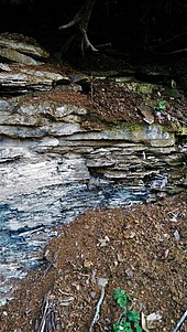
The Posidonia Shale was originally referred to as the Schwarzjura lias was first recovered from the Franconian Jura, that borders to the northeast on the Obermainisches Hügelland and the Oberpfälzisch-Obermainisches Hügelland, tectonically part of the Faulkschollenland. The Franconian Jura rocks recovered are west of the Saxothuringian basement bordering the Franconian Line. It is recovered laterally extensive within Germany belonging to the early Toarcian Central European Epicontinental Basin, that evolved gradually from low tophography tidal flat to floodpains to a shallow shelf sea with intermittent N connection with the Viking Corridor and the Proto-Atlantic Ocean and with the Tethys Ocean towards the S, that filled with seawater the area, subdivided in several subasins with heterogeneous conditions and biotas, from the Netherlands to the Tirol Area.[10] The CEB stablished a relatively shallow transcontinental seaway between the Tethyan and Boreal Arctic Sea biota, thus mixing cold and hot waters.[11][12] In the Mesozoic was marked by the breakup of Pangea during the Late Triassic, what led to the appearance of the early Atlantic connecting with the Boreal waters of the Panthalassa Ocean, and several marine to continental subasins locally.[10] The CEB was part of the Laurasian continental-marine shelf that, resting over the Keuper, slowly openened towards the southeast into the deeper Tethys Ocean. With the flooding in the Early Jurassic by marine waters, several islands, submarine sills, and deeper subbasins developed, what contributed and controlled the evolution of the paleocurrents.[10]
Towards the W is determined by the north–south Kilberg Fault of the Keilberg Rift, the main fault in the Regensburg Basin.[13] Developed by the sinking of the southern German Jura Plateau during the Miocene, it separates the higher, older crystallization of the Moldanubian Basement from the Lower Jurassic chalk complex of the eastern Franconian Jura.[14] During the late Pliensbachian, the zone became a relatively narrow, flat deposit area which flooded during the early Toarcian and reemerged during the Bifrons substage with a changing coastline, thanks to rhythmic uplifts and subsidence of older Paleozoic and Triassic siliciclastic deposits from the east.[14] The granites and gneisses resulting from crystallization were eroded from the Paleozoic exposures on the east, and were deposited on the Jurassic prograded alluvial nearshore sandstone that evolved gradually into the Bajocian layers.[14] The slopes of the area are partially covered by till, soliflucted rubble and loess from the Würm glaciation.[14]
Stratigraphy
[edit]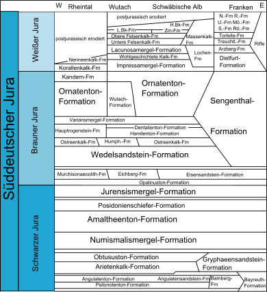
The bituminous facies overlie the Pliensbachian, and are mostly clay marl to marl shales with an organic carbon content of over 2%, with some levels referred as “bitumen-free” or “bitumen-poor”.[15] The lowermost sequence is known as Seegrasschiefer (seagrass slate), appearing just above the limit, being actively burrowed horizons, approximately 15-20 cm thick with clay marl stone appear in the darker, brownish to gray, bituminous clay marl/marl slate.[16] This initial horizons have abundant foraminifera and ostracods as the medium to light gray color without a brown tint.[16] The Formation evolves from bottom to top: blue-gray marls of the uppermost Pliensbachian spinatum zone, being medium gray, pyrite-rich clay marl stones that are still part of the Amaltheenton Formation, which gradually wedge out to the east in the area of Aalen-Wasseralfingen. Towards the middle they start to include thin disturbed bituminous horizons found throughout southwest Germany. Gradually, the bioturbation of the seegrasschiefer merges into the subsequent ash-gray marls without a sharp facies boundary.[15] The Aschgrauen Mergel (ash-gray marl) mark the start of the Posidonia Shale made by dark gray marl, abundant in pyrite with bituminous marl slate intrusions. This horizon, marks a sea transgression, as it extends from Asselfingen/Wutach to Aalen-Reichenbach and then wedges out to the east from Aalen-Wasseralfingen. This initial sequence is overlied by extremely thin (2-5 cm), unnamed bituminous, seegrasschiefer clay marl, followed then by a darker layers with the same lithology.[15] The next are the called "Koblenzer-Hainzen" clay successions of upper the semicelatum subzone, initially poorly layered and more or less bituminous with abundance of Steirmannia radiata and Dactylioceras semieelatum. This section is marked by pyritized lagerstatten fossils, limited to certain areas (Dotternhausen, Holzmaden), and with now well-layered black-brown in color.[16] The Unteren Schiefern layers (Exaratum) appear next marked by the highest bitumen content and characterized by very fine light/dark stratification, abundance of pyrite, fine-grained weathering and the largely absence of bioturbation derived from anoxic conditions while the accumulation of exceptional preserved fossils indicate very weak water movement.[16] The next, Untere Stein, is the most important level of the formation, specially in southwest Germany, southern France and Alsace-Lorraine. It appears across the area either as a concretionary "laibstein" horizon (Aalen region) or as a uniformly layered limestone bank (Wutach area), with Leptolepis coryphaenoides as the character fossil of this limestone bank.[16]
The Mittleren Schiefer/Schieferklotz (upper exaratum to lower elegans subzones) become increasingly poorly layered until it becomes a small brittle limestone bank, the "Stinkkalkbank" (Dotternhausen to Gomaringen and Nürtingen) with Coelodiscus shells, low on bitumen and with biota that marks better oxygenated conditions, such as foraminifera and occasional ostracods.[15] The Obere and Wilder Stein (upper elegans) medium to brown-gray always remain formed as a regular limestone bank of approximately uniform thicknessis, rarely laminated (Dotternhausen) and often shows traces of minor bioturbation (Dotternhausen, Mössingen, Gomaringen; Aalen-Wasseralfingen), becoming calcified towards the upper limit between Nürtingen and Holzmaden, marked with increased presence of Cucullaea muensteri as well foraminifera and ostracods, as well scoria horizons with fish, cephalopod and larger vertebrate remains, as well often contain belemnite rostrums.[15] The last level of the formation is the Wilden Schiefer (probably reaching Bifrons zone) with the presence of "Monotis bank", from Altdorf to Dotternhausen and Göppingen area, with slates getting poorer in bitumen and less layered. The top section is known as "bollensis camp", marked by the mass deposition of Bositra buchi, closed at the top by a new seegrasschiefer. The limit with the Jurensismergel Formation is mostly eroded in the profiles to evolve into marlstones.[15] Several outcrops, mostly in the NW (ex. Harz hills), shows that relict levels of the Posidonienschiefer lasted until the Upper Toarcian, contemporaneous with the Jurensismergel Fm, known as "Dörntener Schiefer".[2]
Sachrang
[edit]The Sachrang Shales where cited originally on the restudy of the Alpine Upper Black Slate, composed with dark gray, somewhat sandy, disintegrating into thin but large plates of Marl that overlies Pliensbachian breccia. The definition of the Sachrang Shales has been convoluted along its history of study of the location, where there are works of the North Alpine Mesozoic that prefer before calling these deposits Sachranger Shale to give it a brief different diagnosis.[17] On the Unken Syncline near Lofen, basinal deposits with abundant Aragonite and Calcite helped to know the major Jurassic basin geometry, where on several layers of the same age was complicated due to the posterior Alpine deformation.[18] Correlated Unken and Diessbach basins developed mostly during the Toarcian, with deposition of abundant material from the near Emerged Landmasses.[18] On the Unken Syncline, the breccias associated with the normal faults were deposited until Oxfordian age.[18]
Lithology
[edit]The black shales are the main part of the strata present, with a major composition of bacterial origin. The shale is made represent blackish gray to dark brown bituminous, fine-leaved, somewhat sandy marl slate, that lies on the profile of the strata, alternated with storage light brown (max. 4 mm) and darker layers (rarely over 2 mm) characteristic.[17] The lighter layers present in the rock get darker while it keeps its fine-plate character.[17] The Shale has a Dark-Gray to brownish tone, alternated with more rarely light gray shades.[19] There is a relatively common presence of blue fittings, as well as Wood and Fish remains (Bones, scales).[17] The younger strata with the fresh outcrops develops on a series of several meters thick wall, that splits into fine paper Slates when weathered.[17] The Slate is among the most common mineral on the strata, with an average lime content of 40.2%, where maximum values are at 58% and minimum values at 26%.[17] Bituminous Claystones are present in the Edge facies of the Sachrang Shale (="Unken Shales"), with green Clay march engagements.[17] There is not clear separation between "Manganese Shale" and "Bituminous shale" in the main localities of the formation, because the Bituminous content fluctuates with the manganese contents, that is always high. The Unken Shales on the Bächental locality is layered on a major Silicate component of the 60% with a pronounced dominance of Illite, along with a significant amount of Montmorillonite.[19] The presence of Quartz and Calcite is relative with other locations of the same region from also the Toarcian, while the Pyrite content is also consistently high. Finally, the Unken Shale samples also show minor levels of Dolomite and Feldspar.[17] There is a great abundance of Foraminiferans and Coccoliths.[20] Dinoflagellates are the major organic component and the most abundant microfossils.[21] Manganese is present, such as in the Toarcian deposits of Hungary. Those are completed by the marl levels, composed by lithoclasts. quartz and smectite are the main minerals, along with illite, chlorite, and plagioclase in minor amounts. Bächental bituminous marls consist mainly of quartz and carbonate minerals.[22] Isorenieratene derivatives are highly abundant on this level, related to several processes such as sedimentary iron, influenced by anoxic conditions.[23] Rhodochrosite and manganese rich calcite are present in the manganese levels, while the Black Shale levels are rich in Pirite.[21] The lower matrix is composed by clay and carbonate minerals, such as muscovite and feldspar. The presence of altered Celadonite, suggest volcanogenic solutions as the most probable source, where the high amounts of dissolved manganese of continental origin was translated to the epicontinental margins of the Tethys.[22] On the Bächental bituminous marls had a bulk mineralogy where the Calcite is the most abundant fraction (49%), followed by Phyllosilicates (35%), Quartz (11%) and Pyrite (5%). While the Clay mineral distribution includes a large amount of Illite (51%), Montmorillonite (40%) and Kaolinite (9%).[17]
Dating
[edit]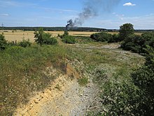
According to sedimentologic and palynologic features, a tidally influenced transgressive development within the Lower Toarcian is inferred with increased continental matter being moved to marine areas causing anoxic conditions, with the Posidonia Shale being the reference formation for this interval. The Posidonia Shale of Dotternhausen and Schesslitz is well dated on the basis of ammonite and microfossil biostratigraphy. The Lower Toarcian sections are subdivided into three ammonite biozones (Dactyloceras tenuicostatum, Harpoceras falciferum, and Hildoceras bifrons) and several subzones.[12] On the other hand, Black shale formation in the Toarcian of NW Germany is associated with a major turnover in phytoplankton assemblages interpreted as the response to lowered salinities in surface waters of the epicontinental sea. The presence of the Turnover is essential for the datation and the preservation of the fauna of the formation, with detailed index ammonites preserved.[24] The study of the different layers and strata of the Posidonia Shale has given different data about the chronology of the formation. Dormettingen shales have been calculated biochronologically and with isochron data, giving an approximate age of 183-181 million years, being close to the Pliensbachian boundary based on the recent revisions of the Early Jurassic Subperiods.[25] The Toarcian and the Pliensbachian are considered as strongly constrained in terms of chronology, where the deposition has been estimated to have lasted 3.2 Myr in the South Germany Basin with the uppermost sequences estimated to be Bifrons in age.[1] The Posidonienschiefer lasts until the Late Toarcian (Variabilis Biozone) in the NW German Basin with the "Dörntener Schiefer", while it mostly disappears in the SW, substituted by the Jurensismergel Fm, with few deposits where it lasts (Wutach area, Nürtingen).[2]
History
[edit]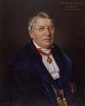
The Posidonia Shale has been a focus of scientific interest for the last 100 years. The first fossils were recorded in 1598 by the medical doctor Johannes Bauhin, who interpreted the local ammonites as "metallic things" in rocks and as "miraculous tricks" of nature, while the crinoids where interpreted as either huge flowers or heads of medusa, and evidencie of the biblical flood.[26] Many people did important geological and paleontological research on the Swabian Posidonia Shale, including Carl Hartwig von Zieten (1785–1846), Eberhard Fraas (1862–1915), Bernhard Hauff senior (1866–1950) and Adolf Seilacher (1925–2014).[26]
The first geological studies were carried out, motivated by the extraction of shales in the southern quarries. Several fossils were reported, studied and named at the time from locations such as Banz Abbey, Ohmden, Holzmaden or Dotternhausen, including Macrospondylus in 1824 (As Steneosaurus, being originally identified as a Gharial), the pterosaur Dorygnathus (as a species of Pterodactylus) in 1830, the fish Lepidotes, the selachian Hybodus or the crinoid Pentacrinites.[27] The first insight on the flora was done in 1845, with partial leaf fragments.[28] Boué in 1829 did a study of the general geology of the Jurassic along Germany, recovering limestone and shale facies, with a superficial assignation of what he considered most of the main Jurassic Strata, without classifying the layers on a concrete subperiod.[29] Further geological work was then carried out, recovering examples of marine facies representing various biomes, all associated with black shale deposits in other areas, as towards the NW or at Regensburg.[15] The main work that described the facies formally was Quenstedt´s 1843 one, classifying the levels based on the amount of bitumen, providing a preliminary stratigraphy and lithology, which would be the basis for most subsequent works.[15]
In the 1900, major paleontological addons included the description of Stenopterygius in 1904 (as Ichthyosaurus).[30] While in 1921, the 1st major fossil inventory was done by Hauff, reporting exquisite specimens, most of them from Holzmaden and some of them nearly complete, including Ammonites, Fish and Marine reptiles, such as Plesiosaurs and Icthyosaurs.[31] Hauff described in 1938 "Acidorhynchus" (Saurorhynchus), the latest surviving of the Saurichthyiformes.[32] In 1953, an impressive Insect fauna was revised in the Northern outcrops.[33] On 1978, Wild described the First and only know Dinosaur Fossil from the formation, what he named Ohmdenosaurus, a small sized Sauropod.[34] Latter works revisited the excepcional preservation of the biota, specially the presence od soft parts.[35] The lithology and sedimentology of the formation was revisited, with several suggestions such as stagnant basin models and restricted open marine ones, all suggested to be deposited on a shallow epicontinental sea.[31] The abundance of organic matter and the composition of the shales, chemically or lithologically, went under diverse renoved works.[36][37] With the addition of multiple new references, the expansion of information thanks to the revision of profiles, boreholes and other outcrops, new works on the characteristics of the deposition, the type of environment and the conditions that led to the exquisite preservation were produced, where paleocurrents where found to be nfluenced from the North and the South of the Central European Basin.[38] The Black shale deposition was found to be related with changues in the oxygen levels.[39] Thanks to the renewed information, a new cycle of publications reviewing the microfacies took place between 1980-1990.[40] The most important works of the XX century where done by Riegraf in 1985-86, being a complete review of all aspects of this formation, updating multiple points based on all the information compiled throughout the century: lithology, stratigraphy, biota list and ammonite biozonation, followed by a focused work on a complete mapping of the microfacies composition and extent of the shale deposits.[41]
In the 2000´s the Posidonienschiefer has seen a series of works, focused on enriching the information previously worked on in depth, revising and updating the deposition models.[12] Likewise, the biota has received multiple updates, with the reclassification of some taxa and the discovery of new ones, as well a revision of the biotic interactions.[42]
Paleogeography and paleoenvironment
[edit]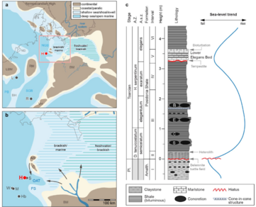
The Posidonia Shale was located in the SW and NW Germanic basins, as part of a shallow epicontinental sea, surrounded and influenced by various highs and emerged lands that provided most of the terrestrial matter found along the Formation. The main outcrops of the formation are disposed along the modern southern Germany, recovering the locations of Holzmaden, Ohmden, as well at Niedersachsen, and others appearing along the east, such as the related to the Banz Abbey strata or Regensburg.[41] The deposition of the shales where delimited to several minibasins, including the Southwest German Basin, a hemipelagic deposit, with the influence of open sea currents from the North and the South, with an estimated water depth of 2-100 m, with few deeper shelf environments.[12][43] Connected to the SW German basin where the Paris Basin, that recovered central France, with correlated sedimentation to the Shale deposition on Germany, also sharing a epicontinental sea, bordered by carbonate facies, specially towards the south.[44] At the North, the Wenzen Well report little deeper basinal settings, heavily influenced by continental matter coming from the main continental land present anywhere nearby the formation, Fennoscandia.[45] In this area, the main emerged units present was the Rhenish High at the west, being a small land of the size of Sicily, and on the east, the N Bohemian Massif.[46] The Bohemian massif with the Southern Vindelician High represent the major emerged units present on the Central European basin on the Toarcian.[45] The Vindelician Land/High has been represented as a peninsula to the Bohemian Massif, or an isolated landmass, that is due to its connections that had not been recovered in depth, being considered a mostly plain emerged sedimentary structure.[45] Finally, the southernmost part of the Formation, the SWGB was separated from the Tethys Ocean by a series of islands related with the Bern High (Allemanic Swell), forming the continuation of the Vindelician High being a small terrestrial setting with similar size to modern Sardinia, with nearby sections like the Salem paleo-swell.[47][48]
The Germanic Epicontinental sea is considered to be an analogue, as compares well to the sedimentation rate in deep-water settings, of the Black Sea.[49] Most of the outcrops (Holzmaden, Dotternhausen, Ohmden or Dormettingen) represent low-energy depositional environments, far from deltaic sediment sources.[12] The Toarcian epicontinental seas of Europe where driven by several global events and changes present on the surface, like the coeval Karoo-Ferrar eruptions in the Southern Hemisphere, what created an enhanced hydrological cycle & oxygen depletion, allowing exceptional preservation. This stage was marked with the presence of a general deposition of shale mudrock along with strong variations on the associated organic matter, associated with extincions such as the Toarcian Oceanic Anoxic Event.[50] The black shales characteristic of this unit reveal a shallow marine environment, influenced by arctic and Tethyan waters, with marked episodes of disappearance of benthic biota. Also measure a change in carbon-isotope excursion in marine and terrestrial life, and was probably a perturbator of the carbon cycle.[51] Global seawater has been proved to be approximately, for the interval of the negative carbon-isotope excursion, close to 1.45‰, less than modern values, with estimated 2.34‰. Waters interchange were one of the major effects on the palatine de-oxygenation showed on most of the Lower Toarcian Layers around the word, with the connection with the Viking Corridor as one of the main effects, due to the arctic waters freshening and breaking the oceanic circulation.[52] The effect was consequently negative on the German realm, where the environments expose a tropical fluctuation, with conditions similar to the modern Caribbean Sea, which hosted a high variety of sea fauna, except on the bottom layers, where only a few genera were able to survive until oxygen conditions got slightly better.[53] The changes on the benthic oxygen where common, with most of the animals dying without being scavenged by bottom-dweller organisms, and sessile life, with this biota limited to "benthic islands" associated with ammonite shells or vertebrate carcasses (Except some Polychaetans on higher oxygen conditions).[50][42] Towards the middle Toarcian show changes on the environment reflect more oxygenated waters and different depositional settings with the presence of trace fossils such as Chondrites and Phymatoderma granulata, surfacing deposit-feeding animals, being adapted for effective nutrient searching, becoming more common on the uppermost layers, yet in some areas, the shale remained until the Late Toarcian.[54] The uppermost layers are marked by regressive sea levels, as it is shown on layers across Bavaria where major events set the fate of the nearshore environments.[55] One example is the case of the Monotis–Dactylioceras beds, that had an extent of +500 km, that has been linked with a possible Tsunami. There is not major indicative of synsedimentary faulting in South Germany, but is present on the western Tethyan Shelf, with breccias created from earthquakes, present on Toarcian levels of the Austrian Adnet Formation. It would start as an initial wave propagation affecting the Altdorf High aiming for the south, where it would have hitten the shoreline of the Bohemian Island.[55]
The main terrestrial environments of the Posidonia Shale are the near emerged lands where the Black Forest High/Swell (known thanks to strata containing fine sand in the tenuicostatum Zone, ‘Glaukonit und viel Feinsand’, at Obereggenen im Breisgau), located at 70 km at the west and the Ries Swell, W of Regensburg, then far towards the W the Vosges Massif is also suggested to be present (known by the abundant detrital quartz from the EST433 borehole located near Bure, Meuse).[12][56] The Environments of this highs are assumed to have been trought phases os aridity and humidy markedby the Toarcian Oceanic Anoxic Event on the basis of Palynology.[57] In the east the SW German sub-basin was bounded by the Bohemian-Hercynian landmass (Modern Bohemian Massif), with the Vindelician peninsula at the S-SW, reaching the west area of Augsburg. Between the Hettangian-Toarcian, this threshold was perhaps temporarily connected via a land bridge with an island in the area of the Aarmassif.[58] The Bohemian Massif was located in a relatively warm, precipitation-rich climate with Bavarian shallow areas receiving freshwater inflows from the east, which temporarily lowered the salinity of the seawater in the whole basin or in parts.[47] The margins of the SWGB as well as the hinterland relief had very gentle topography, and therefore fine-grained siliciclastic sediments where easily transported and deposited in the nearshore area of the basin, as well long transported driftwood, and the lack of insects or terrestrial vertebrates.[47][59] In the south-eastern North-German Basin at Hondelange and Schandelah, the Posidonienschiefer was deposited in the "Oberaller Through", a local depression bordered by the emerged "Calvörde Island" and the submerged Altmark Swell to the N, while the shallow submerged Fallstein Swell closed it at the south, and more towards the E the Bohemian Massif hosted a large delta that discharged towards Oberaller.[60]
In Microfacies, after the Pliensbachian-Toarcian locally is observed a significant decrease in the Crinoid skeleton elements, also that of the Ophiurida; the Echinoids take their place, where really blossomed at that time, while Pedicellaria are observed very often.[41] On the bituminous marls there is a great abundance of saturated Hydrocarbons in the hexanesoluble fraction, Methyl and Methylene where found along long-chain paraffinic molecules (n-alkanes).[19] Benzenemethanol resins are especially strong for the Benzene-Methanol fraction.[61] The main maceral found is Lamalginite, which may derive from thin-walled planktonic and benthic organisms, including Green Algae, Cyanobacteria, and Bacterial mats. There is a clear low frequency of Vitrinite and Inertinite, what suggests that terrestrial inputs of organic matter to be of less importance, although, the main part of OM contained in the basal mudstone, including charred material, was derived from terrestrial sources. This Mudstone contains charred organic material typically connected to Wildfires along with large amounts of expandable Smectite possibly derived from alteration of volcanic ash, what indicated a clear contribution of volcanic-derived detritus during deposition.[59] In the Austrian area, the volcanic materials where probably also sourced by the rift history of the Valais, Briançonnais and Piemonte-Liguria domains (Sinemurian-Callovian), and the Toarcian break-up of the Ligurian-Penninic oceanic realm.[62] There is measurements of reduction of the local salinity on the water where elevated inputs of freshwater due to an accelerated hydrological cycle resulted in a surface-water layer.[59]
Dactyliocerassandstein
[edit]Occurs only in the south-east of the northern Bavarian Jura region, as appears on places like Bruck in der Oberpfalz, the north-east of the Banz Abbey, Wittelshofen, Regensburg and Bodenwöhr, composed mostly by coarse grained sediments, clusters of clay sandstone and sand-lime stone facies (shale, slightly bituminous in layers, and sandstone, older lias sand, sand marl, marl, oolithic limestone and sand-lime banks). This series are coeval with the Posidonienschiefer, marked with more thin outcrops such as the "crassumbank" (Coeloceras cf. crassum, latter found to be C. raquinianum, thus Variabilis in age) at Bodenwöhr, or the Dactylioceras sandstones at Irlbach (NE Regensburg).[13][63] These levels lack bituminous facies or are interspersed with them in profiles as one moves westward, indicating that they probably belonged to more coastal sectors with better oxygenated waters, with the full transition from shale to sandstone in Regensburg, Bruck and Naab areas considered as caused by a major regression of the sea level, marked at Irlbach by white-yellow levels indicating karst funnels or Cenote-like depostion.[63][64]
Economical value
[edit]
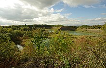
The posidonia slate has been mined in the Holzmaden area for centuries to make wall, table and window panels. Other uses of the shale included be made into fireplace stones in Gomaringen-Mössingen until was replaced by Eifel pumice stone. At Dotternhausen, the ROHRBACH Zement company uses oil shale in the production of binders, mining in the 80´s up to 1,600 t. Shale oil, specially after World War II, when where burned on coal ovens was temporally obtained from the bituminous slate through smoldering and distillation by oil works near Reutlingen; Frommem or Holzheim near Göppingen, yet this turned out to have low profitability and the fact they produced a lot of slag and sulfur-containing exhaust gases, production lasted not long.[41]
Recent studies have shown that the petroleum generation potential of the PS is high in all studied regions due to the high TOC and Hydrogen Index. However, differences exist which can be expressed by SPI values.[65] The latter are highest for northern Germany, where the PS is richest in TOC and has the highest HI values combined with a thickness of 30 to 40 m at most places.[66] Since the first serious evaluations in the 2000s, different organic samples were extracted to revise the changes and potential presence of the Shale Oil on the main quarries of the southern realm. Based on several core samples with abundant organic material (Dinoflagellate cysts and other microorganism fragments, such as microscopic algae) different thermal maturity has been found, especially on the samples from the Hils Syncline strata. The maturation of this strata has implied losing organic carbon and loss of hydrogen index values. Beyond that, the status of the samples has been stable during at least 40 measured years.[67]
Paleontological significance
[edit]In addition to their Posidonia bronni, the shales contain some spectacularly detailed fossils of other Jurassic sea creatures—ichthyosaurs and plesiosaurs, spiral-shelled ammonites and crinoids, or sea-lilies.[41] The best-preserved fossils found on the Early Jurassic can be the ones from the Posidonia Shale. There are also abundant fish fossils (including genera such as Pachycormus, Ohmdenia, Strongylosteus and chondrichthyes like Hybodus or Palaeospinax). Most of the fauna is marine, with several terrestrial specimens, and some of them being semiaquatic, such as the sphenodont Palaeopleurosaurus or fully terrestrial like the dinosaur Ohmdenosaurus and several insects.[41]
Flora has been found, especially the genus Xenoxylon, but also macrofloral remains Otozamites, Equisetites and Pagiophyllum and palynomorphs, dominated by Classopollis.[68][57]
Urweltmuseum Hauff
[edit]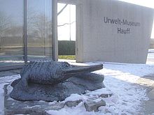
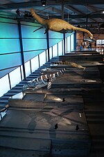
The Main Museum with the taxa Found on the Posidonia Shale, the Hauff Museum recovers the best specimens found in the last 150 years, and it is situated on Ohmden.[69] With different expositions, the museum has several spaces for the marine fauna, where it is exposed, including a disposed strata with the layer showing the provenance of every taxon and its fossil. The Museum has been open since 1937-38, and was founded by Bernhard Hauff, using his private collection of fossils as a base, as an opposite to Alwin Hauff who wanted to use the layers for industrial production.[69] The Museum was reformed on between the years 1967 and 1971. In the year 2000, an external park with Dinosaur models was added.[69] The museum has several halls with different kinds of fauna found on the layers of the formation, where the vertebrate specimens are exposed on the main parts, including on those Icthyosaur remains and several fishes. The Museum has the world's largest colony of sea lilies, measuring an approximate size of 100 square metres. Rolf Bernhard Hauff is the actual director of the museum.[70]
See Also
[edit]- Blue Lias, England
- Charmouth Mudstone Formation, England
- Jurensismergel Formation, Germany
- Sorthat Formation, Denmark
- Hasle Formation, Denmark
- Zagaje Formation, Poland
- Drzewica Formation, Poland
- Ciechocinek Formation, Poland
- Borucice Formation, Poland
- Rotzo Formation, Italy
- Saltrio Formation, Italy
- Moltrasio Formation, Italy
- Marne di Monte Serrone, Italy
- Calcare di Sogno, Italy
- Podpeč Limestone, Slovenia
- Coimbra Formation, Portugal
- El Pedregal Formation, Spain
- Fernie Formation, Canada
- Whiteaves Formation, British Columbia
- Navajo Sandstone, Utah
- Ziliujing Formation, China
- Yanan Formation, China
- Aganane Formation, Morocco
- Tafraout Group, Morocco
- Azilal Formation, Morocco
- Budoš Limestone, Montenegro
- Kota Formation, India
- Cañadón Asfalto Formation, Argentina
- Los Molles Formation, Argentina
- Kandreho Formation, Madagascar
- Elliot Formation, South Africa
- Clarens Formation, South Africa
- Evergreen Formation, Australia
- Cattamarra Coal Measures, Australia
- Hanson Formation, Antarctica
- Mawson Formation, Antarctica
References
[edit]- ^ a b Ruebsam, W.; Schmid-Röhl, A.; Al-Husseini, M. (2023). "Astronomical timescale for the early Toarcian (Early Jurassic) Posidonia Shale and global environmental changes". Palaeogeography, Palaeoclimatology, Palaeoecology. 623: 111619. Bibcode:2023PPP...62311619R. doi:10.1016/j.palaeo.2023.111619. S2CID 258545235. Retrieved 10 July 2023.
- ^ a b c Burnaz, L.; Littke, R.; Grohmann, S. (2024). "Lower Jurassic (Pliensbachian–Toarcian) marine paleoenvironment in Western Europe: sedimentology, geochemistry and organic petrology of the wells Mainzholzen and Wickensen, Hils Syncline, Lower Saxony Basin". Int J Earth Sci. 113 (1): 1999–2022. doi:10.1007/s00531-023-02381-8.
- ^ Neumeister, S.; Gratzer, R.; Algeo, T. J.; Bechtel, A.; Gawlick, H. J.; Newton, R. J.; Sachsenhofer, R. F. (2015). "Oceanic response to Pliensbachian and Toarcian magmatic events: Implications from an organic-rich basinal succession in the NW Tethys". Global and Planetary Change. 126: 62–83. Bibcode:2015GPC...126...62N. doi:10.1016/j.gloplacha.2015.01.007. Retrieved 12 December 2023.
- ^ "Typlokalität der Sachrang-Formation W von Sachrang" (PDF). Retrieved 31 January 2024.
- ^ Etter, Walter; Kuhn, Olivier (2000). "An Articulated Dragonfly (Insecta, Odonata) From The Upper Liassic Posidonia Shale Of Northern Switzerland". Palaeontology. 43 (5): 967–977. Bibcode:2000Palgy..43..967E. doi:10.1111/1475-4983.00157. ISSN 0031-0239. S2CID 140165815.
- ^ Henrotay, M.; Marques, D.; Paicheler, J. C.; Gall, J. C.; Nel, A. (1998). "Le Toarcien inférieur des régions de Bascharage et de Bettembourg (grand-duché du Luxembourg) : évidences paléontologiques et sédimentologiques d'environnements restreints proches de l'émersion" (PDF). Geodiversitas. 20 (2): 263–284.
- ^ a b c Clements, Thomas; Gabbott, Sarah (2022-04-13). "Exceptional Preservation of Fossil Soft Tissues". eLS: 1–10. doi:10.1002/9780470015902.a0029468. ISBN 9780470016176.
- ^ a b c Mönnig, Eckhard (2018). "Der Jura in der Stratigraphischen Tabelle von Deutschland (STD 2016)" (PDF). Newsletters on Stratigraphy. 41 (1–3): 253–261. doi:10.1127/0078-0421/2005/0041-0253. ISSN 0078-0421.
- ^ Brenner, K. (1978). "New aspects about the origin of the Toarcian Posidonia Shales". Neues Jahrbuch für Geologie und Paläontologie - Abhandlungen. 157 (3): 11–18. doi:10.1127/njgpa/157/1978/11.
- ^ a b c Ziegler, P.A. (1982). "Geological Atlas of Western and Central Europe". Amsterdam, Shell International Petroleum Maatschappij. 22 (2): 145–146.
- ^ Bjerrum, Christian J.; Surlyk, Finn; Callomon, John H.; Slingerland, Rudy L. (2001). "Numerical paleoceanographic study of the Early Jurassic Transcontinental Laurasian Seaway". Paleoceanography. 16 (4): 390–404. Bibcode:2001PalOc..16..390B. doi:10.1029/2000pa000512. ISSN 0883-8305. S2CID 128465643.
- ^ a b c d e f RÖHL, H.-J.; SCHMID-RÖHL, A. (2005), "Lower Toarcian (Upper Liassic) Black Shales of the Central European Epicontinental Basin: A Sequence Stratigraphic Case Study from the Sw German Posidonia Shale", Deposition of Organic-Carbon-Rich Sediments: Models, SEPM (Society for Sedimentary Geology), pp. 165–189, doi:10.2110/pec.05.82.0165, ISBN 1-56576-110-3, retrieved 2023-12-12
- ^ a b FREUDENBERGER, WALTER; CHWERD, KLAUSS (1996). "Erläuterungen zur Geologischen Karte von Bayern 1:500000". Geol. Kt. Bayern 1:500000. 329: 1–368. Retrieved 12 December 2023.
- ^ a b c d Brunotte, Ernst; Garleff, Karsten; Jordan, Heinz (1985-12-01). "A Geomorphological Map to Accompany Sheet 4325 (Nörten-Hardenberg) of the 1 : 25 000 Geological Map of Lower Saxony". Zeitschrift der Deutschen Geologischen Gesellschaft. 136 (1): 277–285. doi:10.1127/zdgg/136/1985/277. ISSN 0012-0189.
- ^ a b c d e f g h Quenstedt, Fr. Aug. von (1843). Das Flözgebirge Würtembergs : mit besonderer Rücksicht auf den Jura / von Fr. Aug. Quenstedt. Tübingen: H. Laupp'schen. doi:10.5962/bhl.title.45496.
- ^ a b c d e Hauff, Rolf B. (1921). "Untersuchung der Fossilfundstätten von Holzmaden im Posidonienschiefer des Oberen Lias Württembergs". Palaeontographica. 58 (1–42): 255–263.
- ^ a b c d e f g h i GLAESSNER, M (1977). "Analyse des klassischen nordalpinen Mesozoikums. Stratigraphie, fauna und fazies der no¨rdlichen kalkalpen". Earth-Science Reviews. 13 (2): 192–194. Bibcode:1977ESRv...13..192G. doi:10.1016/0012-8252(77)90023-x. ISSN 0012-8252.
- ^ a b c Channell, J. E. T.; Brandner, R.; Spieler, A.; Stoner, J. S. (1992). "Paleomagnetism and paleogeography of the northern calcareous Alps (Austria)". Tectonics. 11 (4): 792–810. Bibcode:1992Tecto..11..792C. doi:10.1029/91tc03089. ISSN 0278-7407.
- ^ a b c Ebli, O.; Draxler, I.; Klein, P.; Kodina, L. A.; Lobitzler, H. (1991). "Fazies, Paläontologie und organische Geochemie der Sachranger Schiefer (Untertoarcium) im Mittelabschnitt der Nördlichen Kalkalpen zwischen Isar und Saalach" (PDF). Jahrbuch der Geologischen Bundesanstalt. 134 (1): 5–14. Retrieved 13 December 2023.
- ^ Ebli, O. (1989). "Foraminiferen und Coccolithen aus den Lias-Epsilon-Schiefern der Unkener Mulde (Tirolikum, Nördliche Kalkalpen)" (PDF). Mitt. Bayer. Staatsslg. Paläont. Hist. Geol. 29 (1): 61–83. Retrieved 3 March 2022.
- ^ a b Ebli, Oskar; Vető, István; Lobitzer, Harald; Sajgó, Csanád; Attila Demény; Hetényi, Magdolna (1998). "Primary productivity and early diagenesis in the Toarcian Tethys on the example of the Mn-rich black shales of the Sachrang Formation, Northern Calcareous Alps". Organic Geochemistry. 29 (5–7): 1635–1647. Bibcode:1998OrGeo..29.1635E. doi:10.1016/s0146-6380(98)00069-2. ISSN 0146-6380.
- ^ a b Suan, Guillaume; Schlögl, Jan; Mattioli, Emanuela (2016-08-01). "Bio- and chemostratigraphy of the Toarcian organic-rich deposits of some key successions of the Alpine Tethys". Newsletters on Stratigraphy. 49 (3): 401–419. doi:10.1127/nos/2016/0078. ISSN 0078-0421.
- ^ Reinhardt, M.; Duda, J.-P.; Blumenberg, M.; Ostertag-Henning, C.; Reitner, J.; Heim, C.; Thiel, V. (2018-03-22). "The taphonomic fate of isorenieratene in Lower Jurassic shales—controlled by iron?". Geobiology. 16 (3): 237–251. Bibcode:2018Gbio...16..237R. doi:10.1111/gbi.12284. ISSN 1472-4677. PMID 29569335. S2CID 4907374.
- ^ Riegel, Walter; Loh, Hartmut; Maul, Bernd; Prauss, Michael (1986), "Effects and causes in a black shale event — the Toarcian Posidonia Shale of NW Germany", Global Bio-Events, Lecture Notes in Earth Sciences, vol. 8, Berlin/Heidelberg: Springer-Verlag, pp. 267–276, doi:10.1007/bfb0010214, ISBN 3-540-17180-0, retrieved 2023-12-13
- ^ van Acken, D.; Tütken, T.; Daly, J.S.; Schmid-Röhl, A.; Orr, P.J. (2019). "Rhenium‑osmium geochronology of the Toarcian Posidonia Shale, SW Germany". Palaeogeography, Palaeoclimatology, Palaeoecology. 534: 109294. Bibcode:2019PPP...53409294V. doi:10.1016/j.palaeo.2019.109294. ISSN 0031-0182. S2CID 201318850.
- ^ a b Hess, Hans (1999-10-28), "Lower Jurassic Posidonia Shale of Southern Germany", Fossil Crinoids, Cambridge University Press, pp. 183–196, doi:10.1017/cbo9780511626159.025, ISBN 978-0-521-45024-9, retrieved 2023-12-13
- ^ Wurstemberger, A. R. (1876). Über lias epsilon. Schweizerbart. Retrieved 27 January 2024.
- ^ Kurr, J. G. (1845). "Beiträge zur fossilen Flora der Juraformation Württembergs". Gedruckt in der Guttenberg'schen Buchdr. Retrieved 27 January 2024.
- ^ Boué, A. (1829). Geognostisches Gemälde von Deutschland: mit Rücksicht auf die Gebirgs-Beschaffenheit nachbarlicher Staaten: mit acht Steindruck-Tafeln. Hermann'sche Buchhandlung. Retrieved 27 January 2024.
- ^ Jaekel, O. (1904). "Eine neue Darstellung von Ichthyosaurus". Zeitschrift der deutschen geologischen Gesellschaft: 26–34. Retrieved 27 January 2024.
- ^ a b Hauff, B. (1921). "Untersuchung der Fossilfundstätten von Holzmaden im Posidonienschiefer des Oberen Lias Württembergs". Palaeontographica: 1–42. Retrieved 27 January 2024.
- ^ Hauff, B. (1938). "Über Acidorhynchus aus den Posidonienschiefern von Holzmaden". Paläontologische Zeitschrift. 20 (2): 214–248. Bibcode:1938PalZ...20..214H. doi:10.1007/BF03041918. S2CID 128821484. Retrieved 27 January 2024.
- ^ Bode, A. (1953). "Die Insektenfauna des Ostniedersachsischen Oberen Lias" (PDF). Palaeontographica Abteilung A. 103 (1): 1–375. Retrieved 2 March 2022.
- ^ Wild, R. (1978). "Ein Sauropoden-Rest (Reptilia, Saurischia) aus dem Posidonienschiefer (Lias, Toarcium) von Holzmaden". Stuttgarter Beiträge zur Naturkunde, Serie B (Geologie und Paläontologie). 41 (2): 1–15.
- ^ Urlichs, M.; Wild, R.; Ziegler, B. (1979). "Fossilien aus Holzmaden". Stuttgarter Beiträge Naturkunde Ser. 11: 1–34.
- ^ Kroepelin, H.; Wurziger, J. (1949). "Zur Kenntnis der organischen Substanz des Posidonienschiefers. I. Untersuchungen über den Stickstoffgehalt" (PDF). Braunschweig. Wissenschaftl (1): 28–32. Retrieved 27 January 2024.
- ^ Blumer, M. (1950). "Porphyrinfarbstoffe und Porphyrin-Metallkomplexe in schweizerischen Bitumina". Geochemische Untersuchungen V. Helvetica Chimica Acta. 33 (6): 1627–1637. doi:10.1002/hlca.19500330630.
- ^ Kauffman, E.G. (1981). "Ecological reappraisal of the German Posidonienschiefer (Toarcian) and the stagnant basin model". Communities of the Past. 3: 311–381.
- ^ Savrda, C. E.; Bottjer, D. J. (1989). "Anatomy and implications of bioturbated beds in" black shale" sequences: Examples from the Jurassic Posidonienschiefer (southern Germany)". PALAIOS. 4 (4): 330–342. Bibcode:1989Palai...4..330S. doi:10.2307/3514557. JSTOR 3514557. Retrieved 27 January 2024.
- ^ Seilacher, A. (1990). "Die Holzmadener Posidonienschiefer Entstehung der Fossillagerstätte und eines Erdölmuttergesteins". Klassische Fundstellen der Paläontologie. 2: 107–131. Retrieved 27 January 2024.
- ^ a b c d e f Riegraf, W.; Werner, G.; Lörcher, F. (1984). Der Posidonienschiefer: Biostratigraphie, Fauna und Fazies des südwestdeutschen Untertoarciums (Lias e) (PDF). Berlin: F. Enke. ISBN 343294361X. Retrieved 20 February 2022.
- ^ a b Maxwell, Erin E.; Cooper, Samuel L. A.; Mujal, Eudald; Miedema, Feiko; Serafini, Giovanni; Schweigert, Günter (2022). "Evaluating the Existence of Vertebrate Deadfall Communities from the Early Jurassic Posidonienschiefer Formation". Geosciences. 12 (4): 158–176. Bibcode:2022Geosc..12..158M. doi:10.3390/geosciences12040158.
- ^ Böhm, F.; Brachert, T. C. (1993). "Deep-water stromatolites and Frutexites Maslov from the early and Middle Jurassic of S-Germany and Austria". Facies. 28 (1): 145–168. Bibcode:1993Faci...28..145B. doi:10.1007/bf02539734. S2CID 129365360. Retrieved 2 March 2022.
- ^ Tissot, B.; Califet-Debyser, Y.; Deroo, G.; Oudin, J. L. (1971). "Origin and evolution of hydrocarbons in early Toarcian shales, Paris Basin, France". AAPG Bulletin. 55 (12): 2177–2193. Retrieved 27 January 2024.
- ^ a b c Littke, R.; Leythaeuser, D.; Rullkötter, J.; Baker, D. R. (1991). "Keys to the depositional history of the Posidonia Shale (Toarcian) in the Hils Syncline, northern Germany". Geological Society, London, Special Publications. 58 (1): 311–333. Bibcode:1991GSLSP..58..311L. doi:10.1144/GSL.SP.1991.058.01.20. S2CID 129097635. Retrieved 27 January 2024.
- ^ Arp, G.; Balmuk, Y.; Seppelt, S.; Reimer, A. (2023). "Biostratigraphy and sedimentary sequences of the Toarcian Hainberg section (Northwestern Harz foreland, Northern Germany)". Zitteliana. 97: 1–27. doi:10.3897/zitteliana.97.110677. Retrieved 27 January 2024.
- ^ a b c Aldinger, H. (1968). "Die Palaeogeographie der schwäbischen Jurabeckens". Geologisch-Paläontologisches Institut der Technischen Hochschule Stuttgart. Retrieved 27 January 2024.
- ^ Ajuaba, Stephen; Sachsenhofer, Reinhard F.; Galasso, Francesca; Garlichs, Thorsten U.; Gross, Doris; Schneebeli-Hermann, Elke; Misch, David; Oriabure, Jonathan E. (2024-03-27). "The Toarcian Posidonia Shale at Salem (North Alpine Foreland Basin; South Germany): hydrocarbon potential and paleogeography". International Journal of Earth Sciences. 113 (8): 2093–2130. doi:10.1007/s00531-024-02392-z. ISSN 1437-3262.
- ^ Galasso, F.; Feist-Burkhardt, S.; Schneebeli-Hermann, E. (2022). "Do spores herald the Toarcian Oceanic Anoxic Event?". Review of Palaeobotany and Palynology. 306: 104748. Bibcode:2022RPaPa.30604748G. doi:10.1016/j.revpalbo.2022.104748. ISSN 0034-6667. S2CID 251499608.
- ^ a b Schmid-Röhl, Annette; Röhl, Hans-Joachim; Oschmann, Wolfgang; Frimmel, Andreas; Schwark, Lorenz (2002). "Palaeoenvironmental reconstruction of Lower Toarcian epicontinental black shales (Posidonia Shale, SW Germany): global versus regional control". Geobios. 35 (1): 13–20. Bibcode:2002Geobi..35...13S. doi:10.1016/s0016-6995(02)00005-0. ISSN 0016-6995.
- ^ Brumsack, Hans-J. (1991). "Inorganic geochemistry of the German 'Posidonia Shale': palaeoenvironmental consequences". Geological Society, London, Special Publications. 58 (1): 353–362. Bibcode:1991GSLSP..58..353B. doi:10.1144/gsl.sp.1991.058.01.22. ISSN 0305-8719. S2CID 129835129.
- ^ Dera, Guillaume; Donnadieu, Yannick (2012). "Modeling evidences for global warming, Arctic seawater freshening, and sluggish oceanic circulation during the Early Toarcian anoxic event". Paleoceanography. 27 (2). Bibcode:2012PalOc..27.2211D. doi:10.1029/2012pa002283. ISSN 0883-8305.
- ^ Dickson, Alexander J.; Gill, Benjamin C.; Ruhl, Micha; Jenkyns, Hugh C.; Porcelli, Donald; Idiz, Erdem; Lyons, Timothy W.; van den Boorn, Sander H. J. M. (2017). "Molybdenum-isotope chemostratigraphy and paleoceanography of the Toarcian Oceanic Anoxic Event (Early Jurassic)". Paleoceanography. 32 (8): 813–829. Bibcode:2017PalOc..32..813D. doi:10.1002/2016pa003048. ISSN 0883-8305.
- ^ Izumi, Kentaro (2012). "Formation process of the trace fossil Phymatoderma granulata in the Lower Jurassic black shale (Posidonia Shale, southern Germany) and its paleoecological implications". Palaeogeography, Palaeoclimatology, Palaeoecology. 353–355: 116–122. Bibcode:2012PPP...353..116I. doi:10.1016/j.palaeo.2012.07.021. ISSN 0031-0182.
- ^ a b Arp, Gernot; Gropengießer, Sebastian (2015-06-09). "The Monotis–Dactylioceras Bed in the Posidonienschiefer Formation (Toarcian, southern Germany): condensed section, tempestite, or tsunami-generated deposit?". PalZ. 90 (2): 271–286. Bibcode:2016PalZ...90..271A. doi:10.1007/s12542-015-0271-7. ISSN 0031-0220. S2CID 128091360.
- ^ Lézin, Carine; Andreu, Bernard; Pellenard, Pierre; Bouchez, Jean-Luc; Emmanuel, Laurent; Fauré, Philippe; Landrein, Philippe (2013). "Geochemical disturbance and paleoenvironmental changes during the Early Toarcian in NW Europe". Chemical Geology. 341: 1–15. Bibcode:2013ChGeo.341....1L. doi:10.1016/j.chemgeo.2013.01.003. ISSN 0009-2541.
- ^ a b Galasso, F.; Feist-Burkhardt, S.; Schneebeli-Hermann, E. (2022). "The palynology of the Toarcian Oceanic Anoxic Event at Dormettingen, southwest Germany, with emphasis on changes in vegetational dynamics". Review of Palaeobotany and Palynology. 304 (1): 104701. Bibcode:2022RPaPa.30404701G. doi:10.1016/j.revpalbo.2022.104701. Retrieved 3 October 2023.
- ^ Trümpy, R. (1959). "Hypothesen über die Ausbildung von Trias, Lias und Dogger im Untergrund des schweizerischen Molassebeckens". Eclogae Geologicae Helvetiae. 52: 435–448.
- ^ a b c Muscente, A.D.; Vinnes, Olivia; Sinha, Sinjini; Schiffbauer, James D.; Maxwell, Erin E.; Schweigert, Günter; Martindale, Rowan C. (2023). "What role does anoxia play in exceptional fossil preservation? Lessons from the taphonomy of the Posidonia Shale (Germany)". Earth-Science Reviews. 238: 104323. Bibcode:2023ESRv..23804323M. doi:10.1016/j.earscirev.2023.104323. ISSN 0012-8252.
- ^ Marten, Tim; Ruebsam, Wolfgang; Mutterlose, Jörg; Wiesenberg, Guido L. B.; Schwark, Lorenz (2024-06-27). "Latest Pliensbachian to Early Toarcian depositional environment and organo-facies evolution in the North-German Basin (Hondelage Section)". International Journal of Earth Sciences. 113 (8): 2043–2064. doi:10.1007/s00531-024-02433-7. ISSN 1437-3254.
- ^ Gesteine, B., Schichten, B., Schichten, S., Schichten, H., & Gosau, K. (1988) An Organic Geochemical Study of Austrian Bituminous Rocks.Jb. Geol. B.-A.ISSN 0016-7800
- ^ Ratschbacher, Lothar; Dingeldey, Christian; Miller, Christine; Hacker, Bradley R.; McWilliams, Michael O. (2004). "Formation, subduction, and exhumation of Penninic oceanic crust in the Eastern Alps: time constraints from 40Ar/39Ar geochronology". Tectonophysics. 394 (3–4): 155–170. doi:10.1016/j.tecto.2004.08.003. ISSN 0040-1951.
- ^ a b Krumbeck, L. (1932). "Über den Fallaciosus-Horizont im Lias Mittel-ζ von Irlbach bei Regensburg". Centralblatt für Mineralogie, Geologie und Paläontologie, Abteilung B. 10: 499–518.
- ^ Arp, G.; Gropengießer, S.; Schulbert, C.; Jung, D.; Reimer, A. (2021). "Biostratigraphy and sequence stratigraphy of the Toarcian Ludwigskanal section (Franconian Alb, Southern Germany)". Zitteliana. 95: 57–94. doi:10.3897/zitteliana.95.56222. Retrieved 27 January 2024.
- ^ Lorcher, Fritz; Keller, Thomas (1985). "Preparation Techniques for Material From The Posidonienschiefer (Lias Epsilon, Upper Liassic) of Germany". Geological Curator. 4 (3): 164–168. doi:10.55468/gc749. ISSN 0144-5294.
- ^ Song, Jinli; Littke, Ralf; Weniger, Philipp; Ostertag-Henning, Christian; Nelskamp, Susanne (2015). "Shale oil potential and thermal maturity of the Lower Toarcian Posidonia Shale in NW Europe". International Journal of Coal Geology. 150–151: 127–153. Bibcode:2015IJCG..150..127S. doi:10.1016/j.coal.2015.08.011. ISSN 0166-5162.
- ^ Fang, Ronghui; Littke, Ralf; Zieger, Laura; Baniasad, Alireza; Li, Meijun; Schwarzbauer, Jan (2019). "Changes of composition and content of tricyclic terpane, hopane, sterane, and aromatic biomarkers throughout the oil window: A detailed study on maturity parameters of Lower Toarcian Posidonia Shale of the Hils Syncline, NW Germany". Organic Geochemistry. 138: 103928. Bibcode:2019OrGeo.13803928F. doi:10.1016/j.orggeochem.2019.103928. ISSN 0146-6380. S2CID 204261799.
- ^ Wilde, V. (2001). "Die Landpflanzen-Taphozönose aus dem Posidonienschiefer des Unteren Jura (Schwarzer Jura [Epsilon], Unter-Toarcium) in Deutschland und ihre Deutung". Staatliches Museum für Naturkunde. 304 (2): 1–12. Retrieved 3 March 2022.
- ^ a b c Hauff, R. B.; Joger, U. (2018). "HOLZMADEN: Prehistoric Museum Hauff—A Fossil Museum Since 4 Generations—(Urweltmuseum Hauff)". Paleontological Collections of Germany, Austria and Switzerland. Natural History Collections (1 ed.). Berlin: Springer. pp. 325–329. doi:10.1007/978-3-319-77401-5_31. ISBN 978-3-319-77400-8. Retrieved 27 January 2024.
- ^ Urweltmuseum Hauff - Jurassic sea life

