Penumudi
Penumudi | |
|---|---|
Village | |
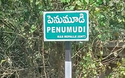
 A signboard of Penumdi village | |
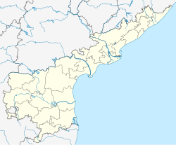
 Dynamic map | |
| Coordinates: 16°01′59″N 80°52′13″E / 16.0330°N 80.8703°E | |
| Country | India |
| State | Andhra Pradesh |
| District | Guntur |
| Mandal | Repalle |
| Government | |
| • Type | Panchayati raj |
| • Body | Penumudi gram panchayat |
| Area | |
| • Total | 553 ha (1,366 acres) |
| Population (2011)[3] | |
| • Total | 3,534 |
| • Density | 640/km2 (1,700/sq mi) |
| Languages | |
| • Official | Telugu |
| Time zone | UTC+5:30 (IST) |
| PIN | 522xxx |
| Area code | +91– |
| Vehicle registration | AP |
Penumudi is a village in Guntur district of the Indian state of Andhra Pradesh. It is located on the banks of the Krishna River, in Repalle mandal of Tenali revenue division.[4][2]పెనుమూడి లో పుష్కర ఘాట్ ఉన్నది. బాపట్ల జిల్లా ప్రజలు అందరూ ఇక్కడికి వస్తుంటారు.
Geography
[edit]Penumudi is located at 16°18′19″N 80°37′06″E / 16.3052°N 80.6182°E. The village is spread over an area of 5.53 km2 (2.14 sq mi).[2]
Demographics
[edit]As of 2011[update] census, Penumudi had a population of 3,534 with 1,044 households. The total population constitute, 1,752 males and 1,782 females —a sex ratio of 1017 females per 1000 males. 316 children are in the age group of 0–6 years, of which 170 are boys and 146 are girls. The average literacy rate stands at 63.05% with 2,029 literates, lower than the state average of 67.41%.[3][5]
Transportation
[edit]National Highway 216 (India) passes through this penumudi village. It is a main and major Spur road of National Highway 16 (India). This road connects Ongole and Kathipudi . This Highway is called Coastal Highway of andhrapradesh.
Governance
[edit]Penumudi gram panchayat is the local self-government of the village.[1] It is divided into wards and each ward is represented by a ward member.[6] The elected members of the gram panchayat is headed by a sarpanch.[7]
Economy
[edit]Agriculture and Aquaculture are the main occupations of the villagers. Paddy and black gram and corn are the major crops cultivated. While, prawns are the main source of income in aquaculture.[1]
See also
[edit]References
[edit]- ^ a b c "Gram Panchayat Identification Codes" (PDF). Saakshar Bharat Mission. National Informatics Centre. p. 117. Archived from the original (PDF) on 18 August 2017. Retrieved 7 May 2019.
- ^ a b c "District Census Hand Book – Guntur" (PDF). Census of India. Registrar General and Census Commissioner of India. pp. 14, 516. Retrieved 7 May 2019.
- ^ a b "Population". Census of India. Registrar General and Census Commissioner of India. Retrieved 8 May 2019.
- ^ Ravikiran, G. (20 August 2016). "Scenic permanent ghats developed below Penumudi bridge for pilgrims". The Hindu. Retrieved 20 May 2019.
- ^ "Literacy of AP (Census 2011)" (PDF). Official Portal of Andhra Pradesh Government. p. 43. Archived from the original (PDF) on 14 July 2014. Retrieved 5 September 2014.
- ^ Seetharam, Mukkavilli (1 January 1990). Citizen Participation in Rural Development. Mittal Publications. p. 34. ISBN 9788170992271.
- ^ Seetharam, Mukkavilli (1 January 1990). Citizen Participation in Rural Development. Mittal Publications. ISBN 9788170992271.

