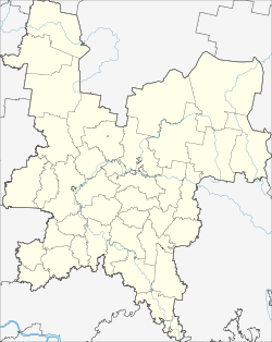
Omutninsk
Omutninsk
Омутнинск | |
|---|---|
 View of Omutninsk | |
| Coordinates: 58°40′N 52°11′E / 58.667°N 52.183°E | |
| Country | Russia |
| Federal subject | Kirov Oblast[1] |
| Administrative district | Omutninsky District[1] |
| Town | Omutninsk[1] |
| First mentioned | 1773 |
| Town status since | 1921 |
| Elevation | 210 m (690 ft) |
| Population | |
• Estimate (2021) | 19,629 |
| • Capital of | Omutninsky District,[1] Town of Omutninsk[1] |
| • Municipal district | Omutninsky Municipal District[2] |
| • Urban settlement | Omutninskoye Urban Settlement[2] |
| • Capital of | Omutninsky Municipal District,[2] Omutninskoye Urban Settlement[2] |
| Time zone | UTC+3 (MSK |
| Postal code(s)[4] | 612740–612744, 612749 |
| OKTMO ID | 33628101001 |
| Website | omutninsk-adm |
Omutninsk (Russian: Омутни́нск) is a town and the administrative center of Omutninsky District in Kirov Oblast, Russia. Population: 19,629 (2021 Census);[5] 23,615 (2010 Census);[6] 26,065 (2002 Census);[7] 29,248 (1989 Soviet census).[8]
History
[edit]It was first mentioned in 1773; town status was granted to it in 1921.[citation needed]
Administrative and municipal status
[edit]Within the framework of administrative divisions, Omutninsk serves as the administrative center of Omutninsky District.[1] As an administrative division, it is, together with four rural localities, incorporated within Omutninsky District as the Town of Omutninsk.[1] As a municipal division, the Town of Omutninsk is incorporated within Omutninsky Municipal District as Omutninskoye Urban Settlement.[2]
Research
[edit]The Institute of Applied Biochemistry is situated near Omutninsk. According to Dr. Ken Alibek, a biological warfare expert, it was (and possibly still is) a combined pesticide production facility and reserve biological weapons production plant that could be activated in time of war.
References
[edit]Notes
[edit]- ^ a b c d e f g h Law #203-ZO
- ^ a b c d e Law #284-ZO
- ^ "Об исчислении времени". Официальный интернет-портал правовой информации (in Russian). June 3, 2011. Retrieved January 19, 2019.
- ^ Почта России. Информационно-вычислительный центр ОАСУ РПО. (Russian Post). Поиск объектов почтовой связи (Postal Objects Search) (in Russian)
- ^ Russian Federal State Statistics Service. Всероссийская перепись населения 2020 года. Том 1 [2020 All-Russian Population Census, vol. 1] (XLS) (in Russian). Federal State Statistics Service.
- ^ Russian Federal State Statistics Service (2011). Всероссийская перепись населения 2010 года. Том 1 [2010 All-Russian Population Census, vol. 1]. Всероссийская перепись населения 2010 года [2010 All-Russia Population Census] (in Russian). Federal State Statistics Service.
- ^ Federal State Statistics Service (May 21, 2004). Численность населения России, субъектов Российской Федерации в составе федеральных округов, районов, городских поселений, сельских населённых пунктов – районных центров и сельских населённых пунктов с населением 3 тысячи и более человек [Population of Russia, Its Federal Districts, Federal Subjects, Districts, Urban Localities, Rural Localities—Administrative Centers, and Rural Localities with Population of Over 3,000] (XLS). Всероссийская перепись населения 2002 года [All-Russia Population Census of 2002] (in Russian).
- ^ Всесоюзная перепись населения 1989 г. Численность наличного населения союзных и автономных республик, автономных областей и округов, краёв, областей, районов, городских поселений и сёл-райцентров [All Union Population Census of 1989: Present Population of Union and Autonomous Republics, Autonomous Oblasts and Okrugs, Krais, Oblasts, Districts, Urban Settlements, and Villages Serving as District Administrative Centers]. Всесоюзная перепись населения 1989 года [All-Union Population Census of 1989] (in Russian). Институт демографии Национального исследовательского университета: Высшая школа экономики [Institute of Demography at the National Research University: Higher School of Economics]. 1989 – via Demoscope Weekly.
Sources
[edit]- Законодательное Собрание Кировской области. Закон №203-ЗО от 4 декабря 2007 г. «О реестре административно-территориальных единиц и населённых пунктов Кировской области», в ред. Закона №350-ЗО от 11 ноября 2013 г. «О внесении изменений в отдельные Законы Кировской области». Вступил в силу по истечении десяти дней со дня официального опубликования. Опубликован: "Вятский край", №227(4115), 11 декабря 2007 г. (Legislative Assembly of Kirov Oblast. Law #203-ZO of December 4, 2007 On the Registry of the Administrative-Territorial Units and the Inhabited Localities of Kirov Oblast, as amended by the Law #350-ZO of November 11, 2013 On Amending Various Laws of Kirov Oblast. Effective as of the day following ten days after the day of the official publication.).
- Законодательное Собрание Кировской области. Закон №284-ЗО от 7 декабря 2004 г. «Об установлении границ муниципальных образований Кировской области и наделении их статусом муниципального района, городского округа, городского поселения, сельского поселения», в ред. Закона №350-ЗО от 11 ноября 2013 г. «О внесении изменений в отдельные Законы Кировской области». Вступил в силу по истечении 10 дней со дня официального опубликования. Опубликован: "Вятский край", №233–234 (3401–3402), 21 декабря 2004 г. (Legislative Assembly of Kirov Oblast. Law #284-ZO of December 7, 2004 On Establishing the Borders of the Municipal Formations of Kirov Oblast and on Granting Them the Municipal District, Urban Okrug, Urban Settlement, Rural Settlement Status, as amended by the Law #350-ZO of November 11, 2013 On Amending Various Laws of Kirov Oblast. Effective as of after 10 days from the day of the official publication.).
External links
[edit]


