Oji-kamiya Station
Appearance
This article needs additional citations for verification. (May 2022) |
N17 Oji-kamiya Station 王子神谷駅 | |||||||||||
|---|---|---|---|---|---|---|---|---|---|---|---|
 Oji-kamiya station, 2023 | |||||||||||
| General information | |||||||||||
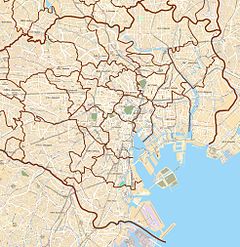
| Location | 2-11 Oji 5-chome, Kita, Tokyo Japan | ||||||||||
| Operated by | |||||||||||
| Line(s) | N Namboku Line | ||||||||||
| Platforms | 2 side platforms | ||||||||||
| Tracks | 2 | ||||||||||
| Construction | |||||||||||
| Structure type | Underground | ||||||||||
| Other information | |||||||||||
| Station code | N-17 | ||||||||||
| History | |||||||||||
| Opened | 29 November 1991 | ||||||||||
| Services | |||||||||||
| |||||||||||
| |||||||||||
Oji-kamiya Station (王子神谷駅, Ōji-kamiya eki) is a subway station in the Tokyo Metro network. It is located in Kita, Tokyo.
Lines
[edit]- Tokyo Metro Namboku Line (station number N-17)
Platforms
[edit]The platforms are configured as two side platforms.
| 1 | N Namboku Line | for Akabane-iwabuchi SR Saitama Rapid Railway Line for Urawa-misono |
| 2 | N Namboku Line |
|
History
[edit]Oji-kamiya Station opened on 29 November 1991.
The station facilities were inherited by Tokyo Metro after the privatization of the Teito Rapid Transit Authority (TRTA) in 2004.[1]
References
[edit]- ^ "「営団地下鉄」から「東京メトロ」へ" [From "Teito Rapid Transit Authority" to "Tokyo Metro"]. Tokyo Metro Online. 8 July 2006. Archived from the original on 16 May 2012. Retrieved 29 May 2022.
External links
[edit]- Oji-kamiya Station Information (Tokyo Metro)
Wikimedia Commons has media related to Ōji-kamiya Station.


