Ogilvie Mountains
| Ogilvie Mountains | |
|---|---|
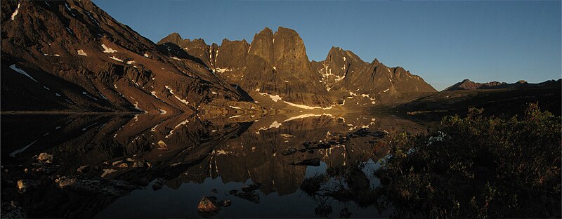
 Mountains in Tombstone Territorial Park | |
| Highest point | |
| Peak | Mount Frank Rae |
| Elevation | 2,362 m (7,749 ft) |
| Coordinates | 64°28′13″N 138°33′18″W / 64.47028°N 138.55500°W[1] |
| Geography | |
| Country | Canada |
| Territories | Yukon |
| Range coordinates | 64°40′04″N 138°28′41″W / 64.66778°N 138.47806°W[2] |
| Parent range | Yukon Ranges |
| Topo map | NTS 116B9 North Fork Pass[2] |
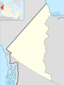
The Ogilvie Mountains are a mountain range in the Yukon Territory of northwestern Canada.
Geologically they are part of the Yukon Ranges, in the upper Laramide Belt of the North American Cordillera.
Geography
[edit]The range lies north of Dawson City, and is crossed by the Dempster Highway.
The area was first surveyed by William Ogilvie and the range subsequently named after him.
- Sub-ranges
- Peaks
The best known mountain peaks of the Ogilvie Mountains are located within Tombstone Territorial Park.[3]
The highest mountain within the range is Mount Frank Rae, at 2,362 m (7,749 ft) in elevation.
The range's most familiar mountains, with their jagged granite peaks, are:[4]
Climate
[edit]Ogilvie River is a weather station near the Ogilvie Maintenance Compound in the northern Ogilvie Mountains, situated at an elevation of 597 m (1959 ft).[5]
| Climate data for Ogilvie River, Yukon, 1981-2006 normals, 1971-2008 extremes: 1959ft (597m) | |||||||||||||
|---|---|---|---|---|---|---|---|---|---|---|---|---|---|
| Month | Jan | Feb | Mar | Apr | May | Jun | Jul | Aug | Sep | Oct | Nov | Dec | Year |
| Record high °C (°F) | 7 (44) |
7 (44) |
8 (46) |
16 (61) |
28 (82) |
31 (88) |
31 (88) |
31 (87) |
26 (79) |
22 (72) |
7 (45) |
10 (50) |
31 (88) |
| Mean maximum °C (°F) | −6.6 (20.2) |
−1.3 (29.6) |
1.4 (34.6) |
10.2 (50.3) |
19.9 (67.9) |
26.2 (79.2) |
26.4 (79.6) |
24.8 (76.6) |
18.1 (64.5) |
7.8 (46.0) |
−4.1 (24.6) |
−2.7 (27.1) |
27.7 (81.9) |
| Mean daily maximum °C (°F) | −22.4 (−8.4) |
−18.7 (−1.7) |
−11.9 (10.6) |
−0.2 (31.6) |
10.4 (50.8) |
18.8 (65.8) |
20.0 (68.0) |
16.6 (61.8) |
9.2 (48.6) |
−4.4 (24.0) |
−18.3 (−1.0) |
−19.9 (−3.9) |
−1.7 (28.9) |
| Daily mean °C (°F) | −28.3 (−19.0) |
−25.6 (−14.1) |
−21.4 (−6.6) |
−9.7 (14.6) |
3.6 (38.4) |
11.3 (52.4) |
12.9 (55.2) |
9.7 (49.4) |
3.0 (37.4) |
−9.9 (14.1) |
−24.0 (−11.2) |
−25.7 (−14.2) |
−8.7 (16.4) |
| Mean daily minimum °C (°F) | −35.5 (−31.9) |
−33.3 (−28.0) |
−30.9 (−23.6) |
−18.7 (−1.7) |
−3.2 (26.3) |
4.1 (39.4) |
5.8 (42.5) |
2.7 (36.9) |
−3.1 (26.4) |
−15.2 (4.6) |
−29.4 (−21.0) |
−31.9 (−25.4) |
−15.7 (3.7) |
| Mean minimum °C (°F) | −48.9 (−56.0) |
−48.3 (−55.0) |
−44.7 (−48.5) |
−33.7 (−28.6) |
−13.1 (8.4) |
−1.7 (29.0) |
0.0 (32.0) |
−4.1 (24.6) |
−10.7 (12.7) |
−29.8 (−21.7) |
−41.2 (−42.2) |
−45.1 (−49.1) |
−50.9 (−59.7) |
| Record low °C (°F) | −57 (−71) |
−56 (−69) |
−54 (−66) |
−43 (−45) |
−27 (−17) |
−6 (21) |
−3 (27) |
−10 (14) |
−25 (−13) |
−42 (−44) |
−51 (−59) |
−53 (−63) |
−57 (−71) |
| Average precipitation mm (inches) | 14 (0.57) |
14 (0.56) |
9.9 (0.39) |
7.9 (0.31) |
22 (0.86) |
43 (1.70) |
53 (2.07) |
40 (1.56) |
33 (1.30) |
27 (1.07) |
18 (0.69) |
18 (0.71) |
299.8 (11.79) |
| Average snowfall cm (inches) | 15 (5.8) |
14 (5.6) |
9.9 (3.9) |
7.1 (2.8) |
5.3 (2.1) |
0.25 (0.1) |
0.0 (0.0) |
0.51 (0.2) |
8.4 (3.3) |
24 (9.5) |
18 (6.9) |
18 (7.1) |
120.46 (47.3) |
| Source: XMACIS2 (normals, extremes & precip/snow)[6] | |||||||||||||
References
[edit]- ^ "Mount Frank Rae". Geographical Names Data Base. Natural Resources Canada. Retrieved 2022-08-05.
- ^ a b "Ogilvie Mountains". Geographical Names Data Base. Natural Resources Canada. Retrieved 2022-08-05.
- ^ tombstonepark
- ^ "Ogilvie Mountains". Peakbagger.com. Retrieved 2022-08-05.
- ^ "Ogilvie Highway Camp (OGIH) Basic Station Information". YukonWeather. Retrieved February 7, 2024.
- ^ "xmACIS". National Oceanic and Atmospheric Administration. Retrieved February 7, 2024.


