North Seal River Airport
Appearance
North Seal River Airport | |||||||||||
|---|---|---|---|---|---|---|---|---|---|---|---|
| Summary | |||||||||||
| Airport type | Private | ||||||||||
| Operator | North Seal River Inc. | ||||||||||
| Location | North Seal River | ||||||||||
| Time zone | CST (UTC−06:00) | ||||||||||
| • Summer (DST) | CDT (UTC−05:00) | ||||||||||
| Elevation AMSL | 962 ft / 293 m | ||||||||||
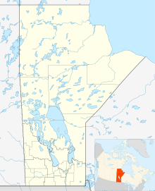
| Coordinates | 58°58′10″N 099°58′30″W / 58.96944°N 99.97500°W | ||||||||||
| Map | |||||||||||
 | |||||||||||
| Runways | |||||||||||
| |||||||||||
Source: Canada Flight Supplement[1] | |||||||||||
North Seal River Airport (TC LID: CEG8) is located on the shore of Egenolf Lake adjacent to North Seal River, Manitoba, Canada.
The airport serves Gangler's North Seal River Lodge and Outposts during the summer and early fall.
See also
[edit]References
[edit]


