New Hampshire, Ohio
Appearance
New Hampshire, Ohio | |
|---|---|
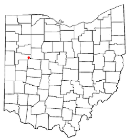
 Location of New Hampshire, Ohio | |
| Coordinates: 40°33′14″N 83°57′11″W / 40.55389°N 83.95306°W | |
| Country | United States |
| State | Ohio |
| County | Auglaize |
| Township | Union |
| Elevation | 1,034 ft (315 m) |
| Population (2020) | |
• Total | 150 |
| Time zone | UTC-5 (Eastern (EST)) |
| • Summer (DST) | UTC-4 (EDT) |
| ZIP code | 45870 |
| Area code | 419 |
| GNIS feature ID | 2628940[1] |
New Hampshire is a census-designated place in central Goshen Township, Auglaize County, Ohio, United States.[1] As of the 2010 census, it had a population of 150.[3]
Located between Wapakoneta and Lakeview at the intersection of U.S. Route 33 with State Routes 196 and 385, the village maintains a small post office (Zip Code: 45870) and a country store.
History
[edit]New Hampshire was laid out in 1836.[4] The community was named after the state of New Hampshire.[5] A post office called New Hampshire has been in operation since 1855.[6]
Education
[edit]The community is served by the Waynesfield-Goshen Local School District.
References
[edit]- ^ a b c U.S. Geological Survey Geographic Names Information System: New Hampshire, Ohio
- ^ "ArcGIS REST Services Directory". United States Census Bureau. Retrieved September 20, 2022.
- ^ "New Hampshire CPD, Ohio - Census Bureau Profile". United States Census Bureau. Retrieved May 22, 2023.
- ^ Sutton, Robert (1880). History of Auglaize County, Ohio : with the Indian history of Wapakoneta, and the first settlement of the county. p. 177.
- ^ "Towns named after states". Reading Eagle. July 2, 1897. p. 3. Retrieved October 14, 2015.
- ^ "Auglaize County". Jim Forte Postal History. Retrieved March 2, 2015.

