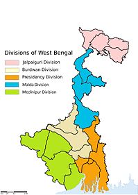
Nawabganj, North 24 Parganas
Tools
Actions
General
Print/export
In other projects
Appearance
From Wikipedia, the free encyclopedia
This article relies largely or entirely on a single source. Relevant discussion may be found on the talk page. Please help improve this article by introducing citations to additional sources. Find sources: "Nawabganj, North 24 Parganas" – news · newspapers · books · scholar · JSTOR (June 2018) |
This article possibly contains original research. Please improve it by verifying the claims made and adding inline citations. Statements consisting only of original research should be removed. (October 2021) (Learn how and when to remove this message) |
Neighbourhood in Presidency, West Bengal, India
Nawabganj | |
|---|---|
Neighbourhood | |
 Local road at Nawabganj | |
| Coordinates: 22°47′44″N 88°21′49″E / 22.795674°N 88.363675°E / 22.795674; 88.363675 | |
| Country | |
| State | West Bengal |
| Division | Presidency |
| District | North 24 Parganas |
| Government | |
| • Type | Municipality |
| • Body | North Barrackpur Municipality |
| Languages | |
| • Official | Bengali, English |
| Time zone | UTC+5:30 (IST) |
| PIN | 743144 |
| Telephone code | +91 33 |
| Vehicle registration | WB |
| Lok Sabha constituency | Barrackpore |
| Vidhan Sabha constituency | Noapara |
| Website | north24parganas |
Nawabganj is a neighbourhood in North Barrackpur of North 24 Parganas district in the Indian state of West Bengal. It is a part of the area covered by Kolkata Metropolitan Development Authority (KMDA).[1]
Geography
[edit]Nawabganj is located at 22°47′44″N 88°21′49″E / 22.795674°N 88.363675°E / 22.795674; 88.363675. It has an average elevation of 12 m (39 ft).
References
[edit]- ^ "Base Map of Kolkata Metropolitan area". Kolkata Metropolitan Development Authority. Archived from the original on 28 September 2007. Retrieved 3 September 2007.
Cities, towns, locations and neighbourhoods in North 24 Parganas district, Presidency division | |||||||||
|---|---|---|---|---|---|---|---|---|---|
| Municipal cities/ towns and census towns | |||||||||
| Locations other than cities and towns |
| ||||||||
| Neighbourhoods of other cities and towns in the district | |||||||||
| Related topics | |||||||||
| Kolkata Municipal Corporation |
|
|---|---|
| Kolkata Urban Agglomeration Outside KMC |
|
Municipalities and CD blocks of West Bengal | |
|---|---|
| Municipal corporations | |
| Municipalities |
|
| Community development blocks1 |
|
| See also | |
| |
Hidden categories:
- Pages using gadget WikiMiniAtlas
- Articles needing additional references from June 2018
- All articles needing additional references
- Articles that may contain original research from October 2021
- All articles that may contain original research
- Use dmy dates from October 2018
- Use Indian English from October 2018
- All Wikipedia articles written in Indian English
- Articles with short description
- Short description is different from Wikidata
- Coordinates on Wikidata


