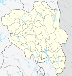
Namnå
Appearance
Namnå | |
|---|---|
Village | |
 View of the old railway station in Namnå | |
| Coordinates: 60°30′01″N 12°04′42″E / 60.50015°N 12.07844°E | |
| Country | Norway |
| Region | Eastern Norway |
| County | Innlandet |
| District | Solør |
| Municipality | Grue Municipality |
| Area | |
• Total | 0.66 km2 (0.25 sq mi) |
| Elevation | 164 m (538 ft) |
| Population (2017)[1] | |
• Total | 357 |
| • Density | 540.9/km2 (1,401/sq mi) |
| Time zone | UTC+01:00 (CET) |
| • Summer (DST) | UTC+02:00 (CEST) |
| Post Code | 2265 Namnå |
Namnå is a village in Grue Municipality in Innlandet county, Norway. The village is located on the east shore of the river Glomma, about 4 kilometres (2.5 mi) north of the village of Kirkenær. The Norwegian National Road 2 and the Solørbanen railway line both run through the village.[3]
The 0.66-square-kilometre (160-acre) village has a population (2017) of 357 and a population density of 540.9 inhabitants per square kilometre (1,401/sq mi). Since 2018, the population and area data for this village area has not been separately tracked by Statistics Norway.[1]
References
[edit]- ^ a b c Statistisk sentralbyrå (17 March 2022). "04859: Area and population of urban settlements (US) 2000 - 2021".
- ^ "Namnå, Grue". yr.no. Retrieved 17 March 2022.
- ^ Thorsnæs, Geir, ed. (23 June 2021). "Namnå". Store norske leksikon (in Norwegian). Kunnskapsforlaget. Retrieved 17 March 2022.
Wikimedia Commons has media related to Namnå.


