Mount Barnard (Alsek Ranges)
Appearance
| Mount Barnard | |
|---|---|
| Boundary Peak 160 | |
 Summit centered behind | |
| Highest point | |
| Elevation | 8,173 ft (2,491 m)[1] |
| Prominence | 3,678 ft (1,121 m)[1][2] |
| Listing | |
| Coordinates | 59°06′07″N 136°58′12″W / 59.10194°N 136.97000°W[3] |
| Geography | |
| Countries | |
| Province | |
| State | Alaska |
| Parent range | Alsek Ranges |
| Topo map | |
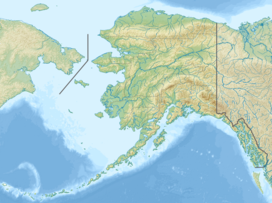
Mount Barnard, also named Boundary Peak 160, is a mountain in Alaska and British Columbia, located on the Canada–United States border, and part of the Alsek Ranges of the Saint Elias Mountains.[2] In 1923 Boundary Peak 160 was named Mount Barnard in honour of Edward Chester Barnard, a U.S. Boundary Commissioner from 1915 to 1921 and chief topographer of the United States and Canada Boundary Survey from 1903 to 1915.[4] The first ascent of Mount Barnard was made on August 24, 1966, from the head of Tarr Inlet[5] by D. Kenyon King, Peter H. Robinson and David P. Johnston. The details on file with Peak Service at Bartlett Cove, Glacier Bay National Monument, Gustavus, Alaska.[6]
Gallery
[edit]See also
[edit]References
[edit]- ^ a b "Mount Barnard". Bivouac.com. Retrieved September 2, 2021.
- ^ a b "Mount Barnard, British Columbia/Alaska". Peakbagger.com. Retrieved September 2, 2021.
- ^ a b "Mount Barnard". BC Geographical Names. Retrieved September 2, 2021.
- ^ "Mount Barnard". Geographic Names Information System. United States Geological Survey, United States Department of the Interior. Retrieved May 16, 2018.
- ^ "Skagway - Forest Service" (PDF). USDA. Retrieved May 18, 2018.
- ^ North America, United States, Alaska, Mount Barnard, Glacier Bay Climbs And Expeditions
Categories:
- Two-thousanders of the United States
- Two-thousanders of British Columbia
- Saint Elias Mountains
- Canada–United States border
- International mountains of North America
- Mountains of Yakutat City and Borough, Alaska
- Mountains of Glacier Bay National Park and Preserve
- British Columbia Interior geography stubs
- British Columbia mountain stubs
- Southeast Alaska geography stubs


