Mollie Beattie Wilderness
| Mollie Beattie Wilderness | |
|---|---|
| Location | Arctic National Wildlife Refuge |
| Nearest city | Kaktovik, Alaska |
| Coordinates | 69°00′53″N 143°12′50″W / 69.01472°N 143.21389°W |
| Area | 8,000,000 acres (3,200,000 ha) |
| Established | 1980 |
| Governing body | United States Fish and Wildlife Service |
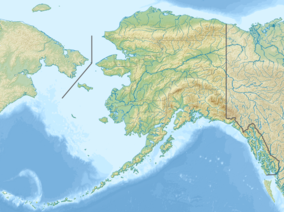
The Mollie Beattie Wilderness is located in the northeastern section of the Arctic National Wildlife Refuge. It is the second-largest designated wilderness area in the United States, after the Wrangell-Saint Elias Wilderness. It has an area of approximately 8,000,000 acres (3,200,000 ha), and comprises over 40 percent of the area of Arctic NWR. Its territory is centered about a part of the Brooks Range that contains a combination of arctic, subarctic, and alpine ecosystems. Animal life is abundant, including that of large mammals such as brown bears, moose, caribou, musk oxen, and (offshore) polar bears and numerous species of whales and seals.[1] The wilderness is named after conservationist Mollie Beattie, the first female director of the United States Fish and Wildlife Service.
See also
[edit]References
[edit]- ^ Mollie Beattie Wilderness Archived 2012-10-16 at the Wayback Machine Wilderness.net
External links
[edit]- Map of Mollie Beattie Wilderness Wilderness.net
- IUCN Category Ib
- Protected areas of North Slope Borough, Alaska
- Wilderness areas of Alaska
- Protected areas of Yukon–Koyukuk Census Area, Alaska
- Brooks Range
- North Slope Borough, Alaska, geography stubs
- Yukon–Koyukuk Census Area, Alaska, geography stubs
- Alaska geography stubs
- Western United States protected area stubs

