Mirsharai Upazila
Mirsharai
মীরসরাই | |
|---|---|
 | |
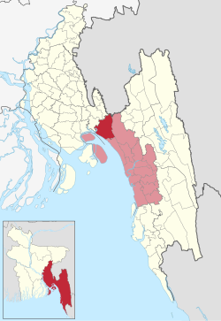
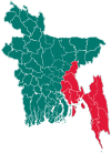
 Mirsarai Upazila on the map | |
| Coordinates: 22°46.3′N 91°34.5′E / 22.7717°N 91.5750°E | |
| Country | |
| Division | Chittagong |
| District | Chittagong |
| Jatiya Sangsad constituency | Chittagong-1 |
| Establishment | 1917 |
| Headquarters | Mirsharai |
| Government | |
| • Body | Upazila Council |
| • MP | Vacant |
| • Chairman | Vacant |
| • Chief Executive Officer | Mahfuza Zerin |
| Area | |
• Total | 482.88 km2 (186.44 sq mi) |
| Population | |
• Total | 472,794 |
| • Density | 980/km2 (2,500/sq mi) |
| Time zone | UTC+6 (BST) |
| Post code | 4320[2] |
| Area code | 03024[3] |
| Website | mirsharai.gov.bd |
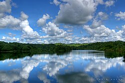
Mirsharai Upazila (Bengali: মীরসরাই উপজেলা) is an upazila of Chattogram District in Chattogram Division, Bangladesh. It comprises two police stations (Jorargonj and Mirsharai) and two municipalities (Baroiyarhat and Mirsharai).
History
[edit]Sultan Fakhruddin Mobarak Shah conquered Chittagong in 1340 AD and established Muslim rule in this region. During the reign of Sultans Hussain Shah and Nusrat Shah, Paragal Khan and Chhuti Khan were the rulers of this area. Subsequently, Nizam Shah, brother of emperor Sher Shah, was the ruler of this area. Nizampur Pargana is named after Nizam Shah and the whole area of Mirsharai came under the control of this pargana.
From the beginning of the 16th century the region was very rich in Bangla literature. Most of the time between 1580 and 1666, the region was under the control of the Arakanese.
The place within the current Mirsharai thana where Bujurg Umed Khan, son of Subadar Sayesta Khan, landed after crossing the Feni River was named as Bujurg Umedpur. With the conquest of Chittagong by Khan in 1666, the region came permanently under Mughal rule.
Towards the end of British rule in India, the Durgapur and Karerhat areas of Mirsharai were the centres of revolutionary activities of Chittagong. A fierce battle was fought between the freedom fighters (under Captain Wali Ahmed) and the Pak Army near the Fenafuni Bridge on the south of Mirsharai sadar, in which about 100 Pak soldiers were killed. The two sides also fought at places including Shuvapur Bridge, Hinguli Bridge, Aochi Mia Bridge and Mostan Nagar.
Geography
[edit]Mirsharai is located at 22°46′20″N 91°34′30″E / 22.7722°N 91.5750°E. It has 79,545 households and a total area of 482.88 km2.
Demographics
[edit]As of the 2011 Census of Bangladesh, Mirsharai upazila had 79,545 households and a population of 398,716. 88,008 (22.07%) were under 10 years of age. Mirsharai had an average literacy rate of 55.08%, compared to the national average of 51.8%, and a sex ratio of 1128 females per 1000 males. 31,206 (7.83%) of the population lived in urban areas.[5] Ethnic population was 2,266 (0.57%), of which Tripura were 2,242.[6]
In the 1991 census in Bangladesh, Mirsharai had a population of 325712. Males constituted 49.97% of the population, and females 50.03%. This Upazila's eighteen up population is 160,496. Mirsharai has an average literacy rate of 37.2% (7+ years), and the national average of 32.4% literate.[7][8]
Administration
[edit]Mirsharai Upazila is divided into Baroiyarhat Municipality, Mirsharai Municipality, and 16 union parishads: Dhum, Durgapur, Haitkandi, Hinguli, Ichhakhali, Jorarganj, Katachhara, Khaiyachhara, Karerhat, Maghadia, Mayani, Mirsharai, Mithanala, Osmanpur, Saherkhali, and Wahedpur. The union parishads are subdivided into 113 mauzas and 208 villages.[9]
Baroiyarhat Municipality and Mirsharai Municipality are each subdivided into 9 wards.[9]
Mahboob Rahman Ruhel is the was last member of parliament, elected at 2024 national parliamentary election.
Education
[edit]There are four colleges in the upazila. They include Nizampur Government College (1964), Baraiya Hat College (1974), Mirsharai College (1973), [10] and Professor Kamal Uddin Chowdhury College. Nizampur Government College is the only government college in the Upzilla.[11]
According to Banglapedia, Abu Torab High School, founded in 1914, Mirsharai Government Model Pilot High School (1962), Mithachhara High School (1947), Sarkar Hat N. R. High School (1939), and Zorwarganj Model Multilateral High School (1914) are notable secondary schools.[10]
Upazila Parishad
[edit]| Serial Number | Designation | Name |
|---|---|---|
| 01 | Upazila Chairman | vacant[12][13] |
| 02 | Vice Chairman | Vacant[13] |
| 03 | Female Vice Chairman | Vacant[13] |
| 04 | Upazila Nirbahi Officer | Mahfuza Zerin[14] |
- List of Upazila Chairman
| Serial Number | Name of Upazila Chairman | Duration |
|---|---|---|
| 01 | Abu Taher | 1985–1986 |
| 02 | Abul Bashar Bhuiyan | 1986–1991 |
| 03 | Gias Uddin | 2009–2014 |
| 04 | Nurul Amin | 2014–2019 |
| 05 | Jasim Uddin | 2019–2024 |
| 06 | Anayet Hossain Nayon[12][13] | 2024–2024 |
See also
[edit]- Mahamaya irrigation project
- Upazilas of Bangladesh
- Districts of Bangladesh
- Divisions of Bangladesh
- Mirsarai Tragedy
References
[edit]- ^ National Report (PDF). Population and Housing Census 2022. Vol. 1. Dhaka: Bangladesh Bureau of Statistics. November 2023. p. 396. ISBN 978-9844752016.
- ^ "Bangladesh Postal Code". Dhaka: Bangladesh Postal Department under the Department of Posts and Telecommunications of the Ministry of Posts, Telecommunications and Information Technology of the People's Republic of Bangladesh. 20 October 2024.
- ^ "Bangladesh Area Code". China: Chahaoba.com. 18 October 2024.
- ^ Population and Housing Census 2022 - District Report: Chattogram (PDF). District Series. Dhaka: Bangladesh Bureau of Statistics. June 2024. ISBN 978-984-475-247-4.
- ^ "Bangladesh Population and Housing Census 2011 Zila Report – Chittagong" (PDF). bbs.gov.bd. Bangladesh Bureau of Statistics.
- ^ "Community Tables: Chittagong district" (PDF). bbs.gov.bd. Bangladesh Bureau of Statistics. 2011.
- ^ "Population Census Wing, BBS". Archived from the original on 2005-03-27. Retrieved November 10, 2006.
- ^ "Bangladesh: Divisions and Urban Areas - Population Statistics, Maps, Charts, Weather and Web Information". www.citypopulation.de. Retrieved 2022-04-30.
- ^ a b "District Statistics 2011: Chittagong" (PDF). Bangladesh Bureau of Statistics. Archived from the original (PDF) on 13 November 2014. Retrieved 14 July 2014.
- ^ a b Momtaz, Ahmed (2012). "Mirsharai Upazila". In Islam, Sirajul; Jamal, Ahmed A. (eds.). Banglapedia: National Encyclopedia of Bangladesh (Second ed.). Asiatic Society of Bangladesh.
- ^ "College List". Bangladesh Bureau of Educational Statistics and Information.
- ^ a b "মিরসরাই উপজেলায় শিষ্যের কাছে হারলেন গুরু" (in Bengali). Somoy TV. 8 May 2024. Retrieved 13 May 2024.
- ^ a b c d "মীরসরাই উপজেলা চেয়ারম্যান পদে নয়ন জয়ী". www.banglanews24.com (in Bengali). 8 May 2024. Retrieved 13 May 2024.
- ^ "কর্মকর্তাবৃন্দ" (in Bengali). 8 May 2024. Retrieved 13 May 2024.

