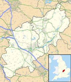
Middleton, Northamptonshire
Appearance
This article needs additional citations for verification. (November 2009) |
| Middleton | |
|---|---|
Location within Northamptonshire | |
| Population | 414 (2011) |
| OS grid reference | SP840899 |
| Unitary authority | |
| Ceremonial county | |
| Region | |
| Country | England |
| Sovereign state | United Kingdom |
| Post town | Market Harborough |
| Postcode district | LE16 |
| Dialling code | 01536 |
| Police | Northamptonshire |
| Fire | Northamptonshire |
| Ambulance | East Midlands |
| UK Parliament | |
Middleton is a village and civil parish in North Northamptonshire close to the county boundary with Leicestershire. At the time of the 2001 census, the parish's population was 328 people,[1] increasing to 414 at the 2011 Census.[2]
The villages name means 'middle farm/settlement'.[3]
Geography
[edit]Middleton is just to the west of the town of Corby, with Cottingham and East Carlton nearby. There is a very steep hill known locally simply as "The Hill". The village has a Leicestershire postcode.
Amenities
[edit]There is a pub with a restaurant - The Red Lion, Willow Cottage B & B and the Jurassic Way waymarked long-distance footpath passes through the village.
References
[edit]- ^ Office for National Statistics: Middleton CP: Parish headcounts. Retrieved 14 November 2009
- ^ "Civil Parish population 2011". Office for National Statistics. Retrieved 7 July 2016.
- ^ "Key to English Place-names".
External links
[edit]Wikimedia Commons has media related to Middleton, Northamptonshire.

